
-
Federal
Sentinel-5P TROPOMI Radiance product band 1 (UV detector) L1B 5.5km x 21km V1 (S5P_L1B_RA_BD1_HiR) at GES DISC
National Aeronautics and Space Administration —
Starting from August 6th in 2019, Sentinel-5P TROPOMI along-track high spatial resolution (~5.5km at nadir) has been implemented. For data before August 6th of 2019,... -
Federal
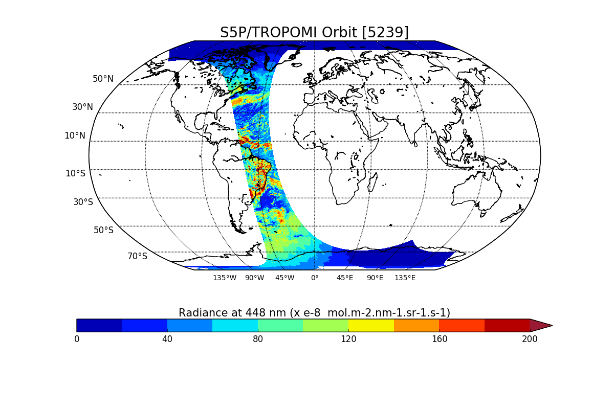
Sentinel-5P TROPOMI Radiance product band 4 (UVIS detector) L1B V1 (S5P_L1B_RA_BD4) at GES DISC
National Aeronautics and Space Administration —
Starting from August 6th in 2019, Sentinel-5P TROPOMI along-track high spatial resolution (~5.5km at nadir) has been implemented. For data after August 6th of 2019,... -
Federal
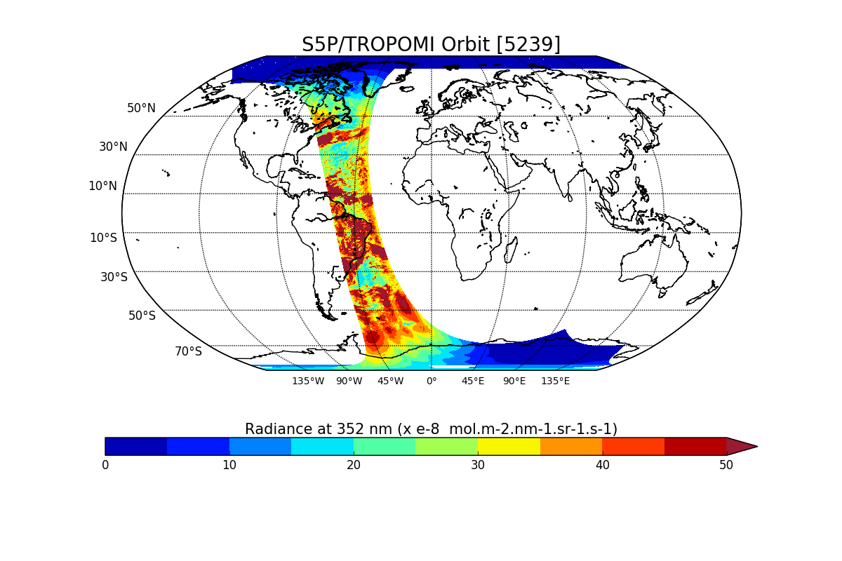
Sentinel-5P TROPOMI Radiance product band 2 (UV detector) L1B V1 (S5P_L1B_RA_BD2) at GES DISC
National Aeronautics and Space Administration —
Starting from August 6th in 2019, Sentinel-5P TROPOMI along-track high spatial resolution (~5.5km at nadir) has been implemented. For data after August 6th of 2019,... -
Federal
Sentinel-5P TROPOMI Radiance product band 5 (NIR detector) L1B 5.5km x 3.5km V2 (S5P_L1B_RA_BD5_HiR) at GES DISC
National Aeronautics and Space Administration —
Starting from August 6th in 2019, Sentinel-5P TROPOMI along-track high spatial resolution (~5.5km at nadir) has been implemented. For data before August 6th of 2019,... -
Federal
AirMSPI verison 6 terrain-projected georegistered radiance product acquired during the NASA ACEPOL flight campaign Oct-Nov 2017
National Aeronautics and Space Administration —
AirMSPI_ACEPOL_Terrain-projected_Georegistered_Radiance_Data are AirMSPI terrain-projected georegistered radiance products acquired during the Aerosol... -
Federal
BUV/Nimbus-4 Level 1 Radiance and Housekeeping Data in Telemetry Units V001 (BUVN4L1PDB) at GES DISC
National Aeronautics and Space Administration —
The Nimbus-4 BUV Level-1 Radiance and Housekeeping Data in Telemetry Units collection contains the raw counts measured by the Backscatter Ultraviolet Spectrometer... -
Federal
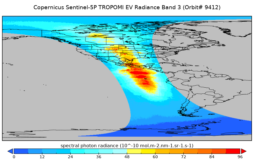
Sentinel-5P TROPOMI Radiance product band 3 (UVIS detector) L1B 5.5km x 3.5km V2 (S5P_L1B_RA_BD3_HiR) at GES DISC
National Aeronautics and Space Administration —
Starting from August 6th in 2019, Sentinel-5P TROPOMI along-track high spatial resolution (~5.5km at nadir) has been implemented. For data before August 6th of 2019,... -
Federal
MODIS/Aqua Clear Radiance Statistics Indexed to Global Grid 5-Min L2 Swath 10km NGDA
National Aeronautics and Space Administration —
The MODIS/Aqua Clear Radiance Statistics Indexed to Global Grid 5-Min L2 Swath 10km (MYDCSR_G)product provides a variety of, statistical measures that characterize... -
Federal
GOES-R PLT Surface Radiance Red Lake V1
National Aeronautics and Space Administration —
The GOES-R PLT Surface Radiance Red Lake dataset consists of surface radiation budget, ultraviolet-B (UVB) and photosynthetically active radiation (PAR) flux,... -
Federal
AirMSPI verison 6 terrain-projected georegistered radiance product acquired during the ImPACT-PM flight campaign
National Aeronautics and Space Administration —
AirMSPI_ImPACT-PM_Terrain-projected_Georegistered_Radiance_Data is an AirMSPI terrain-projected georegistered radiance product acquired during the JPL and Caltech... -
Federal
MODIS/Terra Clear Sky Radiance 8-Day Composite Daily L3 Global 25km Equal Area NGDA
National Aeronautics and Space Administration —
The MODIS/Terra Clear Sky Radiance 8-Day Composite Daily L3 Global 25km Equal Area (MODCSR_8) product is created from composited MODCSR_D files. Nine clear-sky... -
Federal
Sentinel-5P TROPOMI Radiance product band 4 (UVIS detector) L1B 5.5km x 3.5km V1 (S5P_L1B_RA_BD4_HiR) at GES DISC
National Aeronautics and Space Administration —
Starting from August 6th in 2019, Sentinel-5P TROPOMI along-track high spatial resolution (~5.5km at nadir) has been implemented. For data before August 6th of 2019,... -
Federal
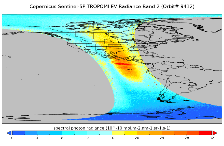
Sentinel-5P TROPOMI Radiance product band 2 (UV detector) L1B 5.5km x 3.5km V2 (S5P_L1B_RA_BD2_HiR) at GES DISC
National Aeronautics and Space Administration —
Starting from August 6th in 2019, Sentinel-5P TROPOMI along-track high spatial resolution (~5.5km at nadir) has been implemented. For data before August 6th of 2019,... -
Federal
MODIS/Aqua 8-Day Clear Sky Radiance Bias Daily L3 Global 1Deg Zonal Bands NGDA
National Aeronautics and Space Administration —
The MODIS/Aqua 8-Day Clear Sky Radiance Bias Daily L3 Global 1Deg Zonal Bands (MYDCSR_B) product consists of 1-degree zonal mean clear-sky biases (observed minus... -
Federal
OMPS-NPP L1G LP Radiance EV Wavelength-Altitude Grid swath orbital 3slit V2.6 (OMPS_NPP_LP_L1G_EV) at GES DISC
National Aeronautics and Space Administration —
The OMPS-NPP L1G LP Radiance EV Wavelength-Altitude Grid swath orbital 3slit product contains the calibrated earth-viewing radiances measured by the Ozone Mapping and... -
Federal
AirMSPI verison 6 terrain-projected georegistered radiance product acquired during the NASA ORACLES flight campaign Jul-Oct 2016
National Aeronautics and Space Administration —
AirMSPI_ORACLES_Terrain-projected_Georegistered_Radiance_Data are AirMSPI Terrain-projected georegistered radiance product acquired during the NASA ObseRvations of... -
Federal
AirMSPI version 6 ellipsoid-projected georegistered radiance product acquired during the CalWater-2 flight campaign Jan-Feb 2015
National Aeronautics and Space Administration —
AirMSPI_CalWater-2_Ellipsoid-projected_Georegistered_Radiance_Data are AirMSPI Ellipsoid-projected georegistered radiance product acquired during the Precipitation,... -
Federal
Sentinel-5P TROPOMI Radiance product band 3 (UVIS detector) L1B V1 (S5P_L1B_RA_BD3) at GES DISC
National Aeronautics and Space Administration —
Starting from August 6th in 2019, Sentinel-5P TROPOMI along-track high spatial resolution (~5.5km at nadir) has been implemented. For data after August 6th of 2019,... -
Federal
Sentinel-5P TROPOMI Radiance product band 5 (NIR detector) L1B V1 (S5P_L1B_RA_BD5) at GES DISC
National Aeronautics and Space Administration —
Starting from August 6th in 2019, Sentinel-5P TROPOMI along-track high spatial resolution (~5.5km at nadir) has been implemented. For data after August 6th of 2019,... -
Federal
AirMSPI verison 6 ellipsoid-projected georegistered radiance product acquired during the NASA ACEPOL flight campaign Oct-Nov 2017
National Aeronautics and Space Administration —
AirMSPI_ACEPOL_Ellipsoid-projected_Georegistered_Radiance_Data are AirMSPI ellipsoid-projected georegistered radiance products acquired during the Aerosol...

Official websites use .gov
A
.gov website belongs to an official government
organization in the United States.
Secure .gov websites use HTTPS
A
lock (
) or https:// means you’ve safely connected to
the .gov website. Share sensitive information only on official,
secure websites.