
-
Federal
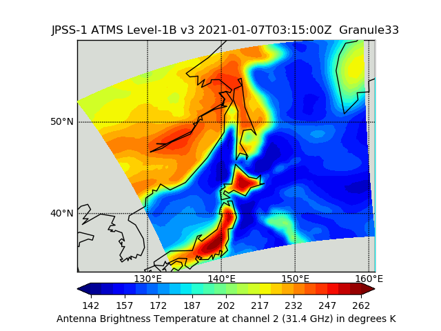
JPSS-1 ATMS Level 1B Brightness Temperature V3 (SNDRJ1ATMSL1B) at GES DISC
National Aeronautics and Space Administration —
The Advanced Technology Microwave Sounder (ATMS) Level 1B data files contain brightness temperature measurements along with ancillary spacecraft, instrument, and... -
Federal
SMEX02 AMSR-E Level 3 Daily Gridded Brightness Temperatures, Iowa, Version 1
National Aeronautics and Space Administration —
This data set contains Advanced Microwave Scanning Radiometer - Earth Observing System (AMSR-E) level 3 daily gridded brightness temperatures, spatially subsetted to... -
Federal
SMAP L2 Radiometer Half-Orbit 36 km EASE-Grid Soil Moisture V009
National Aeronautics and Space Administration —
This Level-2 (L2) soil moisture product provides estimates of global land surface conditions retrieved by the Soil Moisture Active Passive (SMAP) passive microwave... -
Federal
First ISCCP Regional Experiment (FIRE) Atlantic Stratocumulus Transition Experiment (ASTEX) United Kingdom Meteorological Office (UKMO) C-130 Aircraft Data
National Aeronautics and Space Administration —
The First ISCCP Regional Experiments have been designed to improve data products and cloud/radiation parameterizations used in general circulation models (GCMs).... -
Federal
SMEX03 Two-Dimensional Synthetic Aperture Radiometer (2D-STAR) Brightness Temperatures, Georgia, Version 1
National Aeronautics and Space Administration —
Notice to Data Users: The documentation for this data set was provided solely by the Principal Investigator(s) and was not further developed, thoroughly reviewed, or... -
Federal
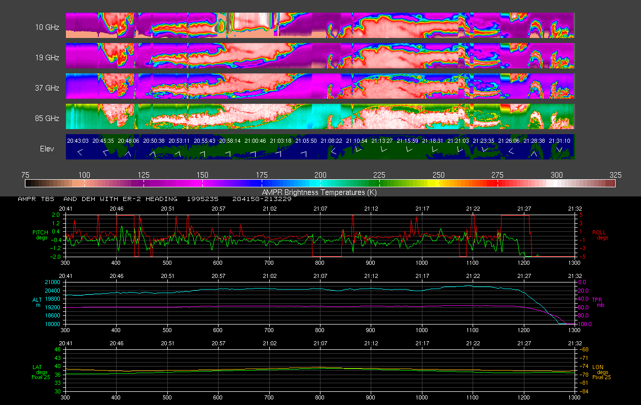
AMPR FIRE III ACE V1
National Aeronautics and Space Administration —
The Advanced Microwave Precipitation Radiometer (AMPR) was deployed during the First ISCCP Regional Experiment-III Arctic Cloud Experiment (FIRE-III/ACE). AMPR data... -
Federal
SMMR/Nimbus-7 Color Images V001 (SMMRN7IM) at GES DISC
National Aeronautics and Space Administration —
SMMRN7IM is the Nimbus-7 Scanning Multichannel Microwave Radiometer (SMMR) Color Image data product scanned from 17" x 15" color prints and saved as JPEG-2000 files.... -
Federal
AMSR-E/Aqua L2A Global Swath Spatially-Resampled Brightness Temperatures V004
National Aeronautics and Space Administration —
The AMSR-E Level-2A product (AE_L2A) contains daily 50 minute half-orbit swath brightness temperatures for six channels ranging from 6.9 GHz through 89 GHz. Data are... -
Federal
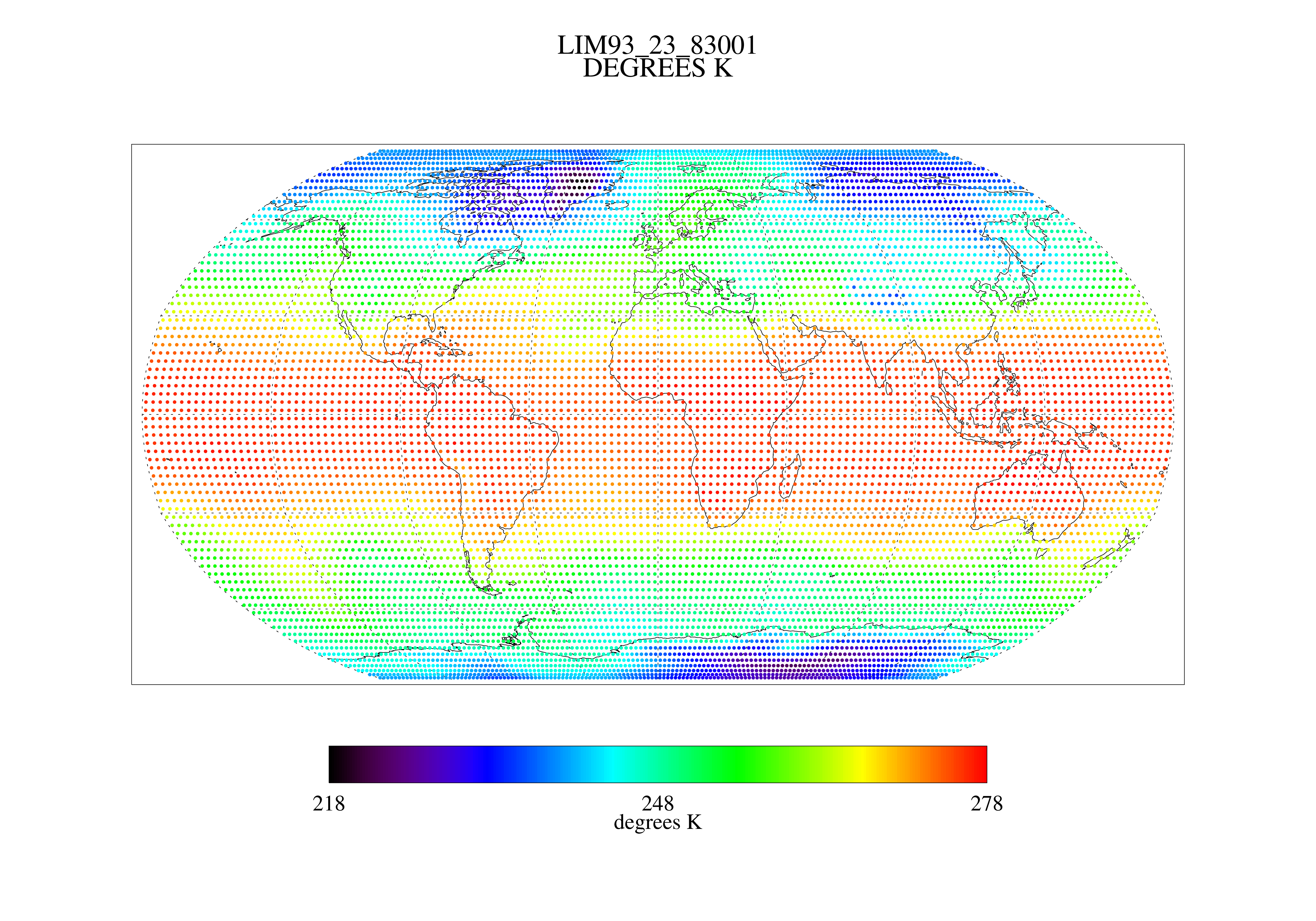
MSU Ch 2/3 Daily Lower Troposphere Temps with Limb93 Correction L3 1 day 2.5 degree x 2.5 degree V001 (MSULTT) at GES DISC
National Aeronautics and Space Administration —
The Microwave Sounding Unit (MSU) Lower Troposphere Deep Layer Temperature product (MSULTT) provides gridded lower tropospheric temperatures derived from MSU... -
Federal
SMEX03 QuikSCAT/SeaWinds Backscatter Data, Brazil, Version 1
National Aeronautics and Space Administration —
This data set includes data collected over the Soil Moisture Experiment 2003 (SMEX03) areas of Alabama, Georgia, Oklahoma, USA , and Brazil. -
Federal
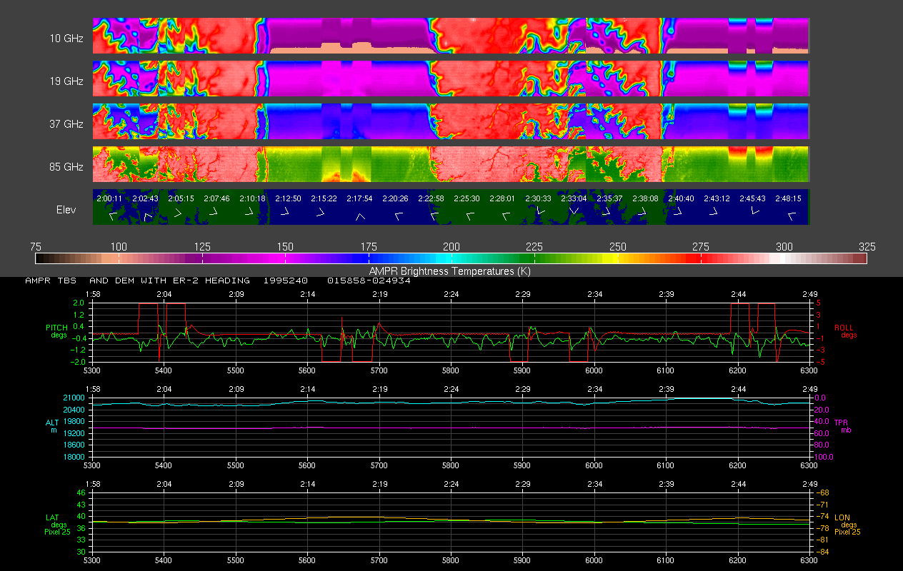
AMPR BRIGHTNESS TEMPERATURE CAMEX-2 V2
National Aeronautics and Space Administration —
The Advanced Microwave Precipitation Radiometer (AMPR) was deployed during the Convection and Moisture Experiment 2 (CAMEX-2). AMPR data were collected at a... -
Federal
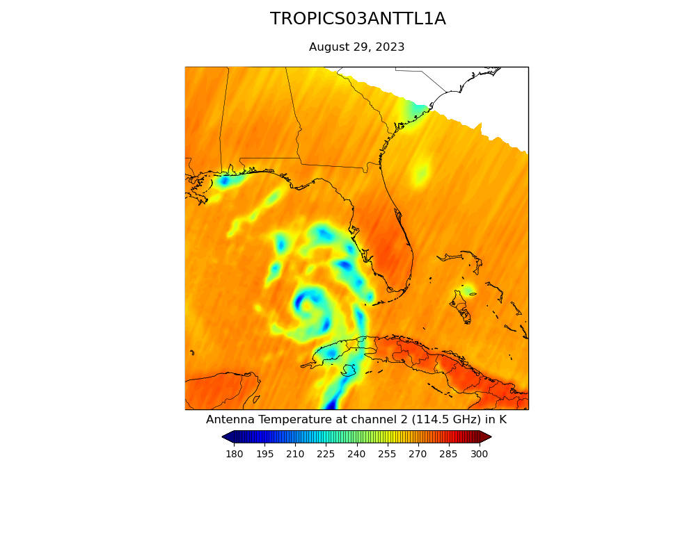
TROPICS03 L1A Orbital Geolocated Native-Resolution Antenna Temperatures V0.2
National Aeronautics and Space Administration —
The "Time-Resolved Observations of Precipitation structure and storm Intensity with a Constellation of Smallsats" (TROPICS) mission has a goal of providing nearly... -
Federal
Inventory of Arctic Rain on Snow Events: Meteorological and Surface Conditions, Version 1
National Aeronautics and Space Administration —
This data set contains surface and upper air data from global atmospheric reanalysis, and passive microwave brightness temperatures for rain on snow events in the... -
Federal
SMAP Enhanced L3 Radiometer Global and Polar Grid Daily 9 km EASE-Grid Soil Moisture V005
National Aeronautics and Space Administration —
This enhanced Level-3 (L3) soil moisture product provides a composite of daily estimates of global land surface conditions retrieved by the Soil Moisture Active... -
Federal
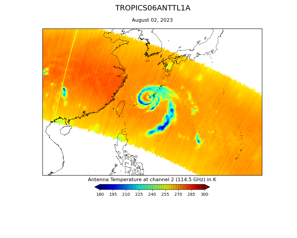
TROPICS06 L2A Unified Resolution Brightness Temperatures V0.2
National Aeronautics and Space Administration —
The "Time-Resolved Observations of Precipitation structure and storm Intensity with a Constellation of Smallsats" (TROPICS) mission has a goal of providing nearly... -
Federal
SMEX03 Aircraft Polarimetric Scanning Radiometer (PSR) Data, Oklahoma, Version 1
National Aeronautics and Space Administration —
This data set includes brightness temperature data for the C-band and X-band of the PSR/CX band radiometer. -
Federal
GRIP HURRICANE IMAGING RADIOMETER (HIRAD) V1
National Aeronautics and Space Administration —
The GRIP Hurricane Imaging Radiometer (HIRAD) V1 dataset contains measurements of brightness temperature taken at 4, 5, 6 and 6.6 GHz, as well as MERRA 2 m wind speed... -
Federal
Millimeter-wave Imaging Radiometer Brightness Temperatures, Wakasa Bay, Japan, Version 1
National Aeronautics and Space Administration —
This data set includes calibrated brightness temperatures measured over Wakasa Bay in the Sea of Japan. -
Federal
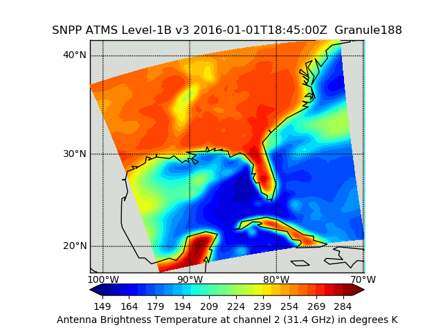
Suomi NPP ATMS Sounder Science Investigator-led Processing System (SIPS) Level 1B Brightness Temperature V3 (SNPPATMSL1B) at GES DISC
National Aeronautics and Space Administration —
The Advanced Technology Microwave Sounder (ATMS) Level 1B data files contain brightness temperature measurements along with ancillary spacecraft, instrument, and... -
Federal
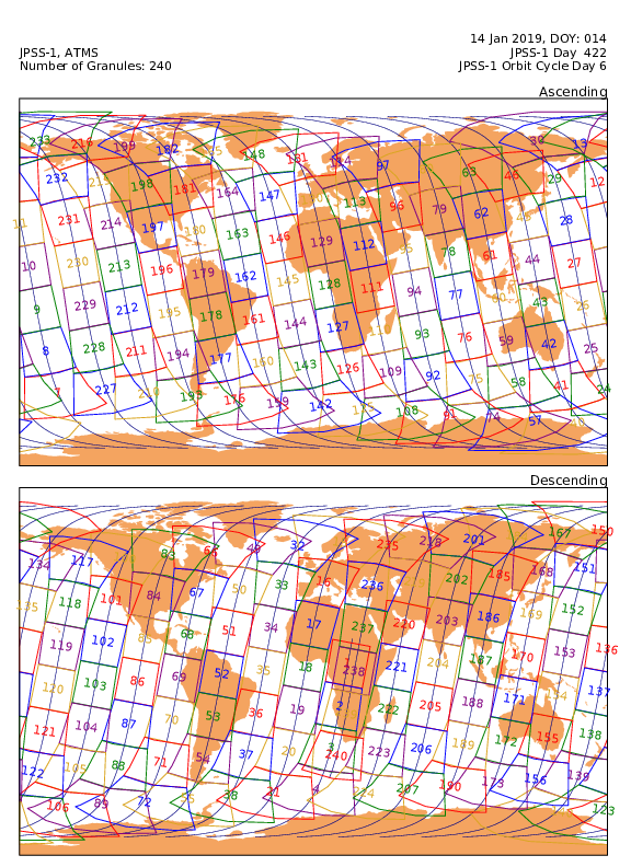
Sounder SIPS: JPSS-1 ATMS Level 1 Daily Polygon Granule Map at GES DISC
National Aeronautics and Space Administration —
The Advanced Technology Microwave Sounder (ATMS) Level 1B data files contain brightness temperature measurements along with ancillary spacecraft, instrument, and...

Official websites use .gov
A
.gov website belongs to an official government
organization in the United States.
Secure .gov websites use HTTPS
A
lock (
) or https:// means you’ve safely connected to
the .gov website. Share sensitive information only on official,
secure websites.