
-
Federal
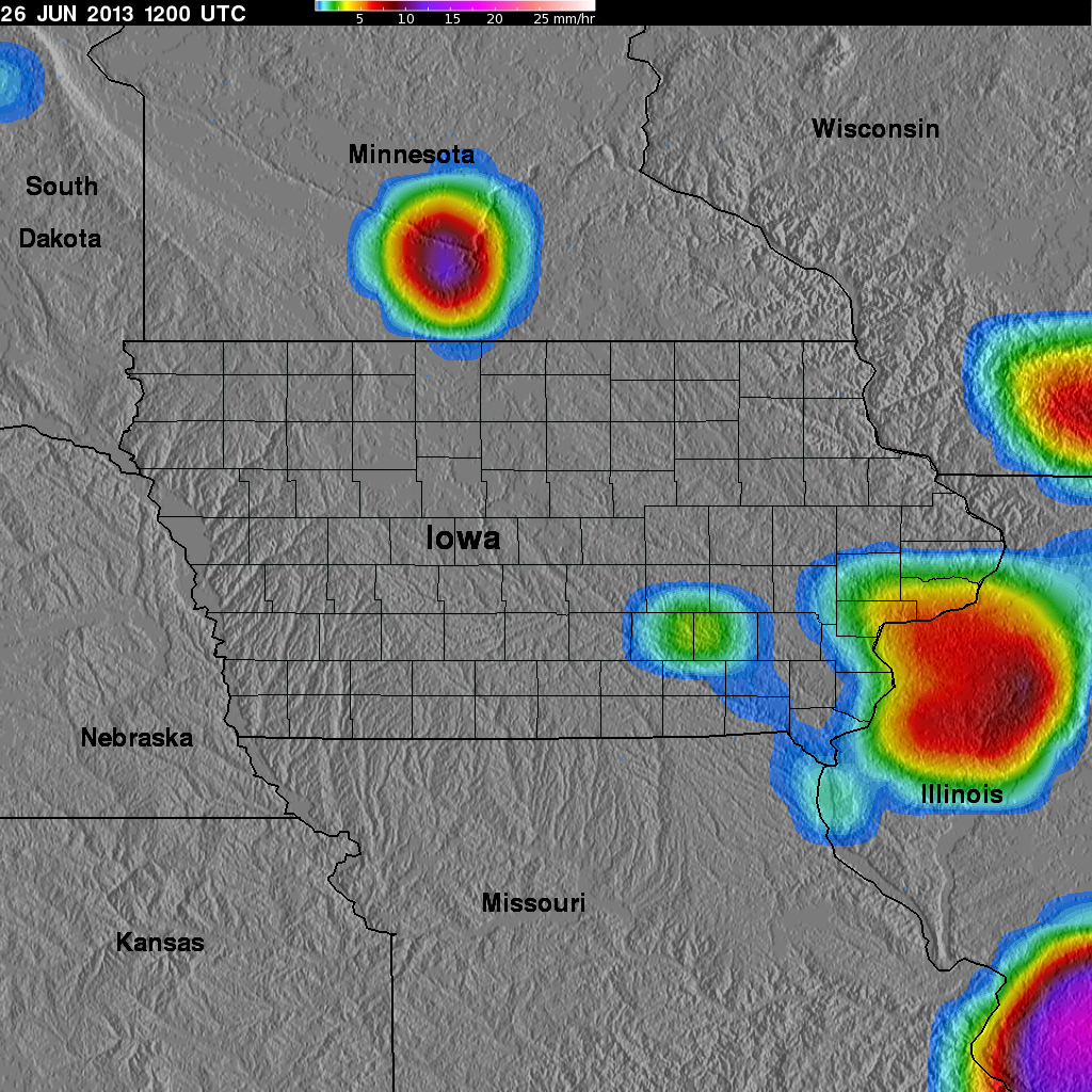
GPM Ground Validation TRMM Multi-satellite Precipitation Analysis (TMPA) IFloodS V7
National Aeronautics and Space Administration —
The GPM Ground Validation TRMM Multi-satellite Precipitation Analysis (TMPA) IFloodS dataset is a subset of the TMPA 3B42RT gridded precipitation real-time product... -
Federal
GRIP HURRICANE IMAGING RADIOMETER (HIRAD) V1
National Aeronautics and Space Administration —
The GRIP Hurricane Imaging Radiometer (HIRAD) V1 dataset contains measurements of brightness temperature taken at 4, 5, 6 and 6.6 GHz, as well as MERRA 2 m wind speed... -
Federal
TCSP HIGH ALTITUDE MMIC SOUNDING RADIOMETER (HAMSR) V1
National Aeronautics and Space Administration —
The High Altitude MMIC Sounding Radiometer (HAMSR) is a 25-channel microwave atmospheric sounder operating as a cross-track scanner. There are three bands: an... -
Federal
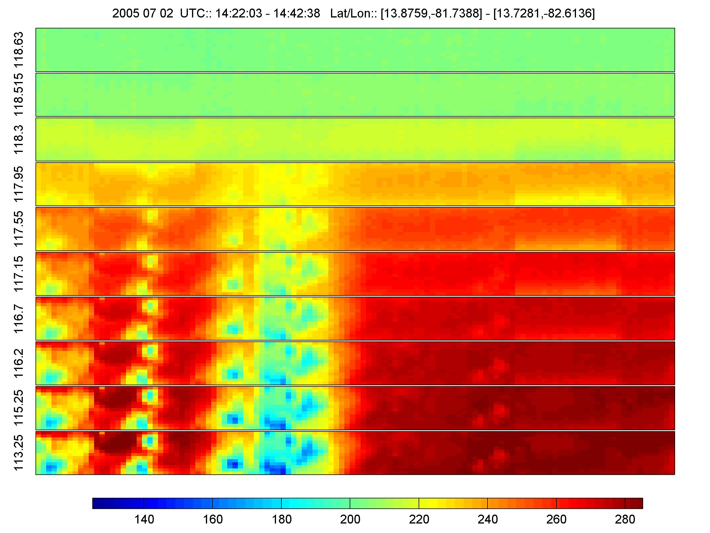
GPM Ground Validation Airborne Precipitation Radar 3rd Generation (APR-3) OLYMPEX V2
National Aeronautics and Space Administration —
The GPM Ground Validation Airborne Precipitation Radar 3rd Generation (APR-3) OLYMPEX V2 dataset was collected from November 12, 2015 to December 19, 2015 during the... -
Federal
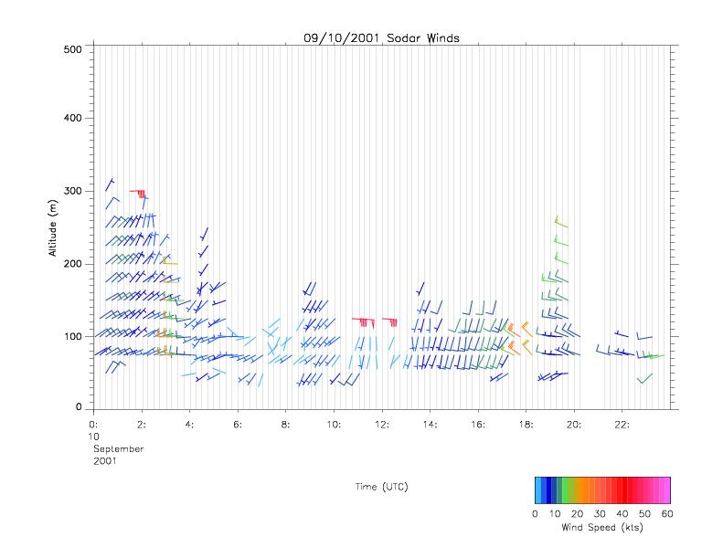
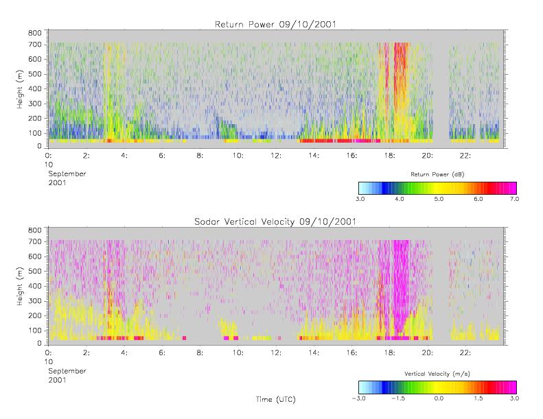
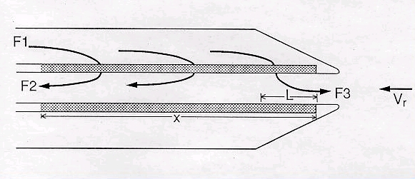
CAMEX-4 MIPS SODAR V1
National Aeronautics and Space Administration —
The University of Alabama in Huntsville (UAH) Mobile Integrated Profiling System (MIPS) is a mobile atmospheric profiling system. It includes a 915 MHz Doppler... -
Federal
CAMEX-4 CVI CLOUD CONDENSED WATER CONTENT V1
National Aeronautics and Space Administration —
The CAMEX-4 DC-8 Forward and NADIR Video dataset consists of DVDs which capture the forward and nadir views from the NASA DC-8 aircraft during CAMEX-4 flights. These... -
Federal
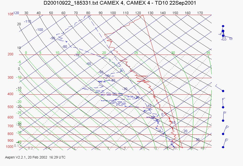
CAMEX-4 ER-2 HIGH ALTITUDE DROPSONDE V1
National Aeronautics and Space Administration —
The CAMEX-4 ER-2 High Altitude Dropsonde dataset was collected by the ER-2 High Altitude Dropsonde System (EHAD), which used dropwinsondes fitted with Global... -
Federal
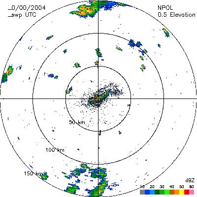
CAMEX-4 NASA PORTABLE S-BAND MULTIPARAMETER WX RESEARCH RADAR V1
National Aeronautics and Space Administration —
The CAMEX-4 NASA Portable S-Band Multiparameter WX Research Radar dataset was collected by the NASA Portable S-band Multiparameter Weather Research Radar (NPOL),... -
Federal
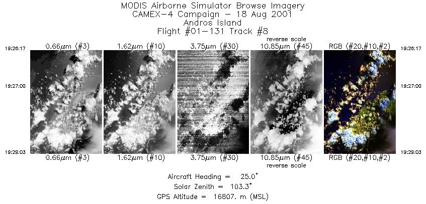
CAMEX-4 ER-2 MODIS AIRBORNE SIMULATOR (MAS) V1
National Aeronautics and Space Administration —
The MODIS Airborne Simulator (MAS) is an airborne scanning spectrometer that acquires high spatial resolution imagery of cloud and surface features from its vantage... -
Federal
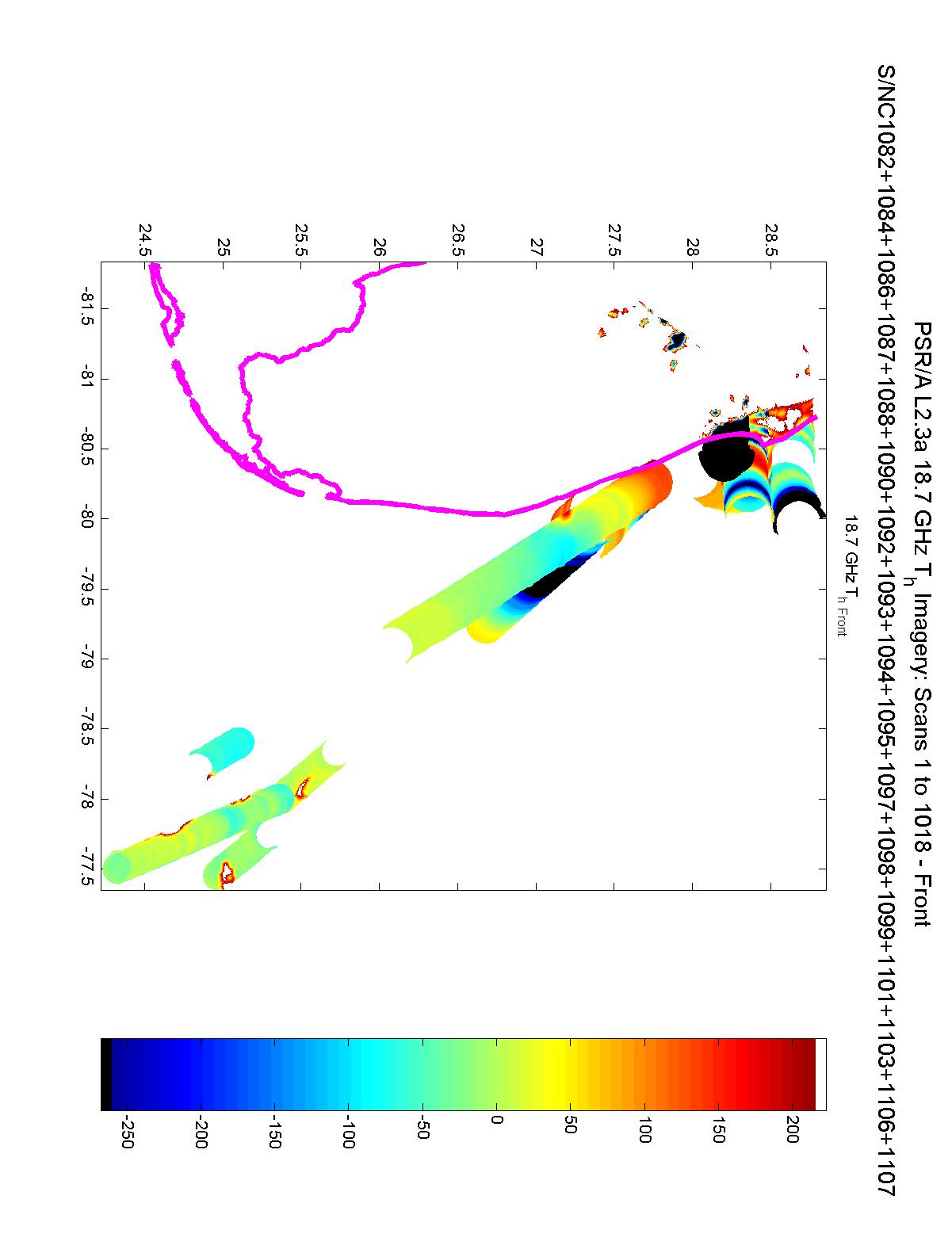
CAMEX-3 POLARIMETRIC SCANNING RADIOMETER (PSR) V1
National Aeronautics and Space Administration —
The Polarimetric Scanning Radiometer (PSR) is a versatile airborne microwave imaging radiometer developed by the Georgia Institute of Technology and the NOAA... -
Federal
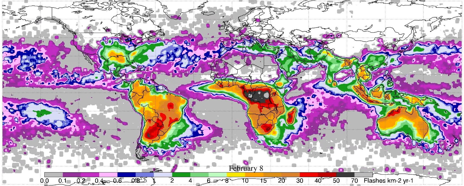
LIS/OTD 0.5 Degree High Resolution Monthly Climatology (HRMC) V2.3.2015
National Aeronautics and Space Administration —
The LIS/OTD 0.5 Degree High Resolution Monthly Climatology (HRMC) contains a variety of gridded climatologies of total lightning flash rates obtained from two... -
Federal
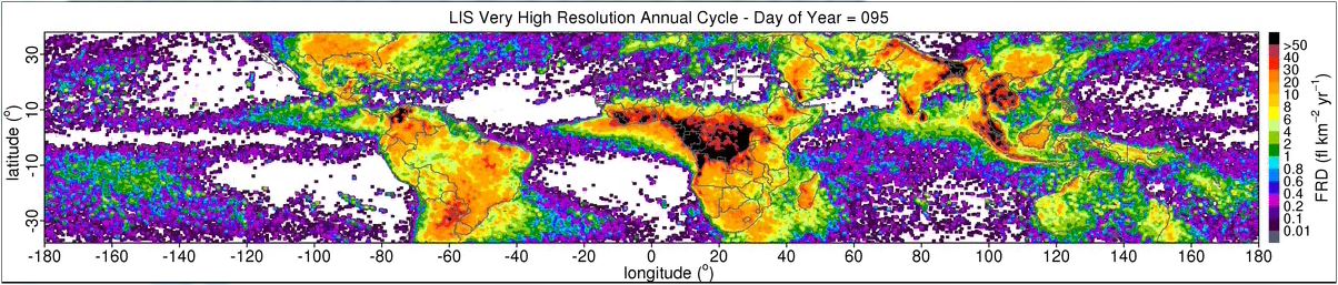
LIS 0.1 DEGREE VERY HIGH RESOLUTION GRIDDED LIGHTNING ANNUAL CLIMATOLOGY (VHRAC) V1
National Aeronautics and Space Administration —
The LIS 0.1 Degree Very High Resolution Gridded Lightning Annual Climatology (VHRAC) dataset consists of gridded annual climatologies of total lightning flash rates... -
Federal
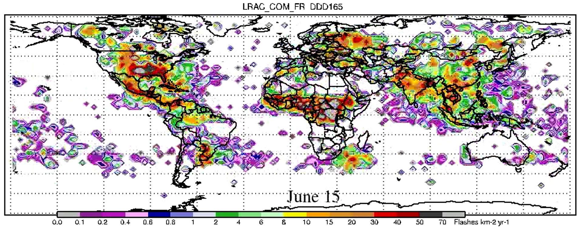
LIS/OTD 2.5 Degree Low Resolution Annual Climatology (LRAC) V2.3.2015
National Aeronautics and Space Administration —
The LIS/OTD 2.5 Degree Low Resolution Annual Climatology (LRAC) contains a variety of gridded climatologies of total lightning flash rates obtained from two lightning... -
Federal
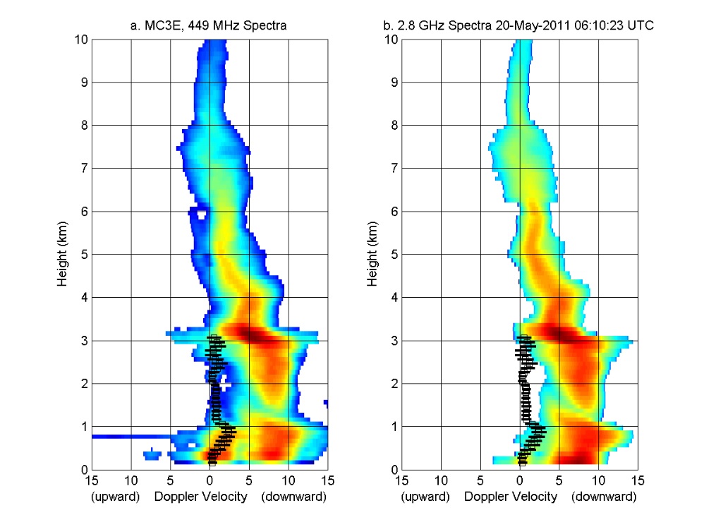
GPM GROUND VALIDATION NOAA UHF 449 PROFILER MC3E V1
National Aeronautics and Space Administration —
The GPM Ground Validation NOAA UHF 449 Profiler MC3E dataset was collected during the NASA supported Midlatitude Continental Convective Clouds Experiment (MC3E). The... -
Federal
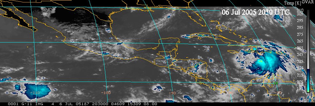
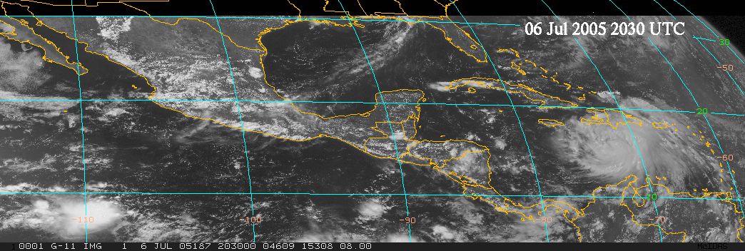
TCSP GOES VISIBLE AND INFRARED IMAGES V1
National Aeronautics and Space Administration —
The TCSP GOES Visible and Infrared Images dataset was collected in support of the Tropical Cloud Systems and Processes (TCSP) mission, visible and infrared imagery... -
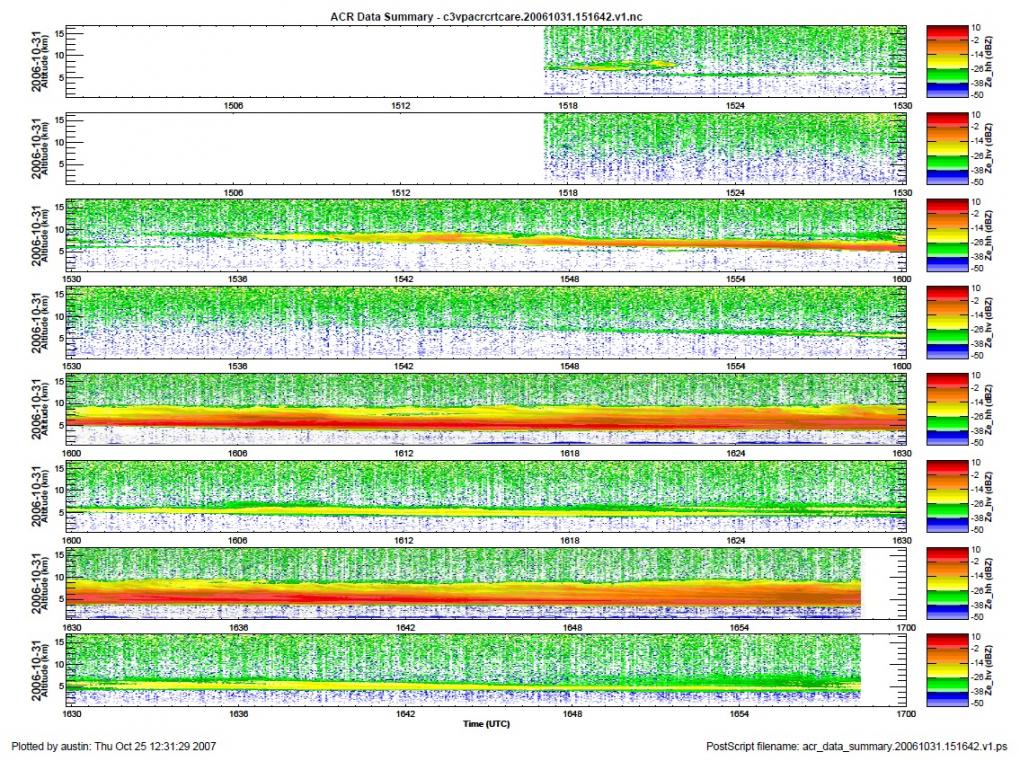
Federal
GPM Ground Validation NASA W-band Aircraft Cloud Radar (WACR) C3VP V1
National Aeronautics and Space Administration —
The GPM Ground Validation NASA W-band Airborne Cloud Radar (WACR) C3VP dataset consists of calibrated co- and cross-polarized radar reflectivity at 94 GHz during the... -
Federal
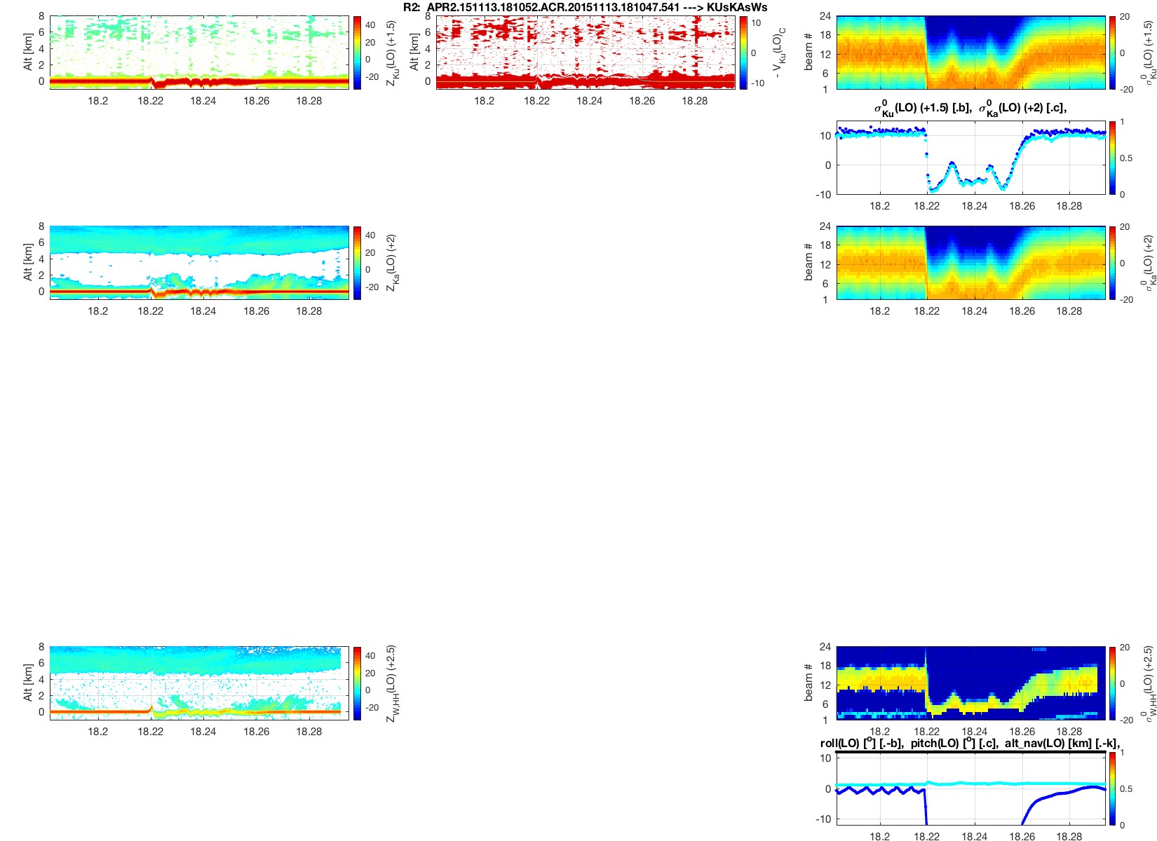
Airborne Precipitation Radar 3rd Generation (APR-3) CPEX-AW V1
National Aeronautics and Space Administration —
The Airborne Precipitation Radar 3rd Generation (APR-3) CPEX-AW dataset consists of radar reflectivity, Doppler velocity for all bands, linear depolarization ratio... -
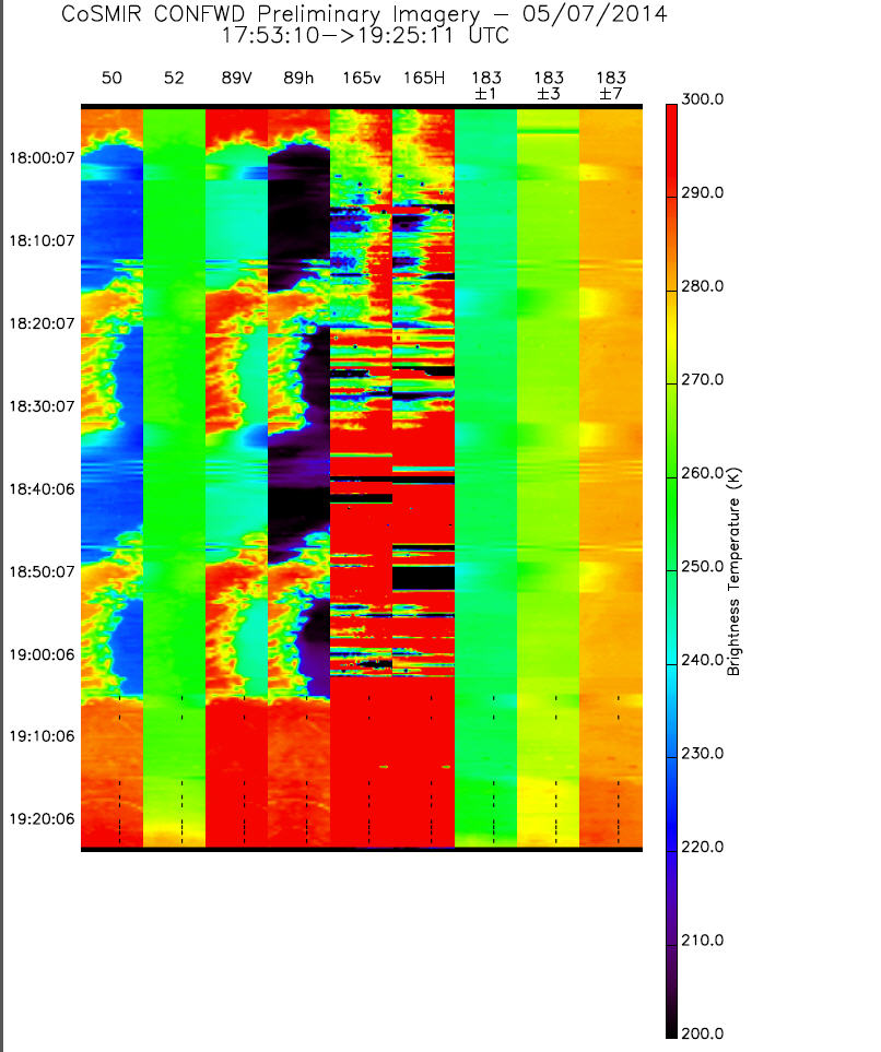
Federal
GPM GROUND VALIDATION CONICAL SCANNING MILLIMETER-WAVE IMAGING RADIOMETER (COSMIR) IPHEx V1
National Aeronautics and Space Administration —
The GPM Ground Validation Conical Scanning Millimeter-wave Imaging Radiometer (CoSMIR) IPHEx dataset consists of brightness temperatures from 9 channels as measured... -
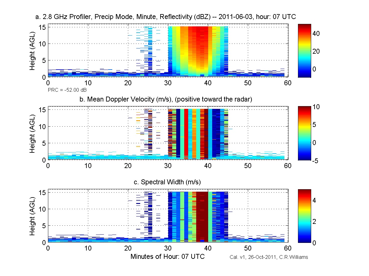
Federal
GPM GROUND VALIDATION NOAA S-BAND PROFILER MINUTE DATA MC3E V1
National Aeronautics and Space Administration —
The GPM Ground Validation NOAA S-Band Profiler Minute Data MC3E dataset was gathered during the Midlatitude Continental Convective Clouds Experiment (MC3E) in... -
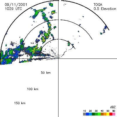
Federal
CAMEX-4 TOGA RADAR V1
National Aeronautics and Space Administration —
The TOGA radar dataset consists of browse and radar data collected from the TOGA radar during the CAMEX-4 experiment. TOGA is a C-band linear polarized doppler radar...

Official websites use .gov
A
.gov website belongs to an official government
organization in the United States.
Secure .gov websites use HTTPS
A
lock (
) or https:// means you’ve safely connected to
the .gov website. Share sensitive information only on official,
secure websites.