

35 datasets found
-
Federal
Gridded Population of the World, Version 4 (GPWv4): Data Quality Indicators, Revision 11
National Aeronautics and Space Administration —
The Gridded Population of the World, Version 4 (GPWv4): Data Quality Indicators, Revision 11 consists of three data layers created to provide context for the... -
Federal
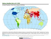
Gridded Population of the World, Version 4 (GPWv4): National Identifier Grid, Revision 11
National Aeronautics and Space Administration —
The Gridded Population of the World, Version 4 (GPWv4): National Identifier Grid, Revision 11 is a raster representation of nation-states in GPWv4 for use in... -
Federal
Global Rural-Urban Mapping Project, Version 1 (GRUMPv1): National Administrative Boundaries
National Aeronautics and Space Administration —
The Global Rural-Urban Mapping Project, Version 1 (GRUMPv1): National Administrative Boundaries are derived from the land area grid to show the outlines of pixels... -
Federal
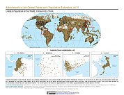
Gridded Population of the World, Version 4 (GPWv4): Administrative Unit Center Points with Population Estimates, Revision 11
National Aeronautics and Space Administration —
The Gridded Population of the World, Version 4 (GPWv4): Administrative Unit Center Points with Population Estimates, Revision 11 consists of UN WPP-adjusted... -
Federal
LBA Regional Boundary for the Legal Amazon of Brazil, 8-km
National Aeronautics and Space Administration —
The Legal Amazon of Brazil is defined by law to include the states of Acre, Amapa, Amazonas, Para, Rondonia, Roraima, Mato Grosso, Maranhao, and Tocantins [Fundacao... -
Federal
China Dimensions Data Collection: China Administrative Regions GIS Data: 1:1M, County Level, 1 July 1990
National Aeronautics and Space Administration —
The China Administrative Regions GIS Data: 1:1M, County Level, 1 July 1990 consists of geographic boundary data for the administrative regions of China as of 1 July... -
Federal
Gridded Population of the World, Version 3 (GPWv3): Coastlines
National Aeronautics and Space Administration —
The Gridded Population of the World, Version 3 (GPWv3): Coastlines are derived from the land area grid to show the outlines of pixels (cells) that contain... -
Federal
National Aggregates of Geospatial Data Collection: Population, Landscape, And Climate Estimates, Version 3 (PLACE III)
National Aeronautics and Space Administration —
The National Aggregates of Geospatial Data Collection: Population, Landscape, And Climate Estimates, Version 3 (PLACE III) data set contains estimates of national-... -
Federal
China Dimensions Data Collection: Fundamental GIS: Digital Chart of China, 1:1M, Version 1
National Aeronautics and Space Administration —
The Fundamental GIS: Digital Chart of China, 1:1M, Version 1 consists of vector maps of China and surrounding areas. The maps include roads, railroads, drainage... -
Federal
National Aggregates of Geospatial Data Collection: Population, Landscape, And Climate Estimates (PLACE)
National Aeronautics and Space Administration —
The National Aggregates of Geospatial Data Collection: Population, Landscape, And Climate Estimates (PLACE) data set contains estimates of national-level aggregations... -
Federal
LBA-ECO LC-01 National, Provincial, and Park Boundaries, Ecuador
National Aeronautics and Space Administration —
This data set contains the national and provincial boundaries of Ecuador as well as the boundaries of two national parks: the Cuyabeno Wildlife Reserve and the Yasuni... -
Federal
Gridded Population of the World, Version 3 (GPWv3): Subnational Administrative Boundaries
National Aeronautics and Space Administration —
The Gridded Population of the World, Version 3 (GPWv3): Subnational Administrative Boundaries are the basis of the population data products in GPWv3. Due to copyright... -
Federal
National Aggregates of Geospatial Data Collection: Population, Landscape, And Climate Estimates, Version 4 (PLACE IV)
National Aeronautics and Space Administration —
The National Aggregates of Geospatial Data Collection: Population, Landscape, And Climate Estimates, Version 4 (PLACE IV) provides measures of population (head... -
Federal
LBA-ECO CD-06 Physical, Political, and Hydrologic Maps, Ji-Parana River Basin, Brazil
National Aeronautics and Space Administration —
This data set contains physical, hydrologic, political, demographic, and societal maps for the Ji-Parana River Basin, in the state of Rondonia, Brazil. These data... -
Federal
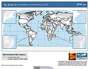
Gridded Population of the World, Version 3 (GPWv3): National Administrative Boundaries
National Aeronautics and Space Administration —
The Gridded Population of the World, Version 3 (GPWv3): National Administrative Boundaries are derived from the land area grid to show the outlines of pixels (cells)...
35 datasets found