Sea Turtle Satellite Telemetry Data in North Atlantic Ocean from 2007-10-16 to 2010-11-26 (NCEI Accession 0159216)
Access & Use Information
Downloads & Resources
-
159216.1.1.tar.gz
-
Full Metadata Record
View the complete metadata record on InPort for more information about this...
-
ARGOS Page
Home page of NOAA Satellite Information System
-
Landing Page Accession 0159216
Sea Turtle Satellite Telemetry Data in North Atlantic Ocean from 2007-10-16...
-
Global Change Master Directory (GCMD) Keywords
14 views
The information provided on this page seeks to define how the GCMD Keywords...
-
NOAA Data Management Plan (DMP)PDF
NOAA Data Management Plan for this record on InPort.
Dates
| Metadata Date | February 29, 2024 |
|---|---|
| Metadata Created Date | November 12, 2020 |
| Metadata Updated Date | April 1, 2024 |
| Reference Date(s) | 2006 (creation), 2017 (revision), (publication) |
| Frequency Of Update |
Metadata Source
- ISO-19139 ISO-19139 Metadata
Harvested from NMFS SEFSC
Graphic Preview

Additional Metadata
| Resource Type | Dataset |
|---|---|
| Metadata Date | February 29, 2024 |
| Metadata Created Date | November 12, 2020 |
| Metadata Updated Date | April 1, 2024 |
| Reference Date(s) | 2006 (creation), 2017 (revision), (publication) |
| Responsible Party | (Point of Contact, Custodian) |
| Contact Email | |
| Guid | gov.noaa.nmfs.inport:30335 |
| Access Constraints | Cite As: Southeast Fisheries Science Center, [Date of Access]: Sea Turtle Satellite Telemetry Data in North Atlantic Ocean from 2007-10-16 to 2010-11-26 (NCEI Accession 0159216) [Data Date Range], https://www.fisheries.noaa.gov/inport/item/30335., Access Constraints: None, Use Constraints: NOAA and NCEI make no warranty, expressed or implied, regarding these data, nor does the fact of distribution constitute such a warranty. NOAA and NCEI cannot assume liability for any damages caused by any errors or omissions in these data. If appropriate, NCEI can only certify that data it distributes are an authentic copy of the records that were accepted for inclusion in the NCEI archives. |
| Bbox East Long | -65.138 |
| Bbox North Lat | 41.451 |
| Bbox South Lat | 26.268 |
| Bbox West Long | -81.335 |
| Coupled Resource | |
| Frequency Of Update | |
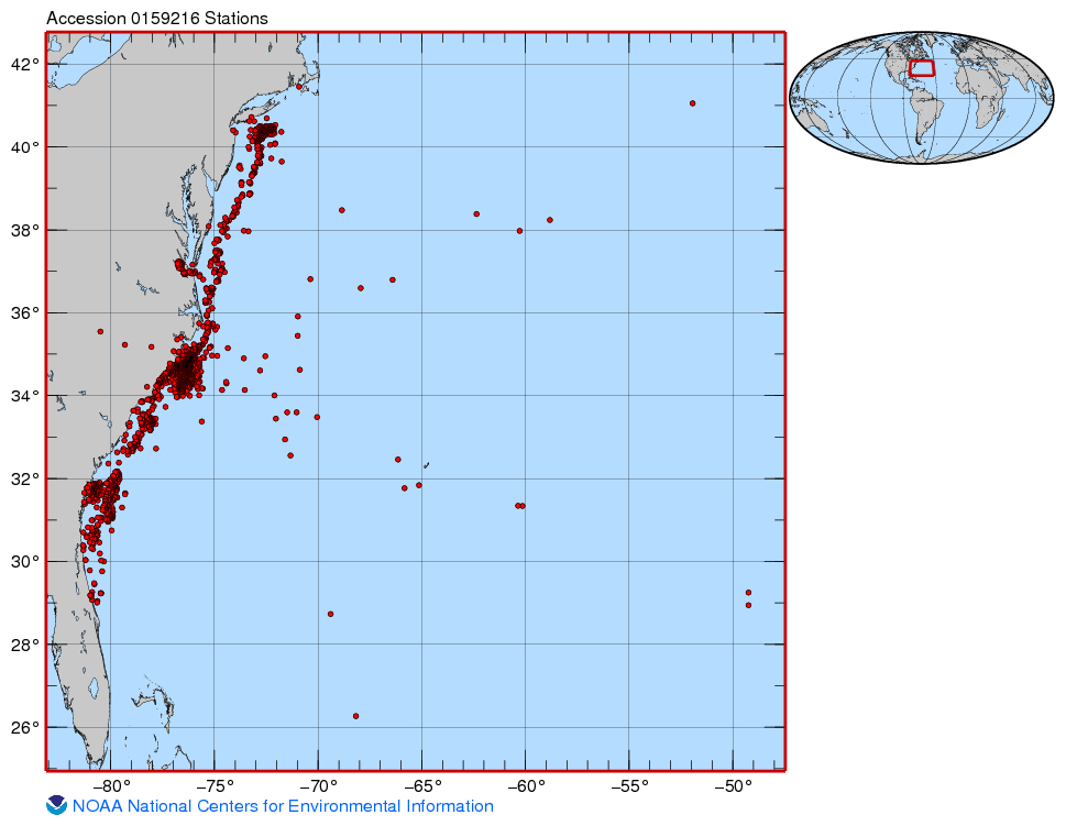
| Graphic Preview Description | Map of sampling points data NCEI Accession 0159216 |
| Graphic Preview File | https://www.ncei.noaa.gov/archive/accession/0159216/1.1/about/0159216_map.jpg |
| Graphic Preview Type | jpg |
| Harvest Object Id | e7504b68-48d5-4156-9bbf-7070cf43520b |
| Harvest Source Id | ca759a40-507d-4d0c-8f8c-64b3c5e05066 |
| Harvest Source Title | NMFS SEFSC |
| Licence | NOAA provides no warranty, nor accepts any liability occurring from any incomplete, incorrect, or misleading data, or from any incorrect, incomplete, or misleading use of the data. It is the responsibility of the user to determine whether or not the data is suitable for the intended purpose. |
| Lineage | |
| Metadata Language | eng |
| Metadata Type | geospatial |
| Old Spatial | {"type": "Polygon", "coordinates": [[[-81.335, 26.268], [-65.138, 26.268], [-65.138, 41.451], [-81.335, 41.451], [-81.335, 26.268]]]} |
| Progress | underDevelopment |
| Spatial Data Service Type | |
| Spatial Reference System | |
| Spatial Harvester | True |
| Temporal Extent Begin | 2006 |
Didn't find what you're looking for? Suggest a dataset here.

