

Reservoir Stimulation Optimization with Operational Monitoring for Creation of EGS
Access & Use Information
Downloads & Resources
-
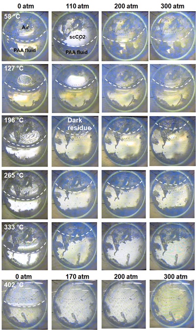
PAA Rheology vs T and P.jpgJPEG
Demonstration of volume expansion of our fracturing fluid
-
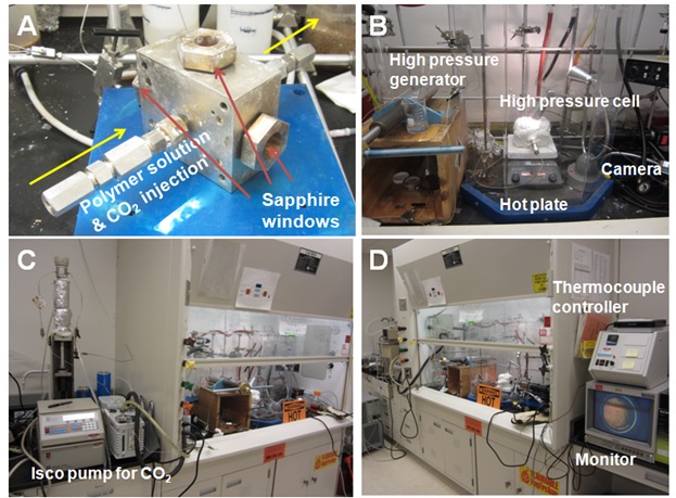
Rheology 3-window cell.jpgJPEG
High P&T cell and system for rheology studies
-
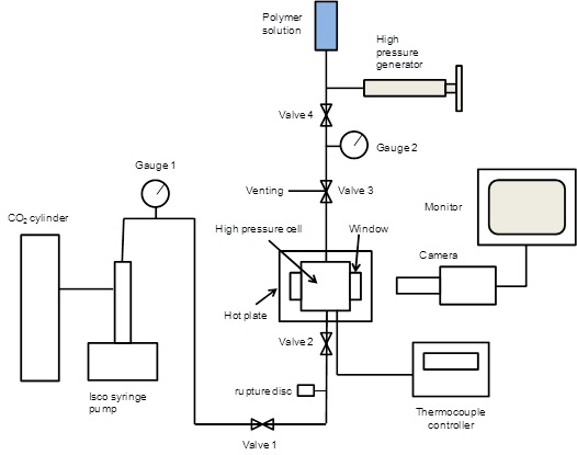
Rheology high P&T system.jpgJPEG
High P/T system schematic
-
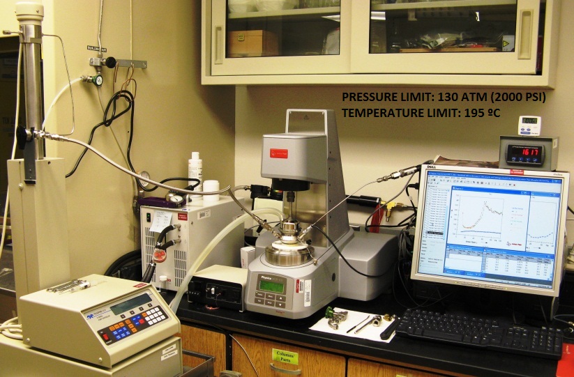
Rheometer system.jpgJPEG
Rheorimeter for viscosity analysis as a function of P, T and shear rate
-
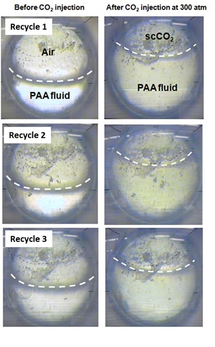
PAA Recycling.jpgJPEG
Recycling fracturing fluid demo
-
Viscosity Test-2_Results PAA.xlsxEXCEL
Viscosity as a function of P on our proposed fracturing fluid
-
Viscosity Test-4_Results-SDS.xlsxEXCEL
Viscosity versus P on SDS solution
-
Viscosity Test-3_Results Xanthan.xlsxEXCEL
Viscosity versus P on xanthan solution
-
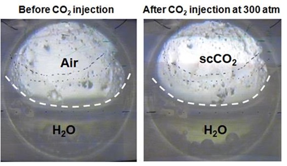
water-CO2 control.jpgJPEG
Viscosity versus P on water
-
NMR capability and needs.pptxPOWERPOINT
NMR instrumentation and high P/T rotors for chemical speciation analysis of...
-
Final High P&T PAA_NMR_rev2a.pptxPOWERPOINT
NMR spectra showing speciation of our polymer with CO2 but limited to 150C...
-
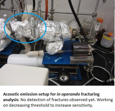
Acoustic emission setup.jpgJPEG
Acoustic analysis setup for in operando monitoring of fracturing processes
-
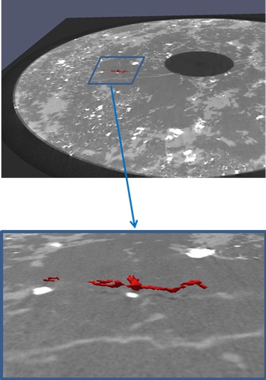
XMT showing local fractures created by PAA on...JPEG
XMT image showing a 3D local fracture generated on highly crystalline rock...
-
Pulse echo Setup and Data report 3-7-13 final.docxDOC
Report on Pulse Echo Analysis data on rock samples previous to fracturing to...
-
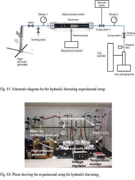
Fracturing high P&T system.jpgJPEG
High P/T fracturing system
-
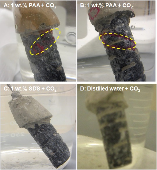
Pics of four Coso samples subjected to 7 atm...JPEG
Images of fractured rock from Coso geothermal site using our fluid technology
-
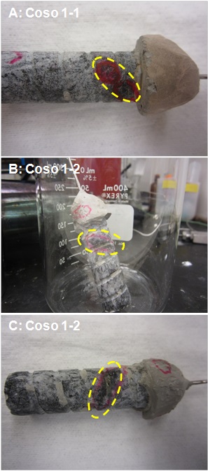
Pics of two PAA-fractured Coso samples...JPEG
Images of fractured rock from Coso geothermal site using our fluid technology
-
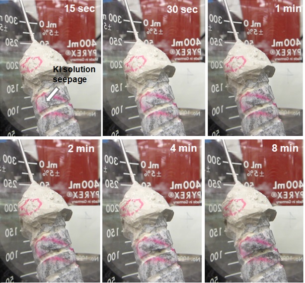
Pics vs time of PAA-fractured Coso 1-2 sample...JPEG
Images of Ki seepage analysis on fractured rock from Coso geothermal site...
-
XMT summary of four fracturing experiments.docxDOC
Summary of XMT images as well as photographs of rock samples from Coso...
-
Landing PageLanding Page
Dates
| Metadata Created Date | January 11, 2025 |
|---|---|
| Metadata Updated Date | January 20, 2025 |
Metadata Source
- Data.json Data.json Metadata
Harvested from OpenEI data.json
Additional Metadata
| Resource Type | Dataset |
|---|---|
| Metadata Created Date | January 11, 2025 |
| Metadata Updated Date | January 20, 2025 |
| Publisher | Pacific Northwest National Laboratory |
| Maintainer | |
| Doi | 10.15121/1148805 |
| Identifier | https://data.openei.org/submissions/6598 |
| Data First Published | 2013-09-25T06:00:00Z |
| Data Last Modified | 2017-05-30T18:18:25Z |
| Public Access Level | public |
| Bureau Code | 019:20 |
| Metadata Context | https://openei.org/data.json |
| Metadata Catalog ID | https://openei.org/data.json |
| Schema Version | https://project-open-data.cio.gov/v1.1/schema |
| Catalog Describedby | https://project-open-data.cio.gov/v1.1/schema/catalog.json |
| Data Quality | True |
| Datagov Dedupe Retained | 20250120143002 |
| Harvest Object Id | 09daaac9-a563-45c3-bd68-4e5c05a2ad7d |
| Harvest Source Id | 7cbf9085-0290-4e9f-bec1-91653baeddfd |
| Harvest Source Title | OpenEI data.json |
| Homepage URL | https://gdr.openei.org/submissions/258 |
| License | https://creativecommons.org/licenses/by/4.0/ |
| Old Spatial | {"type":"Polygon","coordinates":-117.93681758789,36.049347445098,-117.72810665039,36.049347445098,-117.72810665039,36.292405351352,-117.93681758789,36.292405351352,-117.93681758789,36.049347445098} |
| Program Code | 019:006 |
| Projectlead | William Vandermeer |
| Projectnumber | FY13 AOP 25726 |
| Source Datajson Identifier | True |
| Source Hash | 384ea5f086b5b61356731374de1c1d5b08e40ce4dcdb954511f6f8f9cd45ff75 |
| Source Schema Version | 1.1 |
| Spatial | {"type":"Polygon","coordinates":-117.93681758789,36.049347445098,-117.72810665039,36.049347445098,-117.72810665039,36.292405351352,-117.93681758789,36.292405351352,-117.93681758789,36.049347445098} |
Didn't find what you're looking for? Suggest a dataset here.