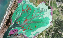
North Carolina Seagrass Submersed Rooted Vasculars 1990 Substrate
Access & Use Information
Downloads & Resources
-
Bulk DownloadZIP
FTP download of data files.
-
Full Metadata Record
View the complete metadata record on InPort for more information about this...
-
CMECS Home Page
Information and resources on the CMECS standard and how to apply it
-
NOAA's Office for Coastal Management (OCM) website
Information on the NOAA Office for Coastal Management (OCM)
-
CMECS Catalog
Searchable online catalog of CMECS units, descriptions, and source references
-
NOAA's Office for Coastal Management (OCM)...
The website provides not only coastal data, but also the tools, training, and...
-
NOAA Office for Coastal Management Website
52 views
NOAA Office for Coastal Management Home Page
-
NOAA Office for Coastal Management Website
52 views
NOAA Office for Coastal Management Home Page
-
Global Change Master Directory (GCMD) Keywords
14 views
The information provided on this page seeks to define how the GCMD Keywords...
-
NOAA Data Management Plan (DMP)PDF
NOAA Data Management Plan for this record on InPort.
Dates
| Metadata Date | February 29, 2024 |
|---|---|
| Metadata Created Date | October 15, 2021 |
| Metadata Updated Date | April 15, 2024 |
| Reference Date(s) | 2015 (publication) |
| Frequency Of Update | asNeeded |
Metadata Source
- ISO-19139 ISO-19139 Metadata
Harvested from NOS OCM
Graphic Preview

Additional Metadata
| Resource Type | Dataset |
|---|---|
| Metadata Date | February 29, 2024 |
| Metadata Created Date | October 15, 2021 |
| Metadata Updated Date | April 15, 2024 |
| Reference Date(s) | 2015 (publication) |
| Responsible Party | NOAA Office for Coastal Management (Point of Contact, Custodian) |
| Contact Email | |
| Guid | gov.noaa.nmfs.inport:47912 |
| Access Constraints | Cite As: Office for Coastal Management, [Date of Access]: North Carolina Seagrass Submersed Rooted Vasculars 1990 Substrate [Data Date Range], https://www.fisheries.noaa.gov/inport/item/47912., Access Constraints: None, Use Constraints: None, Distribution Liability: NOAA provides no warranty, nor accepts any liability occurring from any incomplete, incorrect, or misleading data, or from any incorrect, incomplete, or misleading use of the data. It is the responsibility of the user to determine whether or not the data is suitable for the intended purpose. |
| Bbox East Long | -75.4635 |
| Bbox North Lat | 36.6545 |
| Bbox South Lat | 34.6025 |
| Bbox West Long | -77.0865 |
| Coupled Resource | |
| Frequency Of Update | asNeeded |
| Graphic Preview Description | Sample of benthic cover data |
| Graphic Preview File | https://coast.noaa.gov/data/Images/Collections/BenthicCover_thumbnail.jpg |
| Graphic Preview Type | JPEG |
| Harvest Object Id | 8d3353b8-d50c-451f-abe2-005cf981ae42 |
| Harvest Source Id | c0121fd9-df15-4168-ac04-42f6e36a794d |
| Harvest Source Title | NOS OCM |
| Licence | NOAA provides no warranty, nor accepts any liability occurring from any incomplete, incorrect, or misleading data, or from any incorrect, incomplete, or misleading use of the data. It is the responsibility of the user to determine whether or not the data is suitable for the intended purpose. |
| Lineage | |
| Metadata Language | eng |
| Metadata Type | geospatial |
| Old Spatial | {"type": "Polygon", "coordinates": [[[-77.0865, 34.6025], [-75.4635, 34.6025], [-75.4635, 36.6545], [-77.0865, 36.6545], [-77.0865, 34.6025]]]} |
| Progress | completed |
| Spatial Data Service Type | |
| Spatial Reference System | |
| Spatial Harvester | True |
| Temporal Extent Begin | 1985 |
| Temporal Extent End | 1990 |
Didn't find what you're looking for? Suggest a dataset here.

