

GHRSST Level 3C Indian-Ocean (IO) sub-skin Sea Surface Temperature from the Spinning Enhanced Visible and Infrared Imager (SEVIRI) on MSG in GDS2 format produced by OSISAF
Access & Use Information
Public: This dataset is intended for public access and use.
License: No license information was provided. If this work was prepared by an officer or employee of the United States government as part of that person's official duties it is considered a U.S. Government Work.
Downloads & Resources
-
Data Information (Unknown Format)BIN
-
Data Information (PDF)PDF
osisaf_cdop3_ss1_atbd_geo_sst.pdf
-
Data Information (Unknown Format)BIN
-
Data Information (PDF)PDF
GDS20r5.pdf
-
Data Information (Unknown Format)BIN
-
Data Information (Unknown Format)BIN
-
Data Information (PDF)PDF
osisaf_cdop3_ss1_svr_meteosat08_io_sst.pdf
-
Data Information (Unknown Format)BIN
-
Data Information (Unknown Format)BIN
-
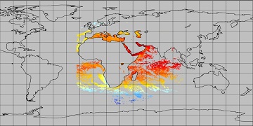
Data Information (JPEG)JPEG
SEVIRI_IO_SST-OSISAF-L3C-v1.0.jpg
-
Landing PageLanding Page
Dates
| Metadata Created Date | April 9, 2025 |
|---|---|
| Metadata Updated Date | September 19, 2025 |
Metadata Source
- Data.json Data.json Metadata
Harvested from NASA Data.json
Additional Metadata
| Resource Type | Dataset |
|---|---|
| Metadata Created Date | April 9, 2025 |
| Metadata Updated Date | September 19, 2025 |
| Publisher | NASA/JPL/PODAAC;EUMETSAT |
| Maintainer | |
| Identifier | 10.5067/GHSIO-3CO01 |
| Data Last Modified | 2025-09-11 |
| Category | Earth Science |
| Public Access Level | public |
| Bureau Code | 026:00 |
| Metadata Context | https://project-open-data.cio.gov/v1.1/schema/catalog.jsonld |
| Schema Version | https://project-open-data.cio.gov/v1.1/schema |
| Catalog Describedby | https://project-open-data.cio.gov/v1.1/schema/catalog.json |
| Harvest Object Id | eef9e3a5-5bd8-498f-9ffa-78ab27530948 |
| Harvest Source Id | 58f92550-7a01-4f00-b1b2-8dc953bd598f |
| Harvest Source Title | NASA Data.json |
| Homepage URL | https://podaac.jpl.nasa.gov/CitingPODAAC |
| Old Spatial | "CARTESIAN",{"NorthBoundingCoordinate":60.0,"WestBoundingCoordinate":-18.5,"EastBoundingCoordinate":101.5,"SouthBoundingCoordinate":-60.0} |
| Program Code | 026:000 |
| Source Datajson Identifier | True |
| Source Hash | a3ea7b3b142ee17ef8a09f4e410e4841f0cb676c055a95141d1105c6a25199cf |
| Source Schema Version | 1.1 |
| Spatial | |
| Temporal | 2017-03-28/2017-03-28 |
Didn't find what you're looking for? Suggest a dataset here.