ATom: L2 Measurements of In Situ Airborne Formaldehyde (ISAF)
Access & Use Information
Downloads & Resources
-
Google Scholar search resultsHTML
Search results for publications that cite this dataset by its DOI.
-
Download this datasetHTML
This link allows direct data access via Earthdata login
-
View documentation related to this datasetHTML
ORNL DAAC Data Set Documentation
-
This dataset's landing pageHTML
Data set Landing Page DOI URL
-
View documentation related to this datasetPDF
ATom: L2 Measurements of In Situ Airborne Formaldehyde (ISAF):...
-
Get a related visualizationPNG
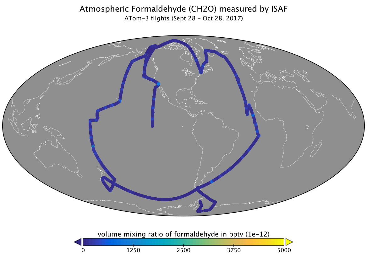
Measurements of atmospheric formaldehyde concentrations from the ISAF...
-
The dataset's project home pageHTML
ATom campaign page
-
Landing PageLanding Page
Dates
| Metadata Created Date | May 30, 2023 |
|---|---|
| Metadata Updated Date | December 7, 2023 |
Metadata Source
- Data.json Data.json Metadata
Harvested from NASA Data.json
Graphic Preview

Additional Metadata
| Resource Type | Dataset |
|---|---|
| Metadata Created Date | May 30, 2023 |
| Metadata Updated Date | December 7, 2023 |
| Publisher | ORNL_DAAC |
| Maintainer | |
| Identifier | C2676907210-ORNL_CLOUD |
| Data First Published | 2021-06-28 |
| Language | en-US |
| Data Last Modified | 2023-06-12 |
| Category | ATom, geospatial |
| Public Access Level | public |
| Bureau Code | 026:00 |
| Metadata Context | https://project-open-data.cio.gov/v1.1/schema/catalog.jsonld |
| Metadata Catalog ID | https://data.nasa.gov/data.json |
| Schema Version | https://project-open-data.cio.gov/v1.1/schema |
| Catalog Describedby | https://project-open-data.cio.gov/v1.1/schema/catalog.json |
| Citation | Hanisco, T.F., R.A. Hannun, J.M. St.Clair, and G.M. Wolfe. 2019. ATom: L2 Measurements of In Situ Airborne Formaldehyde (ISAF). ORNL DAAC, Oak Ridge, Tennessee, USA. https://doi.org/10.3334/ORNLDAAC/1730 |
| Graphic Preview Description | Measurements of atmospheric formaldehyde concentrations from the ISAF instrument during ATom-3 flights in 2017. |
| Graphic Preview File | https://daac.ornl.gov/ATOM/guides/ATom_ISAF_Instrument_Data_Fig1.png |
| Harvest Object Id | 769adae9-7482-4ffb-887d-ad3c93d4737b |
| Harvest Source Id | 58f92550-7a01-4f00-b1b2-8dc953bd598f |
| Harvest Source Title | NASA Data.json |
| Homepage URL | https://doi.org/10.3334/ORNLDAAC/1730 |
| Metadata Type | geospatial |
| Old Spatial | -180.0 -80.12 180.0 80.52 |
| Program Code | 026:001 |
| Source Datajson Identifier | True |
| Source Hash | 4e873e1fe76abb51ff0bf22e1f557fd2ba6ace05c6dc18bc7eef9af5d45a8f08 |
| Source Schema Version | 1.1 |
| Spatial | |
| Temporal | 2016-07-29T14:33:18Z/2018-05-07T06:29:50Z |
Didn't find what you're looking for? Suggest a dataset here.

