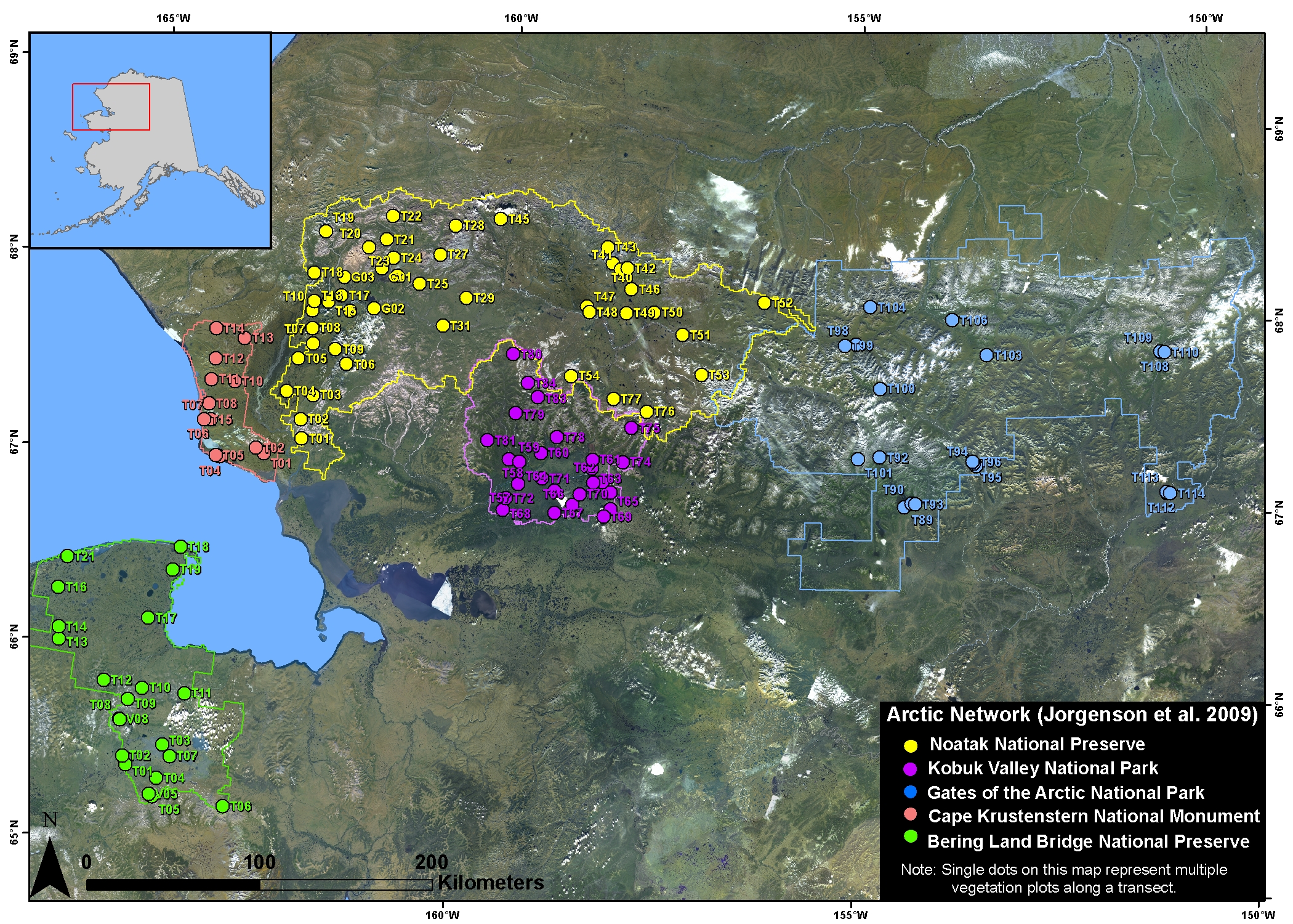
Arctic Vegetation Plots in NPS Arctic Network Parks, Alaska, 2002-2008
Access & Use Information
Downloads & Resources
-
Google Scholar search resultsHTML
Search results for publications that cite this dataset by its DOI.
-
Download this datasetHTML
This link allows direct data access via Earthdata login
-
View documentation related to this datasetHTML
ORNL DAAC Data Set Documentation
-
This dataset's landing pageHTML
Data set Landing Page DOI URL
-
View documentation related to this datasetPDF
PDF of the guide document
-
View documentation related to this datasetPDF
Related study report by Jorgenson et al., 2009
-
View documentation related to this datasetPDF
Pre-ABoVE: Arctic Vegetation Plots in NPS Arctic Network Parks, Alaska,...
-
Get a related visualizationJPEG
Browse Image
-
The dataset's project home pageHTML
ABoVE project site
-
Landing PageLanding Page
Dates
| Metadata Created Date | December 1, 2022 |
|---|---|
| Metadata Updated Date | December 7, 2023 |
Metadata Source
- Data.json Data.json Metadata
Harvested from NASA Data.json
Graphic Preview

Additional Metadata
| Resource Type | Dataset |
|---|---|
| Metadata Created Date | December 1, 2022 |
| Metadata Updated Date | December 7, 2023 |
| Publisher | ORNL_DAAC |
| Maintainer | |
| Identifier | C2162120326-ORNL_CLOUD |
| Data First Published | 2018-12-31 |
| Language | en-US |
| Data Last Modified | 2023-06-12 |
| Category | ABoVE, geospatial |
| Public Access Level | public |
| Bureau Code | 026:00 |
| Metadata Context | https://project-open-data.cio.gov/v1.1/schema/catalog.jsonld |
| Metadata Catalog ID | https://data.nasa.gov/data.json |
| Schema Version | https://project-open-data.cio.gov/v1.1/schema |
| Catalog Describedby | https://project-open-data.cio.gov/v1.1/schema/catalog.json |
| Citation | Jorgenson, M.T. 2018. Arctic Vegetation Plots in NPS Arctic Network Parks, Alaska, 2002-2008. ORNL DAAC, Oak Ridge, Tennessee, USA. https://doi.org/10.3334/ORNLDAAC/1542 |
| Graphic Preview Description | Browse Image |
| Graphic Preview File | https://daac.ornl.gov/ABOVE/guides/Arctic_Network_Veg_Plots_Fig1.jpg |
| Harvest Object Id | 76de10e5-3a79-4fb3-bc0f-07a1bca472d8 |
| Harvest Source Id | 58f92550-7a01-4f00-b1b2-8dc953bd598f |
| Harvest Source Title | NASA Data.json |
| Homepage URL | https://doi.org/10.3334/ORNLDAAC/1542 |
| Metadata Type | geospatial |
| Old Spatial | -165.32 65.28 -150.84 68.49 |
| Program Code | 026:001 |
| Source Datajson Identifier | True |
| Source Hash | 62076f628c5eac6099136813ed14e25e52ea50620aaf587ce7a0b0812c2a5ebe |
| Source Schema Version | 1.1 |
| Spatial | |
| Temporal | 2002-07-10T00:00:00Z/2008-08-10T23:59:59Z |
Didn't find what you're looking for? Suggest a dataset here.

