

AMPR BRIGHTNESS TEMPERATURE (TB) TOGA COARE V2
Access & Use Information
Public: This dataset is intended for public access and use.
License: No license information was provided. If this work was prepared by an officer or employee of the United States government as part of that person's official duties it is considered a U.S. Government Work.
Downloads & Resources
-
Google Scholar search resultsHTML
Search results for publications that cite this dataset by its DOI.
-
Download this datasetHTML
Files may be downloaded directly to your workstation from this link
-
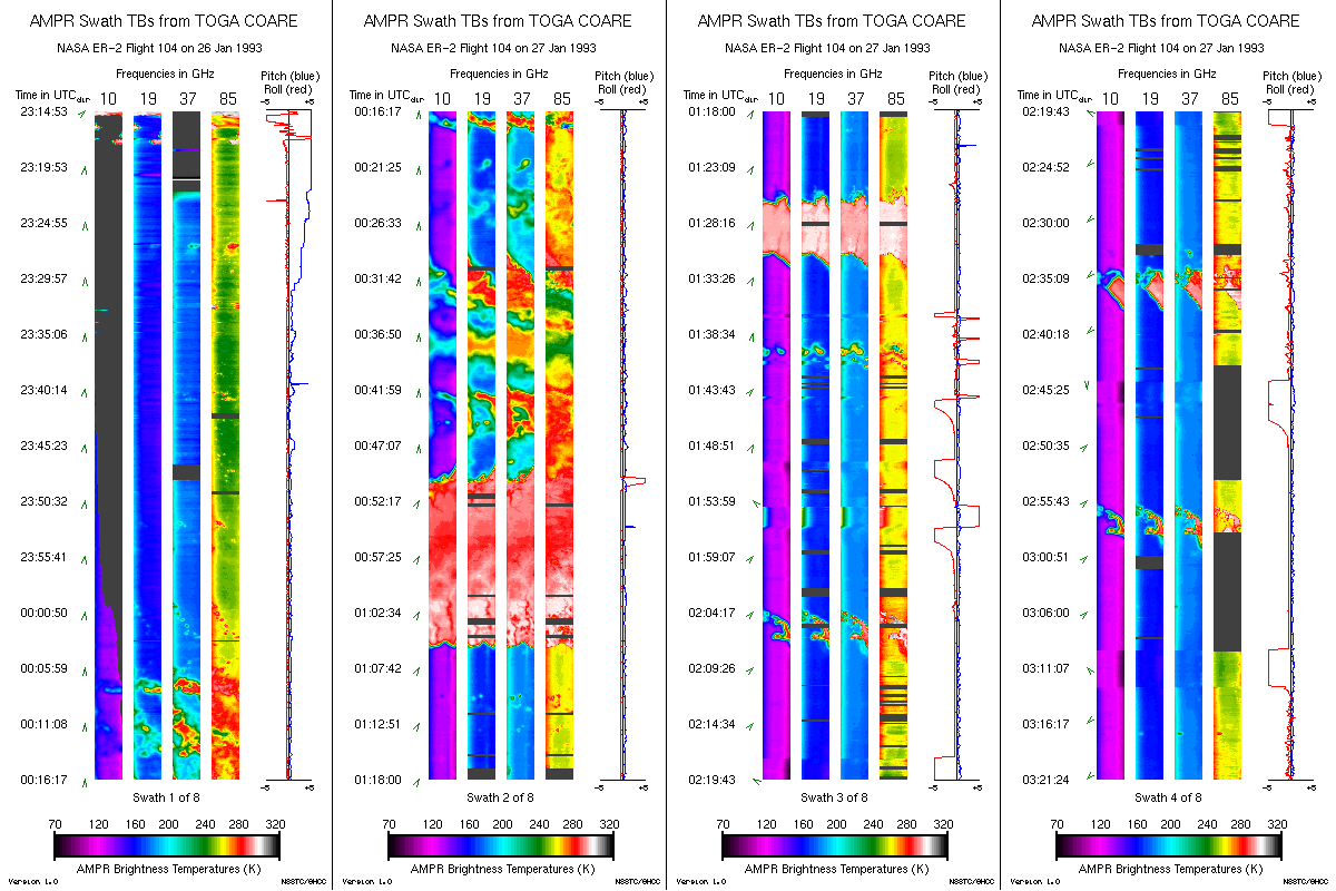
Get a related visualizationGIF
Sample browse image
-
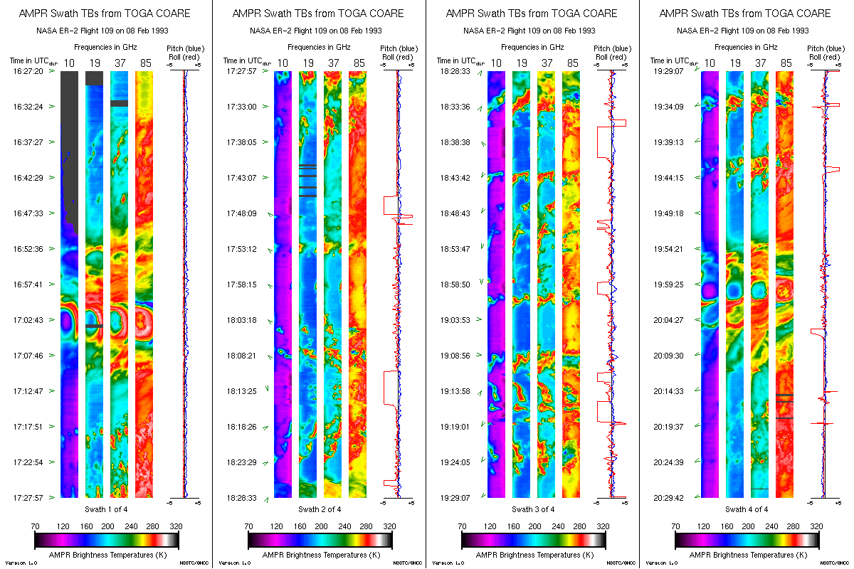
Get a related visualizationGIF
Sample browse image
-
View documentation related to this datasetHTML
The guide document contains detailed information about the dataset
-
View the primary investigator's documentation...PDF
Brief Instrument Description of the Advanced Microwave Precipitation...
-
Downloadable software applicationsHTML
Example program to read AMPR data from a text file into arrays
-
Get a related visualizationHTML
N/A
-
View documentation related to this datasetHTML
Instructions for citing GHRC data
-
Landing PageLanding Page
Dates
| Metadata Created Date | December 1, 2022 |
|---|---|
| Metadata Updated Date | August 22, 2025 |
Metadata Source
- Data.json Data.json Metadata
Harvested from NASA Data.json
Additional Metadata
| Resource Type | Dataset |
|---|---|
| Metadata Created Date | December 1, 2022 |
| Metadata Updated Date | August 22, 2025 |
| Publisher | NASA/MSFC/GHRC |
| Maintainer | |
| Identifier | C1979080426-GHRC_DAAC |
| Data First Published | 1993-01-11 |
| Language | en-US |
| Data Last Modified | 2025-07-17 |
| Category | TOGA COARE, geospatial |
| Public Access Level | public |
| Bureau Code | 026:00 |
| Metadata Context | https://project-open-data.cio.gov/v1.1/schema/catalog.jsonld |
| Schema Version | https://project-open-data.cio.gov/v1.1/schema |
| Catalog Describedby | https://project-open-data.cio.gov/v1.1/schema/catalog.json |
| Harvest Object Id | 0774dcd8-2182-401f-896b-1feacdfc5321 |
| Harvest Source Id | 58f92550-7a01-4f00-b1b2-8dc953bd598f |
| Harvest Source Title | NASA Data.json |
| Homepage URL | https://doi.org/10.5067/TOGACOARE/AMPR/DATA101 |
| Metadata Type | geospatial |
| Old Spatial | 144.774 -21.3571 160.679 0.22934 |
| Program Code | 026:001 |
| Source Datajson Identifier | True |
| Source Hash | 1e142cbff2e97e757da0fadccad6cf1cc7852683a2fa9deb2ccd38b38ac4dcaf |
| Source Schema Version | 1.1 |
| Spatial | |
| Temporal | 1993-01-12T21:32:01Z/1993-02-25T03:13:58Z |
Didn't find what you're looking for? Suggest a dataset here.