

11 datasets found
-
State
Mid-Depth Rocky & Soft-Bottom Ecosystems, California South Coast MPA Baseline Study, 2011 to 2012
State of California —
Seafloor habitats deeper than 100 meters make up an estimated 29% (1840 km2) of state waters in southern California, yet they are sampled with far less frequency when... -
Federal
Gazetteer of Planetary Nomenclature: Moon: 1:10 million-scale Shaded Relief and Color-coded Topography: South Pole
National Aeronautics and Space Administration —
These lunar maps display the four different areas of the moon with color-coded topography in low and high resolution approved by the International Astronomical Union... -
Federal
Gazetteer of Planetary Nomenclature: Moon: 1:1 million-scale maps of the Moon
National Aeronautics and Space Administration —
The purpose of the lunar maps is to provide an up-to-date and comprehensive depiction on lunar nomenclature approved by the International Astronomical Union (IAU). -
Federal
Gazetteer of Planetary Nomenclature: Mars: MOLA global images
National Aeronautics and Space Administration —
These maps display regional feature names and boundaries of regional features of Mars approved by the International Astronomical Union (IAU). -
Federal
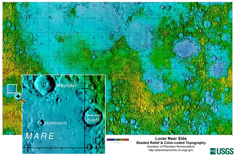
Gazetteer of Planetary Nomenclature: Moon: 1:10 million-scale Shaded Relief and Color-coded Topography: Near Side
National Aeronautics and Space Administration —
These lunar maps display the four different areas of the moon with color-coded topography in low and high resolution approved by the International Astronomical Union... -
Federal
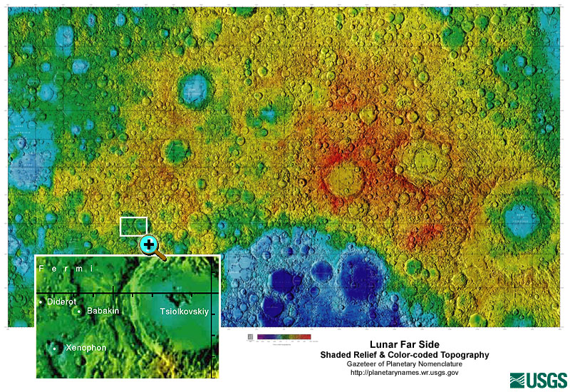
Gazetteer of Planetary Nomenclature: Moon: 1:10 million-scale Shaded Relief and Color-coded Topography: Far Side
National Aeronautics and Space Administration —
These lunar maps display the four different areas of the moon with color-coded topography in low and high resolution approved by the International Astronomical Union... -
State
Spatial and Economic Human Uses, California South Coast MPA Baseline Study, 1992 to 2012
State of California —
This study addresses the South Coast MPA Baseline Program objectives by describing human use patterns across the study region and establishing initial data points for... -
Federal
New River Geothermal Exploration (Ram Power Inc.)
Department of Energy —
The New River Geothermal Exploration (DOE Award No. EE0002843) is located approximately 25km south of the Salton Sea, near town of Brawley in Imperial County and... -
State
Characterization of Human Uses and the Socioeconomic Dimensions, California North Coast MPA Baseline Study, 1992 to 2014
State of California —
The primary goal of this project was to inform long-term marine protected area (MPA) monitoring efforts by gathering up-to-date socioeconomic information to... -
Federal
Alum Innovative Exploration Project (Ram Power Inc.)
Department of Energy —
Data generated from the Alum Innovative Exploration Project, one of several promising geothermal properties located in the middle to upper Miocene (~11-5 Ma, or... -
Federal
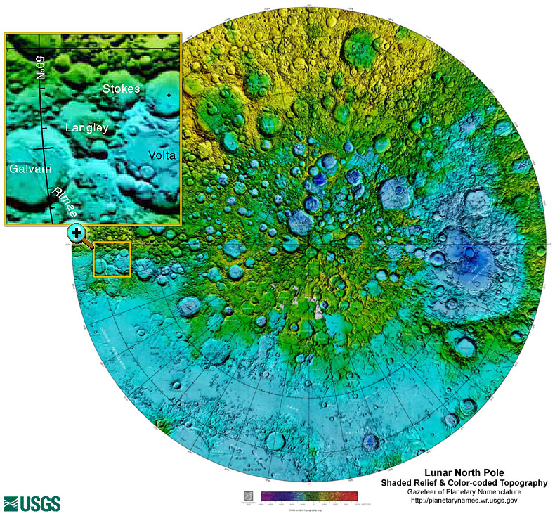
Gazetteer of Planetary Nomenclature: Moon: 1:10 million-scale Shaded Relief and Color-coded Topography: North Pole
National Aeronautics and Space Administration —
These lunar maps display the four different areas of the moon with color-coded topography in low and high resolution approved by the International Astronomical Union...
11 datasets found