
-
Federal
Hudson River, NY/NJ (M060H) Bathymetric Digital Elevation Model (30 meter resolution) Derived From Source Hydrographic Survey Soundings Collected by NOAA
National Oceanic and Atmospheric Administration, Department of Commerce —
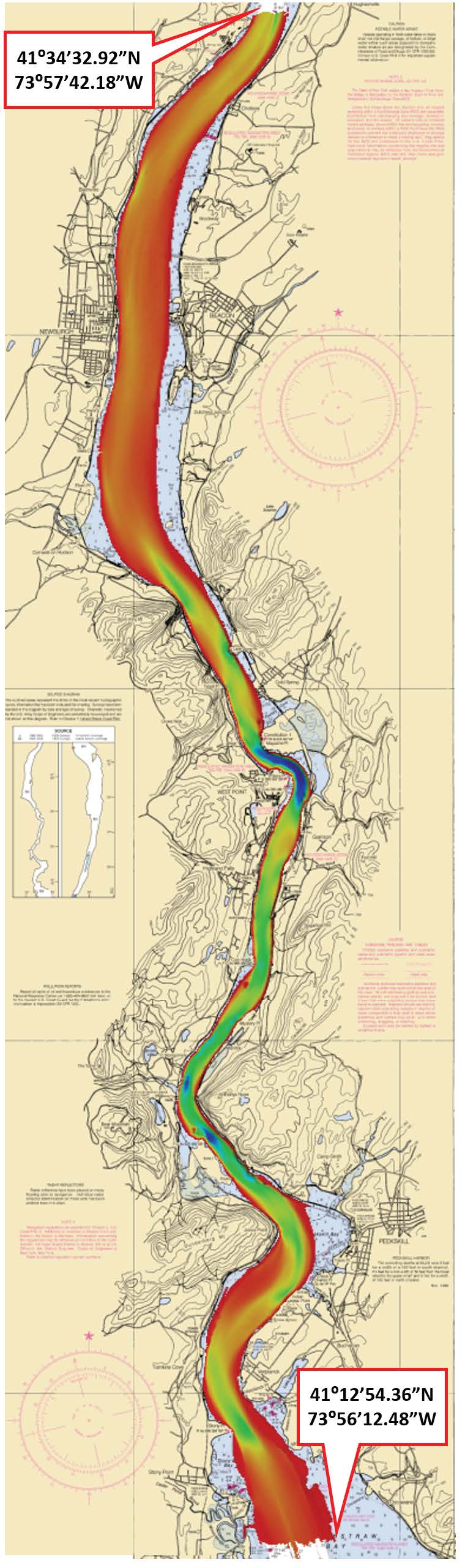
Bathymetry for the Hudson River was derived from twenty surveys containing 120,771 soundings. No surveys were omitted. The average separation between soundings was 51... -
Federal
Sensitivity of Coastal Environments and Wildlife to Spilled Oil: Hudson River: SOCECON (Socioeconomic Resource Points and Lines)
National Oceanic and Atmospheric Administration, Department of Commerce —
This data set contains human-use resource data for marinas, boat ramps, locks and dams, water intake sites, archaeological sites, U.S. Coast Guard stations,... -
Federal
Shoreline Mapping Program of HUDSON RIVER, CASTLE POINT TO 63RD STREET, NY, NY1006 NGDA
National Oceanic and Atmospheric Administration, Department of Commerce —
These data provide an accurate high-resolution shoreline compiled from imagery of HUDSON RIVER, CASTLE POINT TO 63RD STREET, NY . This vector shoreline data is based... -
Federal
Oceanographic data collected from station Mohawk R. Rexford Bridge by Hudson River Environmental Conditions Observing System (HRECOS) and assembled by Mid-Atlantic Regional Association Coastal Ocean Observing System (MARACOOS) in the Hudson River from 2014-08-04 to 2019-03-31 (NCEI Accession 0163415)
National Oceanic and Atmospheric Administration, Department of Commerce —
This dataset contains oceanographic data collected at Mohawk R. Rexford Bridge, a fixed station in the Hudson River. These sensors measure CONDUCTIVITY, DEPTH -... -
Federal
NY/NJ Metro Area, Hudson River, and South Long Island 2016 INVERT Polygons
National Oceanic and Atmospheric Administration, Department of Commerce —
This data set contains sensitive biological resource data for marine, estuarine, and freshwater invertebrates, and federally and/or state endangered, threatened, or... -
Federal
Shoreline Mapping Program of Hudson River, NY, NJ9901A NGDA
National Oceanic and Atmospheric Administration, Department of Commerce —
These data provide an accurate high-resolution shoreline compiled from imagery of Hudson River, NY . This vector shoreline data is based on an office interpretation... -
Federal
Shoreline Mapping Program of Hudson River, Troy to Athens, NY, NY1802A-CM-N NGDA
National Oceanic and Atmospheric Administration, Department of Commerce —
These data provide an accurate high-resolution shoreline compiled from imagery of Hudson River, Troy to Athens, NY . This vector shoreline data is based on an office... -
Federal
Shoreline Data Rescue Project of Hudson River, NY, EC5C07A NGDA
National Oceanic and Atmospheric Administration, Department of Commerce —
These data were automated to provide an accurate high-resolution historical shoreline of Hudson River, NY suitable as a geographic information system (GIS) data... -
Federal
NOAA National Estuarine Research Reserve (NERR) System-wide Monitoring Program Meteorological, Water Quality and Nutrient/Pigment Data from 1994 to 2022 (NCEI Accession 0200366)
National Oceanic and Atmospheric Administration, Department of Commerce —
Meteorological dataset: Meteorological data provide information on atmospheric conditions that can affect water quality and biological and physical processes. Core... -
Federal
Oceanographic and surface meteorological data collected from station Pier 26 Weather/Hydro Station by Hudson River Environmental Conditions Observing System (HRECOS) and assembled by Mid-Atlantic Regional Association Coastal Ocean Observing System (MARACOOS) in the Hudson River from 2017-03-29 to 2018-07-24 (NCEI Accession 0163605)
National Oceanic and Atmospheric Administration, Department of Commerce —
This dataset contains oceanographic and surface meteorological data collected at Pier 26 Weather/Hydro Station, a fixed station in the Hudson River. These sensors... -
Federal
H13022: NOS Hydrographic Survey , 2017-08-09
National Oceanic and Atmospheric Administration, Department of Commerce —
The National Oceanic and Atmospheric Administration (NOAA) has the statutory mandate to collect hydrographic data in support of nautical chart compilation for safe... -
Federal
CTD and sound speed profile data acquired in support of hydrographic multibeam surveys to meet NOAA/NOS, Office of Coast Survey charting requirements
National Oceanic and Atmospheric Administration, Department of Commerce —
Multiple sensors are used to acquire sound speed profiles in the survey areas assigned to the ships and navigation response teams. Some vessels have CTDs and acquire... -
Federal
Oceanographic and surface meteorological data collected from station Mohawk River at Ilion by Hudson River Environmental Conditions Observing System (HRECOS) and assembled by Mid-Atlantic Regional Association Coastal Ocean Observing System (MARACOOS) in the Hudson River from 2013-05-01 to 2017-10-27 (NCEI Accession 0163417)
National Oceanic and Atmospheric Administration, Department of Commerce —
This dataset contains oceanographic and surface meteorological data collected at Mohawk River at Ilion, a fixed station in the Hudson River. These sensors measure... -
Federal
Biological, chemical, and physical data from the Phytoplankton Monitoring Network from 2001-09-13 to 2013-03-07 (NCEI Accession 0117942)
National Oceanic and Atmospheric Administration, Department of Commerce —
The Phytoplankton Monitoring Network (PMN) is a part of the National Centers for Coastal Ocean Science (NCCOS). The PMN was created as an outreach program to connect... -
Federal
Hudson River Sub-Bottom Profile Points
National Oceanic and Atmospheric Administration, Department of Commerce —
Hudson River Estuary Shallow Water Surveys. Subbottom Profile Points. Subbottom data was collected November 5 to December 15, 2009, in the estuary north from... -
Federal
Shoreline Data Rescue Project of Hudson River, NY, EC5C07B NGDA
National Oceanic and Atmospheric Administration, Department of Commerce —
These data were automated to provide an accurate high-resolution historical shoreline of Hudson River, NY suitable as a geographic information system (GIS) data... -
Federal
Shoreline Mapping Program of Hudson River, Catskill to Newburgh, NY, NY1802B-CM-N NGDA
National Oceanic and Atmospheric Administration, Department of Commerce —
These data provide an accurate high-resolution shoreline compiled from imagery of Hudson River, Catskill to Newburgh, NY . This vector shoreline data is based on an... -
Federal
Shoreline Data Rescue Project of Hudson River, NY, NY1934A NGDA
National Oceanic and Atmospheric Administration, Department of Commerce —
These data were automated to provide an accurate high-resolution historical shoreline of Hudson River, NY suitable as a geographic information system (GIS) data... -
Federal
NY/NJ Metro Area, Hudson River, and South Long Island 2016 ESI POLITICAL_JURISDICTIONAL Polygons, Points
National Oceanic and Atmospheric Administration, Department of Commerce —
This data set contains vector polygons depicting jurisdictional boundaries of the Army Corp of Engineers, Coast Guard, Environmental Protection Agency, and FEMA, as... -
Federal
Side-Scan-Sonar Points for Hudson River, NY
National Oceanic and Atmospheric Administration, Department of Commerce —
Side Scan Point Files. These points correspond to individual pings which produced hte side-scan-sonar backscatter imagery. Sonar data were collected November 6 to...

Official websites use .gov
A
.gov website belongs to an official government
organization in the United States.
Secure .gov websites use HTTPS
A
lock (
) or https:// means you’ve safely connected to
the .gov website. Share sensitive information only on official,
secure websites.