
-
Federal
2022 Cartographic Boundary File (KML), Current County Subdivision for Florida, 1:500,000 13 recent views
U.S. Census Bureau, Department of Commerce —
The 2022 cartographic boundary KMLs are simplified representations of selected geographic areas from the U.S. Census Bureau's Master Address File / Topologically... -
Federal
Fisheries One Stop Shop Public Data 2009 - Present
National Oceanic and Atmospheric Administration, Department of Commerce —
The purpose of the Fisheries One-Stop-Shop (FOSS) is to make fisheries dependent information readily available to fisheries managers, scientists and the American... -
Federal
From Past to Present: Ecosystem Services and People of the Guana Peninsula - NERRS/NSC(NERRS Science Collaborative)
National Oceanic and Atmospheric Administration, Department of Commerce —
For over 6,000 years, people have called the Guana Peninsula home, largely due to the bountiful resources of the estuary. These resources, both natural and cultural,... -
Federal
2022 Cartographic Boundary File (KML), Current Place for Florida, 1:500,000
U.S. Census Bureau, Department of Commerce —
The 2022 cartographic boundary KMLs are simplified representations of selected geographic areas from the U.S. Census Bureau's Master Address File / Topologically... -
Federal
2020 Cartographic Boundary File (KML), Current County Subdivision for Florida, 1:500,000
U.S. Census Bureau, Department of Commerce —
The 2020 cartographic boundary KMLs are simplified representations of selected geographic areas from the U.S. Census Bureau's Master Address File / Topologically... -
Federal
F00640: NOS Hydrographic Survey , Port of Miami, FL, 2014-01-31
National Oceanic and Atmospheric Administration, Department of Commerce —
The National Oceanic and Atmospheric Administration (NOAA) has the statutory mandate to collect hydrographic data in support of nautical chart compilation for safe... -
Federal
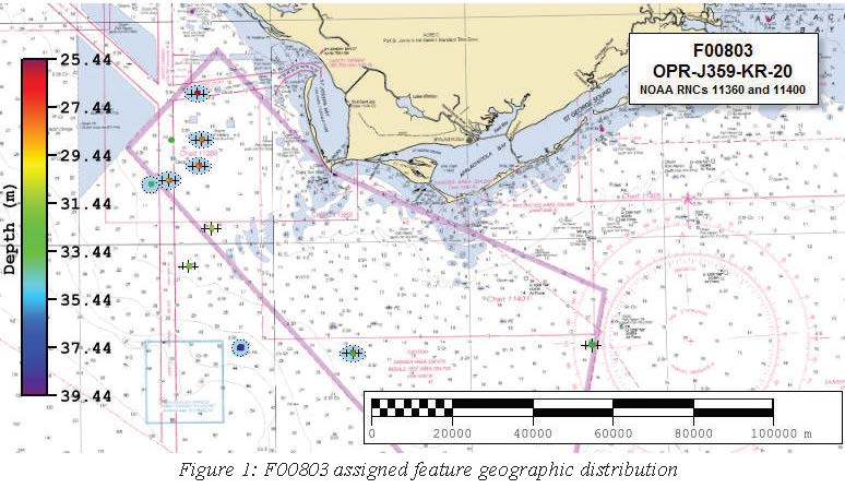
F00803: NOS Hydrographic Survey , 2020-06-28
National Oceanic and Atmospheric Administration, Department of Commerce —
The National Oceanic and Atmospheric Administration (NOAA) has the statutory mandate to collect hydrographic data in support of nautical chart compilation for safe... -
Federal
H12376: NOS Hydrographic Survey , 2014-07-13
National Oceanic and Atmospheric Administration, Department of Commerce —
The National Oceanic and Atmospheric Administration (NOAA) has the statutory mandate to collect hydrographic data in support of nautical chart compilation for safe... -
Federal
H13175: NOS Hydrographic Survey , 2019-06-18
National Oceanic and Atmospheric Administration, Department of Commerce —
The National Oceanic and Atmospheric Administration (NOAA) has the statutory mandate to collect hydrographic data in support of nautical chart compilation for safe... -
Federal
2020 Cartographic Boundary File (KML), 2020 Public Use Microdata Areas for Florida, 1:500,000
U.S. Census Bureau, Department of Commerce —
The 2020 cartographic boundary KMLs are simplified representations of selected geographic areas from the U.S. Census Bureau's Master Address File / Topologically... -
Federal
2020 Cartographic Boundary File (SHP), 2020 Public Use Microdata Areas for Florida, 1:500,000
U.S. Census Bureau, Department of Commerce —
The 2020 cartographic boundary shapefiles are simplified representations of selected geographic areas from the U.S. Census Bureau's Master Address File /... -
Federal
2020 Cartographic Boundary File (SHP), Current Unified School District for Florida, 1:500,000
U.S. Census Bureau, Department of Commerce —
The 2020 cartographic boundary shapefiles are simplified representations of selected geographic areas from the U.S. Census Bureau's Master Address File /... -
Federal
2020 Cartographic Boundary File (SHP), Current State Legislative District-Lower Chamber for Florida, 1:500,000
U.S. Census Bureau, Department of Commerce —
The 2020 cartographic boundary shapefiles are simplified representations of selected geographic areas from the U.S. Census Bureau's Master Address File /... -
Federal
2020 Cartographic Boundary File (SHP), Current State Legislative District-Upper Chamber for Florida, 1:500,000
U.S. Census Bureau, Department of Commerce —
The 2020 cartographic boundary shapefiles are simplified representations of selected geographic areas from the U.S. Census Bureau's Master Address File /... -
Federal
2022 Cartographic Boundary File (SHP), Current Unified School District for Florida, 1:500,000
U.S. Census Bureau, Department of Commerce —
The 2022 cartographic boundary shapefiles are simplified representations of selected geographic areas from the U.S. Census Bureau's Master Address File /... -
Federal
2022 Cartographic Boundary File (SHP), Current State Legislative District-Upper Chamber for Florida, 1:500,000
U.S. Census Bureau, Department of Commerce —
The 2022 cartographic boundary shapefiles are simplified representations of selected geographic areas from the U.S. Census Bureau's Master Address File /... -
Federal
C-CAP Land Cover, Tampa, Florida, 2021
National Oceanic and Atmospheric Administration, Department of Commerce —
The NOAA Coastal Change Analysis Program (C-CAP) produces national standardized land cover and change products for the coastal regions of the U.S. C-CAP products... -
Federal
2022 Cartographic Boundary File (SHP), Current Census Tract for Florida, 1:500,000
U.S. Census Bureau, Department of Commerce —
The 2022 cartographic boundary shapefiles are simplified representations of selected geographic areas from the U.S. Census Bureau's Master Address File /... -
Federal
2022 Cartographic Boundary File (KML), Current Block Group for Florida, 1:500,000
U.S. Census Bureau, Department of Commerce —
The 2022 cartographic boundary KMLs are simplified representations of selected geographic areas from the U.S. Census Bureau's Master Address File / Topologically... -
Federal
F00870: NOS Hydrographic Survey , 2022-10-06
National Oceanic and Atmospheric Administration, Department of Commerce —
The National Oceanic and Atmospheric Administration (NOAA) has the statutory mandate to collect hydrographic data in support of nautical chart compilation for safe...

Official websites use .gov
A
.gov website belongs to an official government
organization in the United States.
Secure .gov websites use HTTPS
A
lock (
) or https:// means you’ve safely connected to
the .gov website. Share sensitive information only on official,
secure websites.