
-
Federal
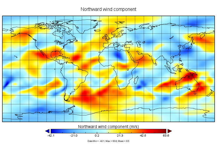
MERRA-2 tavg1_2d_slv_Nx: 2d,1-Hourly,Time-Averaged,Single-Level,Assimilation,Single-Level Diagnostics 0.625 x 0.5 degree V5.12.4 (M2T1NXSLV) at GES DISC recent views
National Aeronautics and Space Administration —
M2T1NXSLV (or tavg1_2d_slv_Nx) is an hourly time-averaged 2-dimensional data collection in Modern-Era Retrospective analysis for Research and Applications version 2... -
Federal
GLDAS Noah Land Surface Model L4 monthly 0.25 x 0.25 degree V2.1 (GLDAS_NOAH025_M) at GES DISC recent views
National Aeronautics and Space Administration —
NASA Global Land Data Assimilation System Version 2 (GLDAS-2) has three components: GLDAS-2.0, GLDAS-2.1, and GLDAS-2.2. GLDAS-2.0 is forced entirely with the... -
Federal
GLDAS Noah Land Surface Model L4 3 hourly 0.25 x 0.25 degree V2.0 (GLDAS_NOAH025_3H) at GES DISC recent views
National Aeronautics and Space Administration —
NASA Global Land Data Assimilation System Version 2 (GLDAS-2) has three components: GLDAS-2.0, GLDAS-2.1, and GLDAS-2.2. GLDAS-2.0 is forced entirely with the... -
Federal
NLDAS Secondary Forcing Data L4 Hourly 0.125 x 0.125 degree V2.0 (NLDAS_FORB0125_H) at GES DISC recent views
National Aeronautics and Space Administration —
This data set contains the secondary forcing hourly data "File B" for Phase 2 of the North American Land Data Assimilation System (NLDAS-2). The data are in 1/8th... -
Federal
GLDAS Catchment Land Surface Model L4 daily 0.25 x 0.25 degree GRACE-DA1 V2.2 (GLDAS_CLSM025_DA1_D) at GES DISC recent views
National Aeronautics and Space Administration —
NASA Global Land Data Assimilation System Version 2 (GLDAS-2) has three components: GLDAS-2.0, GLDAS-2.1, and GLDAS-2.2. GLDAS-2.0 is forced entirely with the... -
Federal
MERRA-2 inst6_3d_ana_Nv: 3d,6-Hourly,Instantaneous,Model-Level,Analysis,Analyzed Meteorological Fields 0.625 x 0.5 degree V5.12.4 (M2I6NVANA) at GES DISC recent views
National Aeronautics and Space Administration —
M2I6NVANA (or inst6_3d_ana_Nv) is an instantaneous 3-dimensional 6-hourly data collection in Modern-Era Retrospective analysis for Research and Applications version 2... -
Federal
FLDAS Noah Land Surface Model L4 Global Monthly 0.1 x 0.1 degree (MERRA-2 and CHIRPS) V001 (FLDAS_NOAH01_C_GL_M) at GES DISC recent views
National Aeronautics and Space Administration —
This dataset contains a series of land surface parameters simulated from the Noah 3.6.1 model in the Famine Early Warning Systems Network (FEWS NET) Land Data... -
Federal
GEOS-5 FP-IT 3D Time-Averaged Model-Layer Assimilated Data Geo-Colocated to OMI/Aura UV2 1-Orbit L2 Swath 13x24km V4 (OMUFPMET) at GES DISC recent views
National Aeronautics and Space Administration —
The GEOS-5 FP-IT 3D Time-Averaged Model-Layer Assimilated Data Geo-Colocated to OMI/Aura UV2 1-Orbit L2 Swath 13x24km (OMUFPMET) product provides selected... -
Federal
Aqua/AIRS L2 Standard Physical Retrieval (AIRS+AMSU) V7.0 at GES DISC recent views
National Aeronautics and Space Administration —
The Atmospheric Infrared Sounder (AIRS) is a grating spectrometer (R = 1200) aboard the second Earth Observing System (EOS) polar-orbiting platform, EOS Aqua. The... -
Federal
Hurricane and Severe Storm Sentinel (HS3) Statistical Hurricane Intensity Prediction Scheme (SHIPS) Intensity V1 recent views
National Aeronautics and Space Administration —
The Hurricane and Severe Storm Sentinel (HS3) Statistical Hurricane Intensity Prediction Scheme (SHIPS) Intensity dataset was obtained from March 18, 2014 through... -
Federal
First ISCCP Regional Experiment (FIRE) Atlantic Stratocumulus Transition Experiment (ASTEX) United Kingdom Meteorological Office (UKMO) C-130 Aircraft Data recent views
National Aeronautics and Space Administration —
The First ISCCP Regional Experiments have been designed to improve data products and cloud/radiation parameterizations used in general circulation models (GCMs).... -
Federal
GEWEX SRB Integrated Product (Rel-4) Ancillary 3-Hourly recent views
National Aeronautics and Space Administration —
GEWEX SRB Integrated Product (Rel-4) Ancillary 3-Hourly contains the global fields of meteorology, clouds and other ancillary data that serves as the inputs to the... -
Federal
AIRS/Aqua L3 8-day Standard Physical Retrieval (AIRS+AMSU+HSB) 1 degree x 1 degree V006 (AIRH3ST8) at GES DISC recent views
National Aeronautics and Space Administration —
The Atmospheric Infrared Sounder (AIRS) is a grating spectrometer (R = 1200) aboard the second Earth Observing System (EOS) polar-orbiting platform, EOS Aqua. In... -
Federal
First ISCCP Regional Experiment (FIRE) Cirrus 1 Colorado State University Sabreliner Aircraft Radiometric and Meteorological Data recent views
National Aeronautics and Space Administration —
This data set contains meteorological and radiometeric data from the NCAR Sabreliner aircraft that was collected during the 1986 FIRE Cirrus IFO. The NCAR Sabreliner... -
Federal
TES/Aura L3 Atmospheric Temperatures Monthly Gridded V005 recent views
National Aeronautics and Space Administration —
TL3ATM_5 is the Tropospheric Emission Spectrometer (TES)/Aura Level 2 Atmospheric Temperatures Limb Version 5 data product. TES was an instrument aboard NASA's Aura... -
Federal
NLDAS Secondary Forcing Data L4 Monthly Climatology 0.125 x 0.125 degree V2.0 (NLDAS_FORB0125_MC) at GES DISC recent views
National Aeronautics and Space Administration —
This data set contains the monthly climatology (MC) data of the secondary forcing data for Phase 2 of the North American Land Data Assimilation System (NLDAS-2). The... -
Federal
TOLNet City College of New York Data recent views
National Aeronautics and Space Administration —
TOLNet_CCNY_Data is the lidar data collected by the New York Tropospheric Ozone Lidar System (NYTOLS) at the City College of New York (CCNY) as part of the... -
Federal
Sounder SIPS: Suomi NPP CrIMSS Level 2 CLIMCAPS Normal Spectral Resolution: Atmosphere cloud and surface geophysical state V2 (SNDRSNIML2CCPRETN) at GES DISC recent views
National Aeronautics and Space Administration —
WARNING: To users of the derived product “co_mmr_midtrop” (carbon monoxide mass mixing ratio to dry air [kg/kg] at ~500 hPa). This variable has a significant bias due... -
Federal
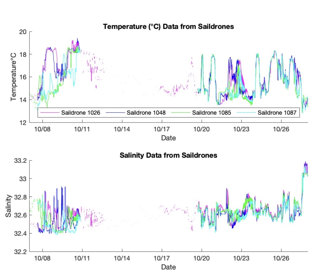
S-MODE L2 Temperature and Salinity from Saildrones Version 1 recent views
National Aeronautics and Space Administration —
This dataset contains Saildrone in-situ measurements taken during the Sub-Mesoscale Ocean Dynamics Experiment (S-MODE) conducted approximately 300 km offshore of San... -
Federal
GLDAS Noah Land Surface Model L4 3 hourly 0.25 x 0.25 degree V2.1 (GLDAS_NOAH025_3H) at GES DISC recent views
National Aeronautics and Space Administration —
NASA Global Land Data Assimilation System Version 2 (GLDAS-2) has three components: GLDAS-2.0, GLDAS-2.1, and GLDAS-2.2. GLDAS-2.0 is forced entirely with the...

Official websites use .gov
A
.gov website belongs to an official government
organization in the United States.
Secure .gov websites use HTTPS
A
lock (
) or https:// means you’ve safely connected to
the .gov website. Share sensitive information only on official,
secure websites.