
-
Federal
Surface-water temperature, salinity, pH, dissolved oxygen, and turbidity data from nearshore coral reef locations along the west coast of Hawaii Island (2010-2013)
Department of the Interior —
Spatial measurements of water temperature, specific conductance, salinity, pH, dissolved oxygen, and turbidity between 0.25 and 0.50 m water depth were collected... -
Federal
Mean high water (MHW) shorelines along the coast of California used to calculated shoreline change from 1998 to 2016
Department of the Interior —
This dataset contains mean high water (MHW) shorelines for sandy beaches along the coast of California for the years 1998/2002, 2015, and 2016. The MHW elevation in... -
Federal
H13092: NOS Hydrographic Survey , 2017-11-09
National Oceanic and Atmospheric Administration, Department of Commerce —
The National Oceanic and Atmospheric Administration (NOAA) has the statutory mandate to collect hydrographic data in support of nautical chart compilation for safe... -
Federal
F00789: NOS Hydrographic Survey , 2019-10-25
National Oceanic and Atmospheric Administration, Department of Commerce —
The National Oceanic and Atmospheric Administration (NOAA) has the statutory mandate to collect hydrographic data in support of nautical chart compilation for safe... -
Federal
F00775: NOS Hydrographic Survey , 2019-06-04
National Oceanic and Atmospheric Administration, Department of Commerce —
The National Oceanic and Atmospheric Administration (NOAA) has the statutory mandate to collect hydrographic data in support of nautical chart compilation for safe... -
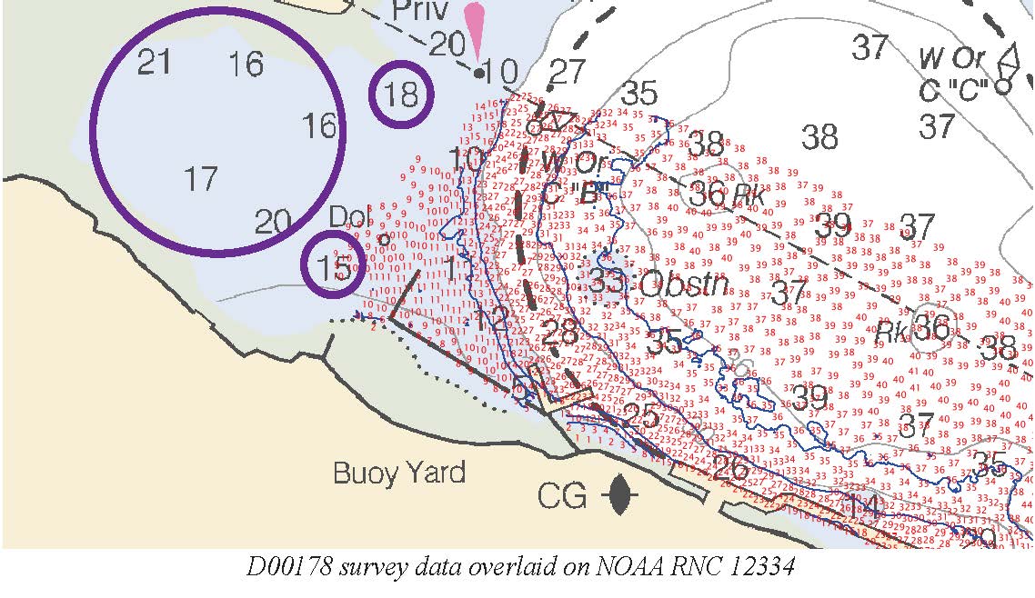
Federal
D00178: NOS Hydrographic Survey , 2013-04-29
National Oceanic and Atmospheric Administration, Department of Commerce —
The National Oceanic and Atmospheric Administration (NOAA) has the statutory mandate to collect hydrographic data in support of nautical chart compilation for safe... -
Federal
Raw continuous resistivity profile data collected by the U.S. Geological Survey in Great South Bay on Long Island, New York, on May 20, 2008
Department of the Interior —
An investigation of submarine aquifers adjacent to the Fire Island National Seashore and Long Island, New York, was conducted to assess the importance of submarine... -
Federal
RES2DINV format continuous resistivity profile data collected by the U.S. Geological Survey in Great South Bay on Long Island, New York, on May 22, 2008
Department of the Interior —
An investigation of submarine aquifers adjacent to the Fire Island National Seashore and Long Island, New York, was conducted to assess the importance of submarine... -
Federal
H13810: NOS Hydrographic Survey , 2023-10-03
National Oceanic and Atmospheric Administration, Department of Commerce —
The National Oceanic and Atmospheric Administration (NOAA) has the statutory mandate to collect hydrographic data in support of nautical chart compilation for safe... -
Federal
Flood inundation map geospatial datasets for Lake Ontario, New York (ver. 2.0, November 2021)
Department of the Interior —
Static flood inundation boundary extents were created along the entire shoreline of Lake Ontario in Cayuga, Jefferson, Monroe, Niagara, Orleans, Oswego, and Wayne... -
Federal
F00657: NOS Hydrographic Survey , 2015-08-12
National Oceanic and Atmospheric Administration, Department of Commerce —
The National Oceanic and Atmospheric Administration (NOAA) has the statutory mandate to collect hydrographic data in support of nautical chart compilation for safe... -
Federal
Flood inundation map geospatial datasets for Lake Ontario, New York
Department of the Interior —
Static flood inundation boundary extents were created along the entire shoreline of Lake Ontario in Cayuga, Jefferson, Monroe, Niagara, Orleans, Oswego, and Wayne... -
Federal
Data acquisition logs in PDF format maintained on U.S. Geological Survey Field Activities 2008-007-FA and 2008-037-FA in Great South Bay, Long Island, New York in May and September, 2008
Department of the Interior —
An investigation of submarine aquifers adjacent to the Fire Island National Seashore and Long Island, New York, was conducted to assess the importance of submarine... -
City
Civic Art Collection
City of San Francisco —
A. SUMMARY This data set includes all of the publicly-sited works in the Civic Art Collection, which includes historic monuments, murals, and artworks commissioned... -
State
Average Weekday Interstate Ferry Ridership Figures for Port Authority: Beginning 1998
State of New York —
This dataset provides average weekday ridership trends on New York/New Jersey interstate ferry routes. It counts ridership as unlinked trips, covering both directions... -
Federal
F00146: NOS Hydrographic Survey , 1957-03-12
National Oceanic and Atmospheric Administration, Department of Commerce —
The National Oceanic and Atmospheric Administration (NOAA) has the statutory mandate to collect hydrographic data in support of nautical chart compilation for safe... -
Federal
Flood inundation map geospatial datasets for Lake Ontario, New York
Department of the Interior —
Static flood inundation boundary extents were created along the entire shoreline of Lake Ontario in Cayuga, Jefferson, Monroe, Niagara, Orleans, Oswego, and Wayne... -
Federal
RES2DINV format continuous resistivity profile data collected by the U.S. Geological Survey in Great South Bay on Long Island, New York, on May 19, 2008
Department of the Interior —
An investigation of submarine aquifers adjacent to the Fire Island National Seashore and Long Island, New York, was conducted to assess the importance of submarine... -
City
FEMA FIRM Flood Hazards (Coastal) - 2021 Update
City of San Francisco —
A) This data describes the Special Flood Hazard Areas (SFHA's) pursuant to the Federal Emergency Management Agency's (FEMA's) Flood Insurance Rate Map (FIRM) for the... -
Federal
RES2DINV format continuous resistivity profile data collected by the U.S. Geological Survey in Great South Bay on Long Island, New York, on Sept. 25, 2008
Department of the Interior —
An investigation of submarine aquifers adjacent to the Fire Island National Seashore and Long Island, New York, was conducted to assess the importance of submarine...

Official websites use .gov
A
.gov website belongs to an official government
organization in the United States.
Secure .gov websites use HTTPS
A
lock (
) or https:// means you’ve safely connected to
the .gov website. Share sensitive information only on official,
secure websites.