

14 datasets found for ""Natural Resources""
-
Federal
Ag and Food Statistics: Charting the Essentials
Department of Agriculture —
A collection of over 75 charts and maps presenting key statistics on the farm sector, food spending and prices, food security, rural communities, the interaction of... -
Federal
2018 Annual Data Files: Centennial Valley Arctic Grayling Adaptive Management Project, 2011-present
Department of the Interior —
2018's Annual Data files have been uploaded as several digital holdings with data used to support the creation of the Centennial Valley Arctic Grayling Adaptive... -
Federal
2017 Annual Data Files: Centennial Valley Arctic Grayling Adaptive Management Project, 2011-present
Department of the Interior —
2017's Annual Data files have been uploaded as several digital holdings with data used to support the creation of the Centennial Valley Arctic Grayling Adaptive... -
State
San Francisco Bay and Sacramento-San Joaquin Delta DEM for Modeling, Version 4.2
State of California —
SUPERSEDED --> See version 4.3 https://data.cnra.ca.gov/dataset/san-francisco-bay-and-sacramento-san-joaquin-delta-dem-for-modeling-version-4-3 ## Citation and... -
Federal
NPP Multi-Biome: Gridded Estimates for Selected Regions Worldwide, 1954-1998, R3
National Aeronautics and Space Administration —
This data set provides two data files (.csv format) containing gridded (0.5-degree) estimates of net primary productivity (NPP), elevation, temperature,... -
State
2010 Urban Water Management Plan (UWMP) Data
State of California —
Numeric data gleaned from the 2010 UWMP reports as reported in the DOST database. -
Federal
USDA Legacy P project: P lability in soils and sediments
Department of Agriculture —
The USDA Legacy Phosphorus Project seeks to leverage watershed research with USDA NRCS (Natural Resource Conservation Service) and USDA ARS (Agricultural Research... -
Federal
2016 Annual Data Files: Centennial Valley Arctic Grayling Adaptive Management Project, 2011-present
Department of the Interior —
2016's Annual Data files have been uploaded as several digital holdings with data used to support the creation of the Centennial Valley Arctic Grayling Adaptive... -
State
San Francisco Bay and Sacramento-San Joaquin Delta DEM for Modeling, Version 4.3
State of California —
Citation and Main Description: This product is described in Chapter 5 of the 2018 DWR Delta Modeling Section annual report, produced jointly with USGS.... -
Federal
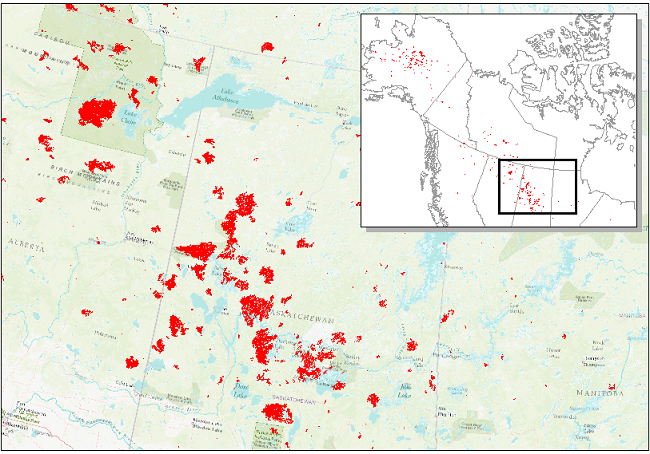
ABoVE: Landsat-derived Burn Scar dNBR across Alaska and Canada, 1985-2015
National Aeronautics and Space Administration —
This dataset contains differenced Normalized Burned Ratio (dNBR) at 30-m resolution calculated for burn scars from fires that occurred within the Arctic Boreal and... -
Federal
Global Soil Profile Data (ISRIC-WISE)
National Aeronautics and Space Administration —
The International Soil Reference and Information Centre-World Inventory of Soil Emission Potentials (ISRIC-WISE) international soil profile data set consists of a... -
Federal
ABoVE: Wildfire Date of Burning within Fire Scars across Alaska and Canada, 2001-2019
National Aeronautics and Space Administration —
This dataset provides estimates of wildfire progression represented by date of burning (DoB) within fire scars across Alaska and Canada for the period 2001-2019. Burn...
14 datasets found for ""Natural Resources""