

6 datasets found for "Bathymetry"
-
Federal
LBA-ECO LC-07 Bathymetric Survey of Floodplain Lake, Lago Curuai, Para, Brazil: 2004
National Aeronautics and Space Administration —
The bathymetry data provided represent a continuous surface of interpolated point measurements of depth values of Lago Curuai, an Amazon River floodplain lake,... -
Federal
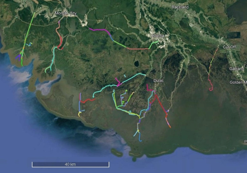
Delta-X: Acoustic Doppler Current Profiler Channel Surveys, MRD, Louisiana, 2021, V2
National Aeronautics and Space Administration —
This dataset provides river discharge measurements collected at selected locations in the Atchafalaya and Terrebonne Basins within the Mississippi River Delta (MRD)... -
Federal
Delta-X: Sonar Bathymetry Survey of Channels, MRD, Louisiana, 2021
National Aeronautics and Space Administration —
This dataset includes bathymetry data for water channels in a portion of the Mississippi River Delta (MRD) of coastal Louisiana. The data were collected using sonar... -
Federal
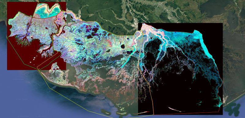
Delta-X: Ecogeomorphic Cell Products across the MRD, LA, USA, 2021
National Aeronautics and Space Administration —
This product delineates the Mississippi River Delta (MRD) landscape into distinct ecogeomorphic cells, which are small contiguous areas of land with similar... -
Federal
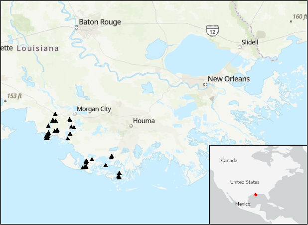
Lake Bathymetry Maps derived from Landsat and Random Forest Modeling, North Slope, AK
National Aeronautics and Space Administration —
This dataset provides lake bathymetry maps derived from Landsat surface reflectance products for a portion of the North Slope area of Alaska. A random forest... -
Federal
Pre-Delta-X: Channel Bathymetry of the Atchafalaya Basin, LA, USA, 2016
National Aeronautics and Space Administration —
This dataset provides water depths and water surface elevations collected during bathymetric surveys of the main channel of the Wax Lake Delta within the Mississippi...
6 datasets found for "Bathymetry"