
-
Federal
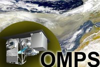
OMPS-NPP L2 NM Aerosol Index swath orbital recent views
National Aeronautics and Space Administration —
The OMPS-NPP L2 NM Aerosol Index swath orbital product provides aerosol index values from the Ozone Mapping and Profiling Suite (OMPS) Nadir-Mapper (NM) instrument on... -
Federal
Upwelling Index, 48N 125W, 6-hourly recent views
National Oceanic and Atmospheric Administration, Department of Commerce —
Upwelling index computed from 1-degree FNMOC sea level pressure for 15 locations off the North American West Coast at each 3 degrees of latitude from 21N to 60N. The... -
Federal
United States Historical Climatology Network (USHCN), Version 2.5 recent views
National Oceanic and Atmospheric Administration, Department of Commerce —
The U.S. Historical Climatology Network Monthly Data, Version 2.5 consists of precipitation and temperature data "corrected" for changes in station location,... -
Federal
CERES Energy Balanced and Filled (EBAF) TOA and Surface Monthly means data in netCDF Edition 4.2 recent views
National Aeronautics and Space Administration —
CERES_EBAF_Edition4.2 is the Clouds and the Earth's Radiant Energy System (CERES) Energy Balanced and Filled (EBAF) Top-of-Atmosphere (TOA) and surface monthly means... -
Federal
Upwelling Index, 45N 125W, 6-hourly recent views
National Oceanic and Atmospheric Administration, Department of Commerce —
Upwelling index computed from 1-degree FNMOC sea level pressure for 15 locations off the North American West Coast at each 3 degrees of latitude from 21N to 60N. The... -
Federal
Empire Wind Met Buoy - Historical Data recent views
National Oceanic and Atmospheric Administration, Department of Commerce —
This dataset contains observations to support the development of the Empire Wind Offshore Wind Project and to further understanding of metocean conditions off the... -
Federal
CMS: Global 0.5-deg Wetland Methane Emissions and Uncertainty (WetCHARTs v1.3.3) recent views
National Aeronautics and Space Administration —
This dataset provides global monthly wetland methane (CH4) emissions estimates at 0.5 by 0.5-degree resolution for the period 2001-01-01 to 2022-08-31 that were... -
Federal
OCO-2 Level 2 geolocated XCO2 retrievals results, physical model, Retrospective Processing V11r (OCO2_L2_Standard) at GES DISC recent views
National Aeronautics and Space Administration —
Version 11r is the current version of the data set. Older versions will no longer be available and are superseded by Version 11r. The Orbiting Carbon Observatory is... -
Federal
Global Maps of Atmospheric Nitrogen Deposition, 1860, 1993, and 2050 recent views
National Aeronautics and Space Administration —
This data set provides global gridded estimates of atmospheric deposition of total inorganic nitrogen (N), NHx (NH3 and NH4+), and NOy (all oxidized forms of nitrogen... -
Federal
International Surface Temperature Initiative (ISTI) Global Land Surface Temperature Databank - Stage 3 Monthly recent views
National Oceanic and Atmospheric Administration, Department of Commerce —
The Global Land Surface Temperature Databank contains monthly timescale mean, maximum, and minimum temperature for approximately 40,000 stations globally. It was... -
Federal
TRMM Precipitation Radar Rain Characteristics L2 1.5 hours V7 (TRMM_2A23) at GES DISC recent views
National Aeronautics and Space Administration —
The new version of these data is in GPM-like format (consistent with the GPM Dual-frequency Radar data format), and can be found under the name GPM_2APR. The TRMM... -
Federal
Rapid Refresh (RAP) [13 km] recent views
National Oceanic and Atmospheric Administration, Department of Commerce —
The Rapid Refresh (RAP) numerical weather model took the place of the Rapid Update Cycle (RUC) on May 1, 2012. Run by the National Centers for Environmental... -
Federal
A Global Database of Gas Fluxes from Soils after Rewetting or Thawing, Version 1.0 recent views
National Aeronautics and Space Administration —
This database contains information compiled from published studies on gas flux from soil following rewetting or thawing. The resulting database includes 222 field and... -
Federal
CALIPSO Lidar Level 3 Tropospheric Aerosol Profiles, Cloud Free Data, Standard V4-20 recent views
National Aeronautics and Space Administration —
CAL_LID_L3_Tropospheric_APro_CloudFree-Standard-V4-20 is the Cloud-Aerosol Lidar and Infrared Pathfinder Satellite Observation (CALIPSO) Lidar Level 3 Tropospheric... -
Federal
Integrated Global Radiosonde Archive (IGRA), Version 2 recent views
National Oceanic and Atmospheric Administration, Department of Commerce —
Integrated Global Radiosonde Archive (IGRA) Version 2 consists of quality-controlled radiosonde observations of temperature, humidity, and wind at stations across all... -
Federal
MODIS/Aqua Clouds 1km and 5km 5-Min L2 Wide Swath Subset along CloudSat V002 (MAC06S1) at GES DISC NGDA recent views
National Aeronautics and Space Administration —
This is the wide-swath MODIS/Aqua subset along CloudSat field of view track. The goal of the wide-swath subset is to select and return MODIS data that are within... -
Federal
CERES A-Train Integrated CALIPSO, CloudSat, CERES, and MODIS (CCCM) Merged Release B1 NGDA recent views
National Aeronautics and Space Administration —
CER-NEWS_CCCM_Aqua-FM3-MODIS-CAL-CS_RelB1 is the Clouds and the Earth's Radiant Energy System (CERES) NASA Energy and Water cycle Study (NEWS) A-Train Integrated... -
Federal
Aqua/AIRS L2 Standard Physical Retrieval (AIRS+AMSU) V7.0 at GES DISC recent views
National Aeronautics and Space Administration —
The Atmospheric Infrared Sounder (AIRS) is a grating spectrometer (R = 1200) aboard the second Earth Observing System (EOS) polar-orbiting platform, EOS Aqua. The... -
Federal
CERES Energy Balanced and Filled (EBAF) TOA Monthly means data in netCDF Edition4.2 recent views
National Aeronautics and Space Administration —
CERES_EBAF-TOA_Edition4.2 is the Clouds and the Earth's Radiant Energy System (CERES) Energy Balanced and Filled (EBAF) Top-of-Atmosphere (TOA) Monthly means data in... -
Federal
NOAA GOES-R Series Advanced Baseline Imager (ABI) Level 2 Clear Sky Mask (ACM) recent views
National Oceanic and Atmospheric Administration, Department of Commerce —
The Clear Sky Mask product contains an image in the form of a binary cloud mask that identifies pixels within a coverage region as clear or cloudy. The production of...

Official websites use .gov
A
.gov website belongs to an official government
organization in the United States.
Secure .gov websites use HTTPS
A
lock (
) or https:// means you’ve safely connected to
the .gov website. Share sensitive information only on official,
secure websites.