
-
Federal
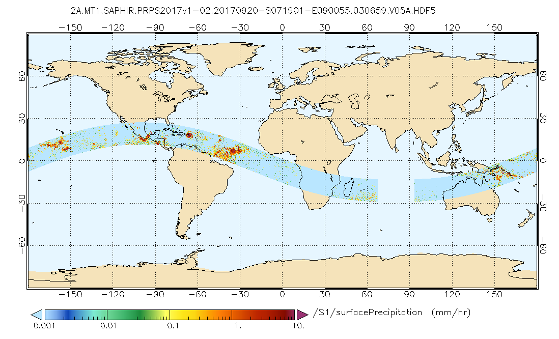
GPM SAPHIR on MT1 (PRPS) Climate-based Radiometer Precipitation Profiling L2 1.5 hours 10 km V06 (GPM_2APRPSMT1SAPHIR_CLIM) at GES DISC
National Aeronautics and Space Administration —
Version 6 is the current version of this dataset. Older versions are no longer available and have been superseded by Version 6.The Precipitation Retrieval and... -
Federal
SatCORPS CERES GEO Edition 4 GOES-16 Northern Hemisphere Version 1.4
National Aeronautics and Space Administration —
CER_GEO_Ed4_GOE16_NH_V01.4 is the Satellite Cloud and Radiation Property retrieval System (SatCORPS) Clouds and the Earth's Radiant Energy System (CERES)... -
Federal
BARREL 3C X-ray Spectrometer (MSPC) Bremsstrahlung X-ray Spectrum Medium Time Resolution, Level 2, 4 s Data
National Aeronautics and Space Administration —
MSPC: 48 channels of medium time resolution, 4 s, Bremsstrahlung X-ray spectra detected with a NaI Scintillator. The nominal energy range covered by the 48 channels... -
Federal
PSP FIELDS Digital Fields Board (DFB) AC-coupled V5 Antenna Voltage, Monopole Mode, Auto Spectra, High Gain, Sensor coordinates, Level 2 (L2), 0.873813 s Data
National Aeronautics and Space Administration —
PSP FIELDS Digital Fields Board, DFB, V5 data:The DFB is the low frequency, less than 75 kHz, component of the FIELDS experiment on the Parker Solar Probe spacecraft,... -
Federal
NAMMA MODIS/AQUA AND MODIS/TERRA DEEP BLUE PRODUCTS V1
National Aeronautics and Space Administration —
The NAMMA MODIS/AQUA and MODIS/TERRA Deep Blue Products dataset is a collection of images depicting the aerosol optical depth derived from the MODIS deep blue... -
Federal
VLA Orion Nebula Cluster Compact Source Catalog
National Aeronautics and Space Administration —
This table contains a deep centimeter-wavelength catalog of the Orion Nebula Cluster (ONC), based on a 30-hr single-pointing observation with the Karl G. Jansky Very... -
Federal
GLDAS Noah Land Surface Model L4 monthly 1.0 x 1.0 degree V2.0 (GLDAS_NOAH10_M) at GES DISC
National Aeronautics and Space Administration —
NASA Global Land Data Assimilation System Version 2 (GLDAS-2) has three components: GLDAS-2.0, GLDAS-2.1, and GLDAS-2.2. GLDAS-2.0 is forced entirely with the... -
Federal
MLS/Aura Level 3 Daily Binned Nitric Acid (HNO3) Mixing Ratio on Zonal and Similar Grids V004 (ML3DZHNO3) at GES DISC
National Aeronautics and Space Administration —
ML3DZHNO3 is the EOS Aura Microwave Limb Sounder (MLS) daily binned on zonal and assorted vertical grids product for nitric acid (HNO3) derived from radiances... -
Federal
Aquarius Official Release Level 3 Rain-flagged Sea Surface Salinity Standard Mapped Image Mission Cumulative Data V5.0
National Aeronautics and Space Administration —
Aquarius Level 3 sea surface salinity (SSS) standard mapped image data contains gridded 1 degree spatial resolution SSS averaged overdaily, 7 day, monthly, and... -
Federal
Long-Run Marginal Emission Rates for Electricity - Workbooks for 2021 Cambium Data
Department of Energy —
These workbooks contain modeled estimates of long-run marginal emission rates (LRMER) for the contiguous United States. The LRMER is an estimate of the rate of... -
Federal
Aquarius Official Release Level 3 Rain-flagged Sea Surface Salinity Standard Mapped Image Monthly Data V5.0
National Aeronautics and Space Administration —
Aquarius Level 3 sea surface salinity (SSS) rain-flagged standard mapped image data contains gridded 1 degree spatial resolution SSS averagedover daily, 7 day,... -
Federal
Nimbus-6 Level 3 NMC Data Systems Test for the Global Atmospheric Research Program (GARP) V001 (NMCN6L3GARP) at GES DISC
National Aeronautics and Space Administration —
The NMCN6L3GARP is the Nimbus-6 Level 3 NMC Data Systems Test for the Global Atmospheric Research Program (GARP) product. The product consists of meterological... -
Federal
PSP Solar Wind Electrons Alphas and Protons (SWEAP) SPAN-A Electron Energy Spectra, Level 2 (L2), 1.74 s Data
National Aeronautics and Space Administration —
SPAN-E Level 2 ELectron Energy Spectra Data-------------------------------------------File Naming Format: psp_swp_spa_sf1_L2_32E_YYYYMMDD_v01.cdfThe SF1 product is an... -
Federal
Symbiotic Stars Catalog
National Aeronautics and Space Administration —
This database table contains a catalog of confirmed and suspected symbiotic stars. The list includes 188 symbiotic stars as well as 30 objects suspected of being... -
Federal
RSS SSM/I OCEAN PRODUCT GRIDS WEEKLY AVERAGE FROM DMSP F13 NETCDF V7
National Aeronautics and Space Administration —
The RSS SSM/I Ocean Product Grids Weekly Average from DMSP F13 netCDF dataset is part of the collection of Special Sensor Microwave/Imager (SSM/I) and Special Sensor... -
Federal
Global Food Security Support Analysis Data (GFSAD) Crop Dominance 2010 Global 1 km V001
National Aeronautics and Space Administration —
The NASA Making Earth System Data Records for Use in Research Environments (MEaSUREs) Global Food Security Support Analysis Data (GFSAD) Crop Dominance Global 1... -
Federal
ASTER L2 Surface Reflectance SWIR and ASTER L2 Surface Reflectance VNIR V003
National Aeronautics and Space Administration —
The Terra Advanced Spaceborne Thermal Emission and Reflection Radiometer (ASTER) Surface Reflectance VNIR and SWIR (AST_07) data product contains measures of the... -
Federal
GHRSST Level 4 DMI_OI Global Foundation Sea Surface Temperature Analysis (GDS version 2)
National Aeronautics and Space Administration —
A Group for High Resolution Sea Surface Temperature (GHRSST) Level 4 sea surface temperature analysis produced daily on an operational basis by the Danish... -
Federal
GLDAS CLM Land Surface Model L4 3 hourly 1.0 x 1.0 degree Subsetted V001 (GLDAS_CLM10SUBP_3H) at GES DISC
National Aeronautics and Space Administration —
With the upgraded Land Surface Models (LSMs) and updated forcing data sets, the GLDAS version 2.1 (GLDAS-2.1) production stream serves as a replacement for GLDAS-001.... -
Federal
LBA-ECO CD-03 Cloud Base-Backscatter Data, km 67 Tower Site, Tapajos National Forest
National Aeronautics and Space Administration —
A Vaisala CT-25K ceilometer was installed at an old-growth forest site located at the km 67 Eddy Flux Tower site in the Tapajos National Forest, Para, Brazil, off...

Official websites use .gov
A
.gov website belongs to an official government
organization in the United States.
Secure .gov websites use HTTPS
A
lock (
) or https:// means you’ve safely connected to
the .gov website. Share sensitive information only on official,
secure websites.