

3,647 datasets found for "电子游戏糖果派官方网站✅澳门葡京赌场官方网站-网址【079.one】㊙️最火爆PG电子超高爆奖率,注册即送38元.icFVXTeWbV"
-
Federal
GEDI L4B Gridded Aboveground Biomass Density, Version 2
National Aeronautics and Space Administration —
This Global Ecosystem Dynamics Investigation (GEDI) L4B product provides 1 km x 1 km (1 km, hereafter) estimates of mean aboveground biomass density (AGBD) based on... -
Federal
JPSS-2 CrIS Level 1B Beta Full Spectral Resolution V3 (SNDRJ2CrISL1B) at GES DISC
National Aeronautics and Space Administration —
The goal of creating this product is to allow users to begin working with data from the CrIS instrument on-board the recently launched NOAA-21 / JPSS-2 (J2)... -
Federal
PREFIRE Spectral Radiance from PREFIRE Satellite 1 R01
National Aeronautics and Space Administration —
PREFIRE (Polar Radiant Energy in the Far InfraRed Experiment) Spectral Radiance from PREFIRE Satellite 1 (PREFIRE_SAT1_1B-RAD) contains calibrated and geolocated... -
Federal
Biome-BGC: Terrestrial Ecosystem Process Model, Version 4.1.1
National Aeronautics and Space Administration —
Biome-BGC is a computer program that estimates fluxes and storage of energy, water, carbon, and nitrogen for the vegetation and soil components of terrestrial... -
Federal
TRMM Precipitation Radar Rainfall Rate and Profile L2 1.5 hours V7 (TRMM_2A25) at GES DISC
National Aeronautics and Space Administration —
The new version of these data is in GPM-like format (consistent with the GPM Dual-frequency Radar data format), and can be found under the name GPM_2APR. The TRMM... -
Federal
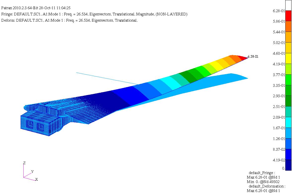
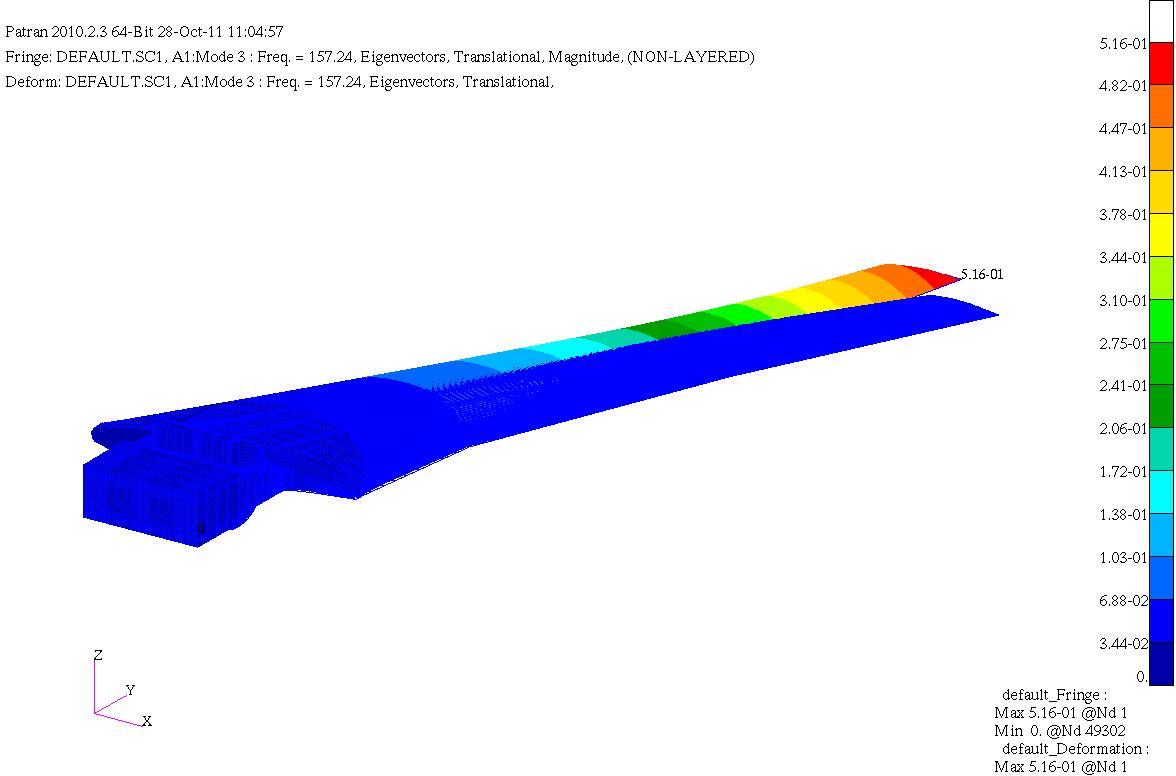
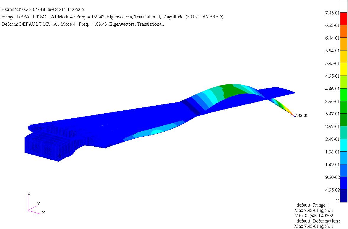
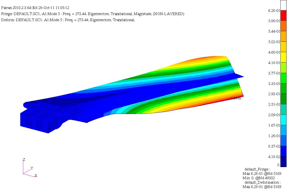
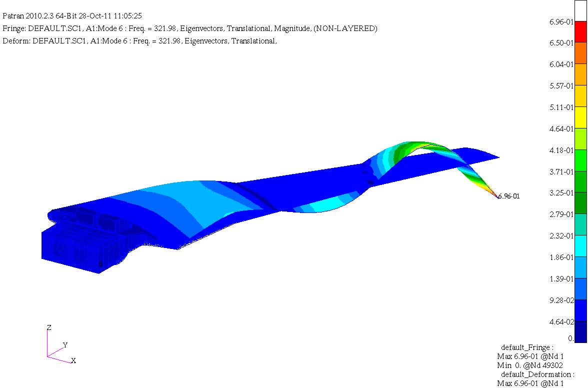
HIRENASD Comparisons of FEM modal frequencies and modeshapes
National Aeronautics and Space Administration —
Below are frequency comparisons of different models with experiment Note Modeshapes aren't very descriptive for higher modes. There is coupling between them so this... -
Federal
AM Bench 2022 Microstructure Measurements for IN718 3D builds
Department of Commerce —
The following data files include microstructure measurement results associated with the 2022 Additive Manufacturing Benchmark test series (AM-Bench 2022) AMB2022-01... -
Federal
Sentinel-5P TROPOMI Total Ozone Column 1-Orbit L2 7km x 3.5km V1 (S5P_L2__O3_TOT) at GES DISC
National Aeronautics and Space Administration —
Starting from August 6th in 2019, Sentinel-5P TROPOMI along-track high spatial resolution (~5.5km at nadir) has been implemented. Starting from July 13th in 2020,... -
Federal
LBA-ECO LC-08 Soil, Vegetation, and Land Cover Maps for Brazil and South America
National Aeronautics and Space Administration —
This data set provides (1) soil maps for Brazil that are digital versions of the MAPA DE SOLOS DO BRASIL (EMBRAPA, 1981) classified at three levels of detail,... -
Federal
TROPICS05 L1B Orbital Geolocated Native-Resolution Brightness Temperatures V0.2
National Aeronautics and Space Administration —
The "Time-Resolved Observations of Precipitation structure and storm Intensity with a Constellation of Smallsats" (TROPICS) mission has a goal of providing nearly... -
Federal
Sentinel-6A Level 1B GNSS Radio Occultation Daily RINEX V1 (S6A_RO_1B_POD_RNX_) at GES DISC
National Aeronautics and Space Administration —
This dataset provides the L1B Global Navigation Satellite System (GNSS) Radio Occultation (RO) Precise Orbit Determination (POD) data generated by NASA JPL from... -
Federal
Utah FORGE 3-2417: Low Frequency Distributed Acoustic Sensing Data from 16A/16B Stimulation - April, 2024
Department of Energy —
This dataset contains processed low-frequency Distributed Acoustic Sensing (LF-DAS) data collected between April 2 and April 12, 2024, during the Utah FORGE... -
Federal
Soil Thermal Conductivity Data (FIFE)
National Aeronautics and Space Administration —
The purpose of the 1989 FIFE soil properties investigation was to obtain a description of the thermal properties of the soils within the FIFE study area. Soil thermal... -
Federal
GOES-R PLT Lightning Instrument Package (LIP) V1
National Aeronautics and Space Administration —
The GOES-R PLT Lightning Instrument Package (LIP) dataset consists of electrical field measurements of lightning and navigation data collected by the Lightning... -
Federal
Sentinel-5P TROPOMI Methane CH4 1-Orbit L2 7km x 7km V1 (S5P_L2__CH4___) at GES DISC
National Aeronautics and Space Administration —
Starting from August 6th in 2019, Sentinel-5P TROPOMI along-track high spatial resolution (~5.5km at nadir) has been implemented. For data after August 6th of 2019,... -
Federal
Global Gridded Soil Phosphorus Distribution Maps at 0.5-degree Resolution
National Aeronautics and Space Administration —
This data set provides estimates of different forms of naturally occurring soil phosphorus (P) including labile inorganic P, organic P, occluded P, secondary mineral... -
Federal
Wind Turbine Oil and Gas Pipeline Setbacks: Ordinances (2022) and Extrapolated Trends, 115 Hub Height 170 Rotor Diameter
Department of Energy —
This dataset represents wind energy setback requirements from oil and gas pipelines. A setback requirement is a minimum distance from a pipeline that an energy...
3,647 datasets found for "电子游戏糖果派官方网站✅澳门葡京赌场官方网站-网址【079.one】㊙️最火爆PG电子超高爆奖率,注册即送38元.icFVXTeWbV"