

40,225 datasets found for "Administrative Units"
-
Federal
KauaiW_shorelines - Shorelines of the western coastal region of Kauai, Hawaii, from Oomano to Polihale, used in shoreline change analysis.
Department of the Interior —
Sandy ocean beaches are a popular recreational destination, often surrounded by communities containing valuable real estate. Development is on the rise despite the... -
Federal
Surficial sediment distribution interpretation of the sidescan sonar mosaic of National Oceanic and Atmospheric Administration (NOAA) survey H11043 off Branford, Connecticut
Department of the Interior —
The U.S. Geological Survey, in cooperation with the National Oceanic and Atmospheric Administration and the Connecticut Department of Environmental Protection, has... -
Federal
Location of Seafloor Photographs Acquired During U.S. Geological Survey (USGS) Cruise 09059 (RAFA09059) in Long Island Sound, North of Plum Island, New York (RAFA09059_PIBOTPHOTOS, Geographic)
Department of the Interior —
The U.S. Geological Survey (USGS), in cooperation with the Connecticut Department of Environmental Protection and National Oceanic and Atmospheric Administration... -
Federal
Shot-Point Navigation Data Collected Along Chirp Seismic-Profile Lines During U.S. Geological Survey (USGS) Cruise R/V RAFAEL 08034 in the Vicinity of Edgartown Harbor, Offshore Massachusetts (08034_KELNAV.SHP)
Department of the Interior —
The U.S. Geological Survey (USGS), in cooperation with the National Oceanic and Atmospheric Administration (NOAA) and the Massachusetts Office of Coastal Zone... -
Federal
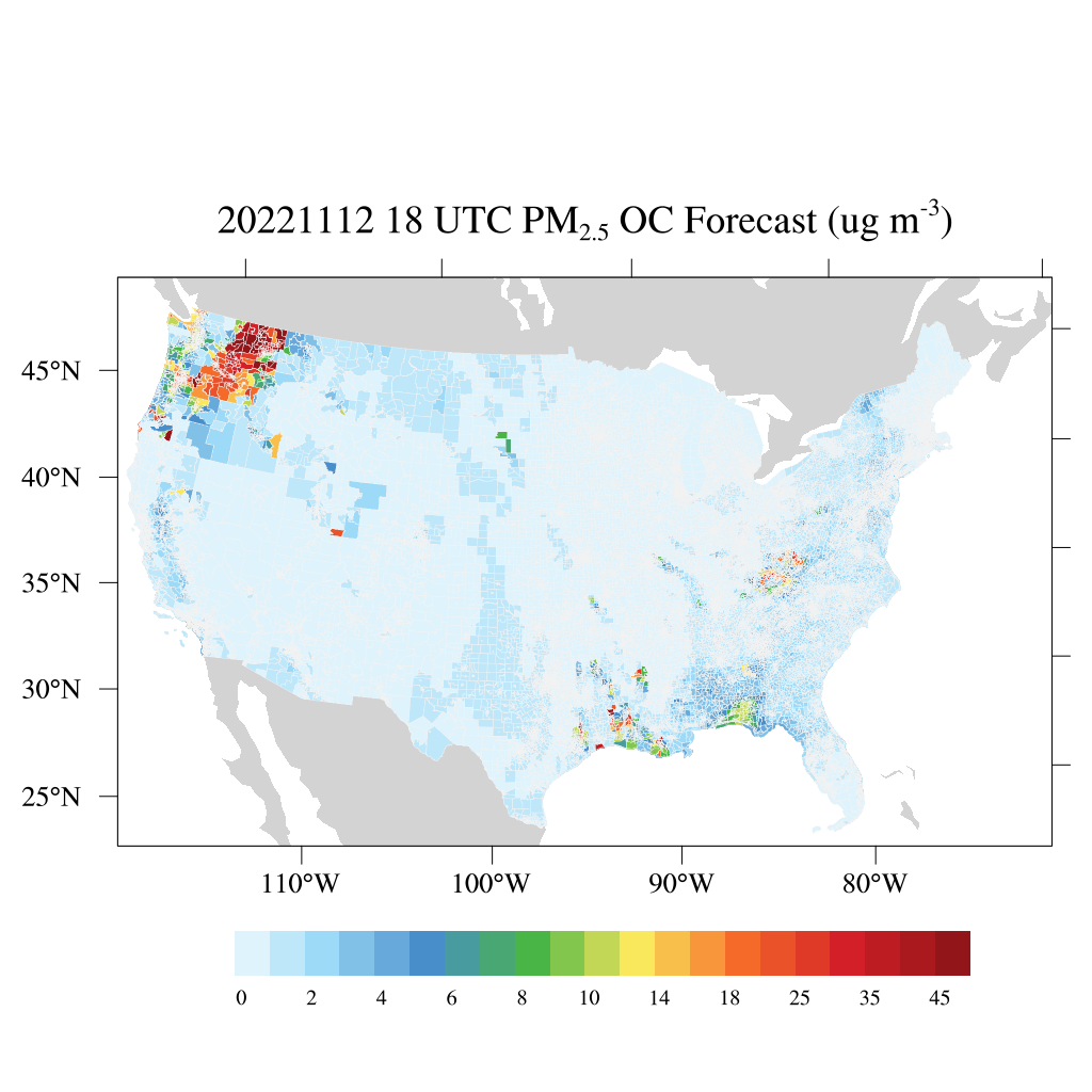
HAQES 3-Hourly Ensemble mean surface PM2.5 Organic Carbon concentration at census level, North America V1 (HAQES_NA_PM25_OC_CENSUS) at GES DISC
National Aeronautics and Space Administration —
This product provides HAQES 3-hourly ensemble mean surface PM2.5 Organic Carbon concentration at the census level over the continental United States (CONUS). The...
40,225 datasets found for "Administrative Units"