
-
Federal
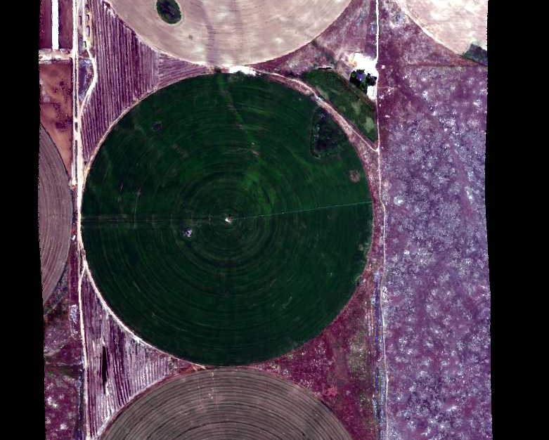
NACP Integrated Wildland and Cropland 30-m Fuel Characteristics Map, U.S.A., 2010
National Aeronautics and Space Administration —
The data set provides a 30-m comprehensive fuelbed characteristics map for both the wildland and cropland areas of the conterminous United States (CONUS) for 2010.... -
Federal
Hyperspectral Imagery from AVIRIS-NG for Sites in ID and CA, USA, 2014 and 2015
National Aeronautics and Space Administration —
This dataset provides surface reflectance measured by the Airborne Visible/Infrared Imaging Spectrometer-Next Generation (AVIRIS-NG) instrument during flights over... -
Federal
ABoVE: Methane Flux across Two Thermokarst Lake Ecosystems, Interior Alaska, 2018
National Aeronautics and Space Administration —
This dataset provides diffusive methane (CH4) fluxes collected from two thermokarst lakes in the Goldstream Valley, north of Fairbanks in interior Alaska. Fluxes were... -
Federal
Total Leaf Tissue Water Potential (FIFE)
National Aeronautics and Space Administration —
The Total Leaf Tissue Water Potential Data Set was collected during the summer months of 1988 and 1989. The objective of this study was to determine the influence of... -
Federal
BigFoot Leaf Area Index Surfaces for North and South American Sites, 2000-2003
National Aeronautics and Space Administration —
The BigFoot project gathered leaf area index (LAI) data for nine EOS Land Validation Sites located from Alaska to Brazil from 2000 to 2003. Each site is... -
Federal
BigFoot GPP Surfaces for North and South American Sites, 2000-2004
National Aeronautics and Space Administration —
The BigFoot project gathered Gross Primary Production (GPP) data for nine EOS Land Validation Sites located from Alaska to Brazil from 2000 to 2004. Each site is... -
Federal
BIGFOOT Meteorological Data for North and South American Sites, 1991-2004
National Aeronautics and Space Administration —
The BigFoot Project has compiled daily meteorological measurements for nine EOS Land Validation Sites located from Alaska to Brazil from 1991 to 2004. Each site is... -
Federal
BigFoot Field Data for North American Sites, 1999-2003
National Aeronautics and Space Administration —
The BigFoot project gathered field data for selected EOS Land Validation Sites in North America from 1999 to 2003. Data collected and derived for varying intervals at... -
Federal
BigFoot Land Cover Surfaces for North and South American Sites, 2000-2003
National Aeronautics and Space Administration —
The BigFoot project gathered data for nine EOS Land Validation Sites located from Alaska to Brazil from 2000 to 2003. Each site is representative of one or two... -
Federal
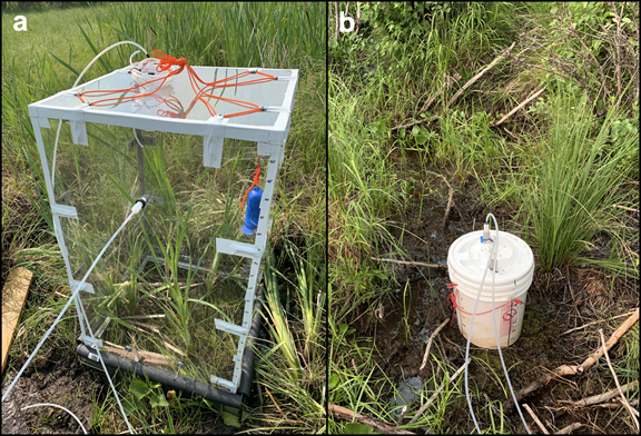
Methane Fluxes from Shorelines and Differing Surfaces, Big Trail Lake, Alaska, 2019
National Aeronautics and Space Administration —
This dataset provides methane fluxes from hot-spot and non-hot spot differing surfaces at Big Trail Lake (BTL) in the Goldstream Valley near Fairbanks, AK, USA.... -
Federal
SE-590 Leaf Optical Prop. Data (FIFE)
National Aeronautics and Space Administration —
The SE-590 Leaf Level Spectral Observations from GSFC Data Set were acquired in situ with a Spectron SE590 spectroradiometer fitted with the 1 degree IFOV lens, and... -
Federal
MMR Leaf Optical Properties Data (FIFE)
National Aeronautics and Space Administration —
The Leaf Optical Properties from UNL Data Set contains leaf-level spectral observations acquired in situ with the Nebraska Multiband Leaf Radiometer (NMLR) coupled... -
Federal
NPP Grassland: Bridger, USA, 1970-1973, R1
National Aeronautics and Space Administration —
This data set contains three ASCII text files for the Bridger grassland study site in the Rocky Mountains (45.78 N, -110.78 W, Elevation 2,340 m). Two files contain... -
Federal
TRMM (TMPA-RT) Near Real-Time IR precipitation estimate L3 1-hour 0.25 degree x 0.25 degree V7 (TRMM_3B41RT) at GES DISC
National Aeronautics and Space Administration —
TMPA (3B41RT) dataset have been discontinued as of Dec. 31, 2019, and users are strongly encouraged to shift to the successor IMERG datasets (doi:... -
Federal
BigFoot NPP Surfaces for North and South American Sites, 2000-2004
National Aeronautics and Space Administration —
The BigFoot project gathered Net Primary Production (NPP) data for nine EOS Land Validation Sites located from Alaska to Brazil from 2000 to 2004. Each site is... -
Federal
TRMM (TMPA-RT) Near Real-Time Microwave precipitation estimate L3 3 hour 0.25 degree x 0.25 degree V7 (TRMM_3B40RT) at GES DISC
National Aeronautics and Space Administration —
TMPA (3B40RT) dataset have been discontinued as of Dec. 31, 2019, and users are strongly encouraged to shift to the successor IMERG datasets (doi:...

Official websites use .gov
A
.gov website belongs to an official government
organization in the United States.
Secure .gov websites use HTTPS
A
lock (
) or https:// means you’ve safely connected to
the .gov website. Share sensitive information only on official,
secure websites.