

13 datasets found for "Bays"
-
Federal
HLS Landsat Operational Land Imager Surface Reflectance and TOA Brightness Daily Global 30m v2.0
National Aeronautics and Space Administration —
The Harmonized Landsat Sentinel-2 (HLS) project provides consistent surface reflectance (SR) and top of atmosphere (TOA) brightness data from a virtual constellation... -
Federal
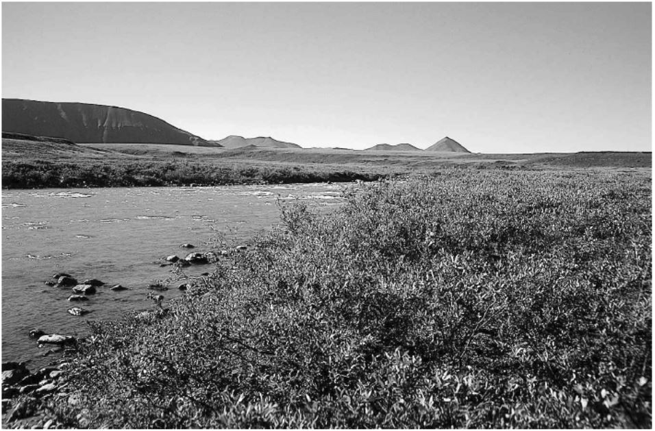
Arctic Vegetation Plots in Willow Communities, North Slope, Alaska, 1997
National Aeronautics and Space Administration —
This data set provides environmental, soil, and vegetation data collected in July and August 1997 from 85 study plots in willow shrub communities located along a... -
Federal
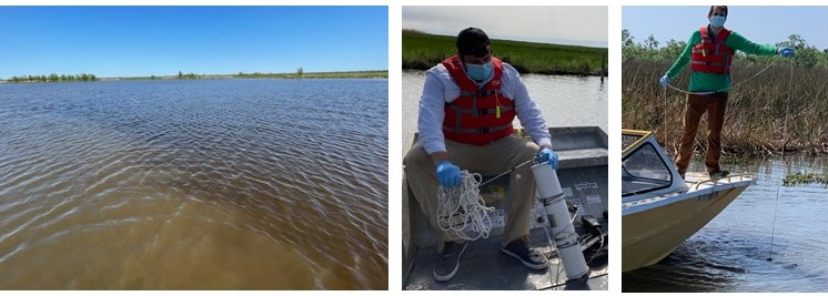
Delta-X: In Situ Water Surface Reflectance across MRD, LA, USA, 2021, V3
National Aeronautics and Space Administration —
This dataset includes above water measurements of remote-sensing reflectance measured in situ at field sampling stations during the Delta-X 2021 field efforts.... -
Federal
Saildrone Baja field campaign surface and ADCP measurements
National Aeronautics and Space Administration —
Saildrone is a wind and solar powered unmanned surface vehicle (USV) capable of long distance deployments lasting up to 12 months and providing high quality, near... -
Federal
Delta-X: Total Suspended Solids Concentration across MRD, LA, USA, 2021, Version 2
National Aeronautics and Space Administration —
This dataset provides measurements of total suspended solids concentrations (TSS) of surface waters in the Atchafalaya River and Terrebonne Basins during the spring... -
Federal
Delta-X: Particulate Organic Carbon Concentration from Water Samples, MRD, LA, 2021
National Aeronautics and Space Administration —
This dataset provides measurements of particulate organic carbon (POC) concentrations made on water samples collected during 2021 in surface waters of the Atchafalaya... -
Federal
OMG Narwhals Shipboard Conductivity, Temperature, and Depth (CTD) profiles, 2018-2020
National Aeronautics and Space Administration —
This OMG Narwhals dataset contains measurements from the ship based full water column CTD profiles that were obtained during summer mooring deployment/recovery... -
Federal
SASSIE Arctic Field Campaign Wave Glider Data Fall 2022 Version 1
National Aeronautics and Space Administration —
The Salinity and Stratification at the Sea Ice Edge (SASSIE) project is a NASA experiment that aims to understand how salinity anomalies in the upper ocean generated... -
Federal
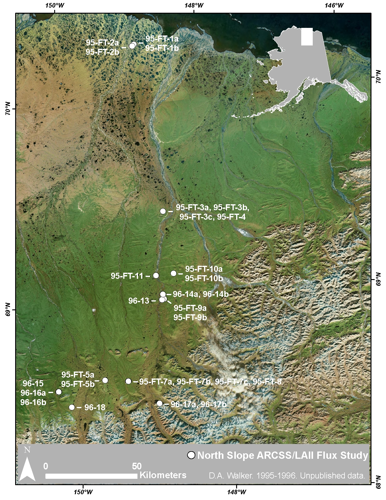
Arctic Vegetation Plots at ARCSS/LAII Flux Sites, North Slope, Alaska, 1995-1996
National Aeronautics and Space Administration —
This dataset provides vegetation cover and environmental plot and soil data collected at flux tower sites of the North Slope Arctic System Science/Land-Atmosphere-Ice... -
Federal
HLS Sentinel-2 Multi-spectral Instrument Surface Reflectance Daily Global 30m v2.0
National Aeronautics and Space Administration —
The Harmonized Landsat Sentinel-2 (HLS) project provides consistent surface reflectance data from the Operational Land Imager (OLI) aboard the joint NASA/USGS Landsat... -
Federal
Saildrone Baja field campaign surface and ADCP measurements
National Aeronautics and Space Administration —
Saildrone is a wind and solar powered unmanned surface vehicle (USV) capable of long distance deployments lasting up to 12 months and providing high quality, near... -
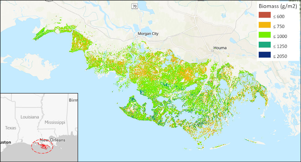
Federal
Aboveground Biomass High-Resolution Maps for Selected US Tidal Marshes, 2015
National Aeronautics and Space Administration —
This dataset provides maps of aboveground tidal marsh biomass (g/m2) at 30 m resolution for six estuarine regions of the conterminous United States: Cape Cod, MA;...
13 datasets found for "Bays"