
-
Federal
Gridded Population of the World, Version 4 (GPWv4): Data Quality Indicators, Revision 11
National Aeronautics and Space Administration —
The Gridded Population of the World, Version 4 (GPWv4): Data Quality Indicators, Revision 11 consists of three data layers created to provide context for the... -
Federal
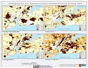
U.S. Census Grids (Summary File 1), 2000: Metropolitan Statistical Areas
National Aeronautics and Space Administration —
U.S. Census Grids (Summary File 1), 2000: Metropolitan Statistical Areas contain grids of demographic and socioeconomic data from the year 2000 U.S. census in ASCII... -
Federal
U.S. Population Grids (Summary File 3), 2000: Alabama, Louisiana, and Mississippi, Alpha Version
National Aeronautics and Space Administration —
The U.S. Population Grids (Summary File 3), 2000: Alabama, Louisiana, and Mississippi, Alpha Version data set contains an ARC/INFO Workspace with grids of demographic... -
Federal
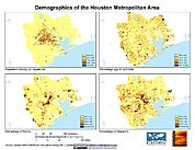
U.S. Population Grids (Summary File 1), 2000: Houston Metropolitan Statistical Area, Alpha Version
National Aeronautics and Space Administration —
The U.S. Population Grids (Summary File 1), 2000: Houston Metropolitan Statistical Area, Alpha Version data set contains an ARC/INFO Workspace with grids of... -
Federal
Star Formation in Nearby Clouds (SFiNCs) X-Ray Source Catalog
National Aeronautics and Space Administration —
The Star Formation in Nearby Clouds (SFiNCs) project is aimed at providing a detailed study of the young stellar populations and of star cluster formation in the... -
Federal
Poverty Mapping Project: Small Area Estimates of Poverty and Inequality
National Aeronautics and Space Administration —
The Poverty Mapping Project: Small Area Estimates of Poverty and Inequality data set consists of consumption-based poverty, inequality and related measures for... -
Federal
National Land Cover Data set 1992 (NLCD1992)
National Aeronautics and Space Administration —
National Land Cover Dataset 1992 (NLCD1992) is a 21-class land cover classification scheme that has been applied consistently across the lower 48 United States at a... -
Federal
Cep B/OB3 Star-Forming Region Chandra X-Ray Point Source Catalog
National Aeronautics and Space Administration —
This table contains the Cepheus B star formation region (the Cep B molecular cloud and the Cep OB3b OB association) Chandra X-Ray point source catalog. The Cepheus B... -
Federal
Lynds 1641 and iota Ori Region XMM-Newton X-Ray Point Source Catalog
National Aeronautics and Space Administration —
This table contains results from an XMM-Newton and Spitzer survey of the part of the Orion A cloud south of the Orion Nebula, the 'Survey of Orion A with XMM-Newton... -
Federal
Swift BAT 60-Month Survey of Active Galactic Nuclei Catalog
National Aeronautics and Space Administration —
Surveys above 10 keV represent one of the best resources to provide an unbiased census of the population of active galactic nuclei (AGNs). The authors present the... -
Federal
NGC 6231 Chandra X-Ray Point Source Catalog 2
National Aeronautics and Space Administration —
NGC 6231 is a young cluster (age ~2-7 Myr) dominating the Sco OB1 association (distance ~1.59 kpc) with ~100 O and B stars and a large pre-main-sequence stellar... -
Federal
Chamaeleon I North Cloud Chandra X-Ray Point Source Catalog
National Aeronautics and Space Administration —
This table contains the Chamaeleon (Cha) I North Cloud Chandra X-Ray point source catalog. Sensitive X-ray imaging surveys provide a new and effective tool to... -
Federal
U.S. Population Grids (Summary File 1), 2000: Alabama, Louisiana, Mississippi and Texas, Alpha Version
National Aeronautics and Space Administration —
The U.S. Population Grids (Summary File 1), 2000: Alabama, Louisiana, Mississippi and Texas, Alpha Version data set contains an ARC/INFO Workspace with grids of... -
Federal
NACP MCI: CO2 Emissions Inventory, Upper Midwest Region, USA., 2007
National Aeronautics and Space Administration —
This data set provides a bottom-up CO2 emissions inventory for the mid-continent region of the United States for the year 2007. The study was undertaken as part of... -
Federal
Archive of Census Related Products (ACRP): 1990 Enhanced Migration Files
National Aeronautics and Space Administration —
The 1990 Enhanced Migration Files portion of the Archive of Census Related Products (ACRP) contains migration data derived from the U.S. Census Bureau's Summary Tape... -
Federal
LBA-ECO ND-01 Streamwater and Watershed Characteristics, Rondonia, Brazil: 1998-1999
National Aeronautics and Space Administration —
This data set provides the results of (1) synoptic streamwater sampling and analyses from numerous sites across Rondonia and (2) corresponding watershed... -
Federal
LBA-ECO LC-31 Historical Land-Use in the Amazon: 1940-1995
National Aeronautics and Space Administration —
This data set provides annual spatial patterns of cropland, natural pasture, and planted pasture land uses across Amazonia for the period 1940/1950-1995. Two series... -
Federal
NGC 2264 Chandra X-Ray Point Source Catalog 2
National Aeronautics and Space Administration —
With the goal of improving the member census of the NGC 2264 star-forming region and studying the origin of X-ray activity in young pre-main sequence (PMS) stars, the...

Official websites use .gov
A
.gov website belongs to an official government
organization in the United States.
Secure .gov websites use HTTPS
A
lock (
) or https:// means you’ve safely connected to
the .gov website. Share sensitive information only on official,
secure websites.