
-
Federal
Global Land Cover Characterization Program
National Aeronautics and Space Administration —
The Global Land Cover Characterization Project was established to meet science data requirements identified by the International Geosphere and Biosphere Programme... -
Federal
Sentinel-5P TROPOMI Near-Real-Time (NRT) Carbon Monoxide CO Column 1-Orbit L2 5.5km x 7km V2 (S5P_L2__CO_____HiR_NRT) at GES DISC
National Aeronautics and Space Administration —
The Sentinel-5P TROPOMI Near Real Time (NRT) Carbon Monoxide CO Column 1-Orbit L2 5.5km x 7km V2 (S5P_L2__CO_HiR_NRT) at GES DISC is the near real time version of the... -
Federal
MEaSUREs Annual Antarctic Ice Velocity Maps V001
National Aeronautics and Space Administration —
This data set, part of the NASA Making Earth System Data Records for Use in Research Environments (MEaSUREs) program, provides annual maps of Antarctic ice velocity.... -
Federal
Altimeter Corrected Elevations, Version 2 (ACE2)
National Aeronautics and Space Administration —
The Altimeter Corrected Elevations, Version 2 (ACE2) data set, is the Global Digital Elevation Model (GDEM) created by using multi-mission Satellite Radar Altimetry... -
Federal
MEaSUREs ITS_LIVE Antarctic Quarterly 1920 m Ice Shelf Height Change and Basal Melt Rates, 1992-2017 V001
National Aeronautics and Space Administration —
This ITS_LIVE data set, part of the Making Earth System Data Records for Use in Research Environments (MEaSUREs) Program, includes quarterly estimates of Antarctic... -
Federal
Sentinel-5P TROPOMI Near-Real-Time (NRT) Sulphur Dioxide SO2 1-Orbit L2 5.5km x 3.5km V2 (S5P_L2__SO2____HiR_NRT) at GES DISC
National Aeronautics and Space Administration —
The Sentinel-5P TROPOMI Near Real Time (NRT) Sulphur Dioxide SO2 1-Orbit L2 5.5km x 3.5km V2 (S5P_L2__SO2_HiRNRT) at GES DISC is the near real time version of the... -
Federal
Sentinel-5P TROPOMI Near-Real-Time (NRT) Total Ozone Column 1-Orbit L2 5.5km x 3.5km V2 (S5P_L2__O3_TOT_HiR_NRT) at GES DISC
National Aeronautics and Space Administration —
The Sentinel-5P TROPOMI Near Real Time (NRT) Total Ozone Column 1-Orbit L2 5.5km x 3.5km V2 (S5P_L2__O3_TOT_HiR_NRT) at GES DISC is the near real time version of the... -
Federal
Country-Level Population and Downscaled Projections Based on the SRES A1, B1, and A2 Scenarios, 1990-2100
National Aeronautics and Space Administration —
The Country-Level Population and Downscaled Projections Based on Special Report on Emissions Scenarios (SRES) A1, B1, and A2 Scenarios, 1990-2100, were adopted in... -
Federal
MEaSUREs Greenland Ice Velocity: Selected Glacier Site Single-Pair Velocity Maps from Optical Images V001
National Aeronautics and Space Administration —
This data set, part of the NASA Making Earth System Data Records for Use in Research Environments (MEaSUREs) program, consists of surface velocity estimates for... -
Federal
Sentinel-5P TROPOMI Near-Real-Time (NRT) Radiance product band 5 (NIR detector) L1B 5.5km x 3.5km V2 (S5P_L1B_RA_BD5_HiR_NRT) at GES DISC
National Aeronautics and Space Administration —
The Sentinel-5P TROPOMI Near Real Time (NRT) Radiance product band 5 (NIR detector) L1B 5.5km x 21km V2 (S5P_L1B_RA_BD5_HiR_NRT) product at GES DISC is the near real... -
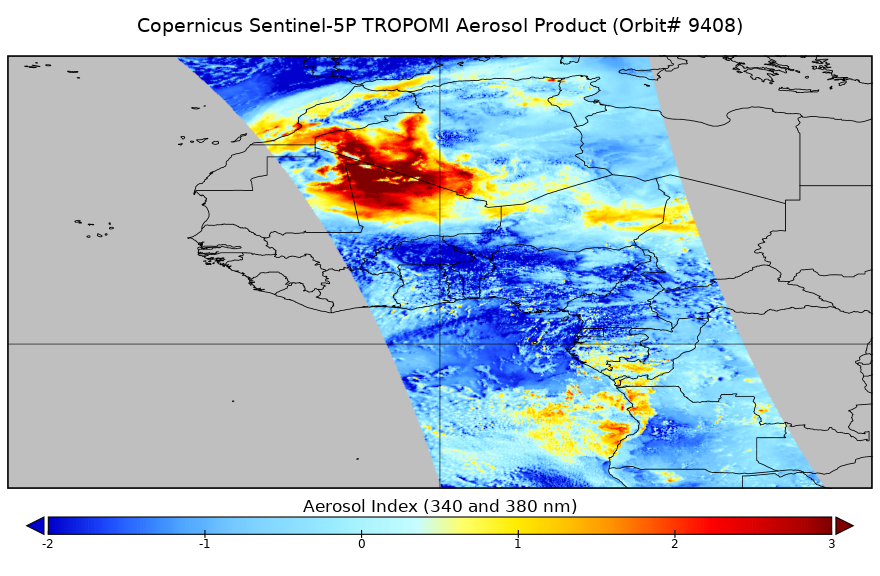
Federal
Sentinel-5P TROPOMI Near-Real-Time (NRT) Aerosol Index 1-Orbit L2 5.5km x 3.5km V2 (S5P_L2__AER_AI_HiR_NRT) at GES DISC
National Aeronautics and Space Administration —
The Sentinel-5P TROPOMI Near Real Time (NRT) Aerosol Index 1-Orbit L2 5.5km x 3.5km V2 (S5P_L2__AER_AI_HiR_NRT) at GES DISC is the near real time version of the... -
Federal
Sentinel-5P TROPOMI Near-Real-Time (NRT) Radiance product band 4 (UVIS detector) L1B 5.5km x 3.5km V2 (S5P_L1B_RA_BD4_HiR_NRT) at GES DISC
National Aeronautics and Space Administration —
The Sentinel-5P TROPOMI Near Real Time (NRT) Radiance product band 4 (UVIS detector) L1B 5.5km x 21km V2 (S5P_L1B_RA_BD4_HiR_NRT) product at GES DISC is the near real... -
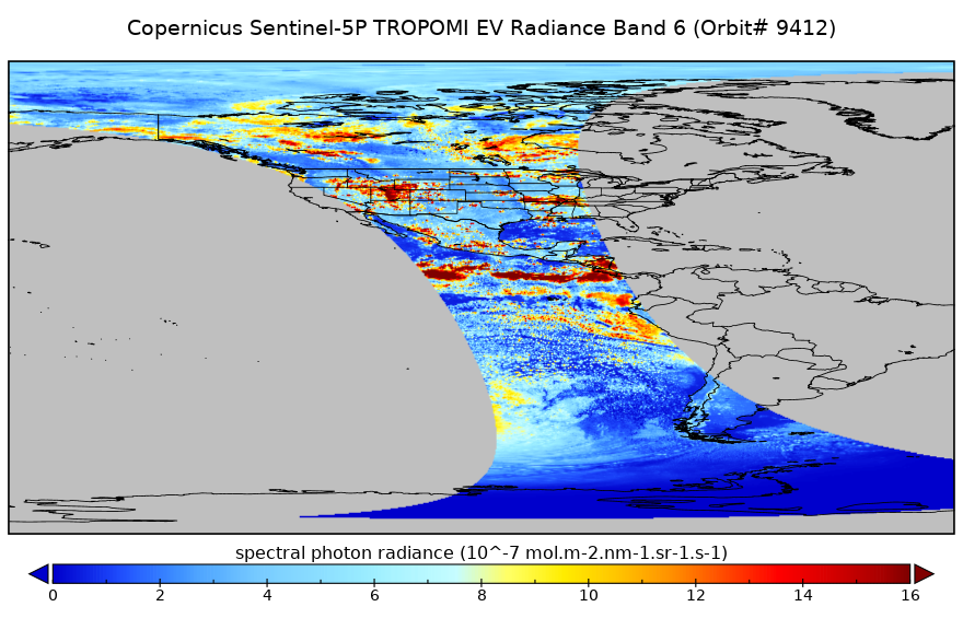
Federal
Sentinel-5P TROPOMI Near-Real-Time (NRT) Radiance product band 6 (NIR detector) L1B 5.5km x 3.5km V2 (S5P_L1B_RA_BD6_HiR_NRT) at GES DISC
National Aeronautics and Space Administration —
The Sentinel-5P TROPOMI Near Real Time (NRT) Radiance product band 6 (NIR detector) L1B 5.5km x 21km V2 (S5P_L1B_RA_BD6_HiR_NRT) product at GES DISC is the near real... -
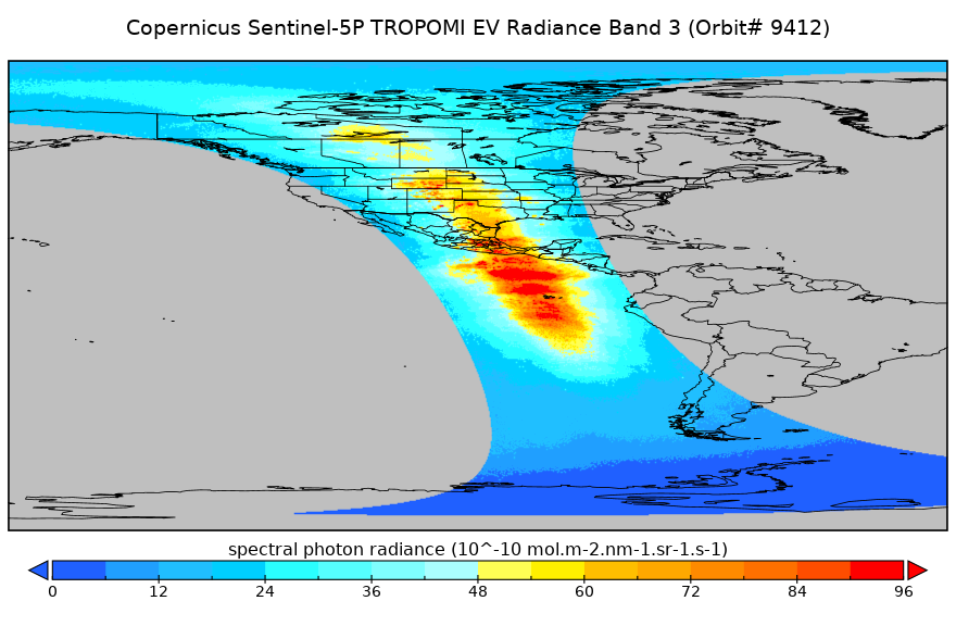
Federal
Sentinel-5P TROPOMI Near-Real-Time (NRT) Radiance product band 3 (UVIS detector) L1B 5.5km x 3.5km V2 (S5P_L1B_RA_BD3_HiR_NRT) at GES DISC
National Aeronautics and Space Administration —
The Sentinel-5P TROPOMI Near Real Time (NRT) Radiance product band 3 (UVIS detector) L1B 5.5km x 21km V2 (S5P_L1B_RA_BD3_HiR_NRT_NRT) product at GES DISC is the near... -
Federal
West Africa Coastal Vulnerability Mapping: Subset of High and Low Resolution Altimeter Corrected Elevations 2 (ACE2)
National Aeronautics and Space Administration —
The West Africa Coastal Vulnerability Mapping: Subset of High and Low Resolution Altimeter Corrected Elevations 2 (ACE2) data set consists of extracts from the 3 arc-... -
Federal
MEaSUREs Greenland 6 and 12 day Ice Sheet Velocity Mosaics from SAR V002
National Aeronautics and Space Administration —
This data set, part of the NASA Making Earth System Data Records for Use in Research Environments (MEaSUREs) Program, contains 6 and 12 day surface velocity estimates... -
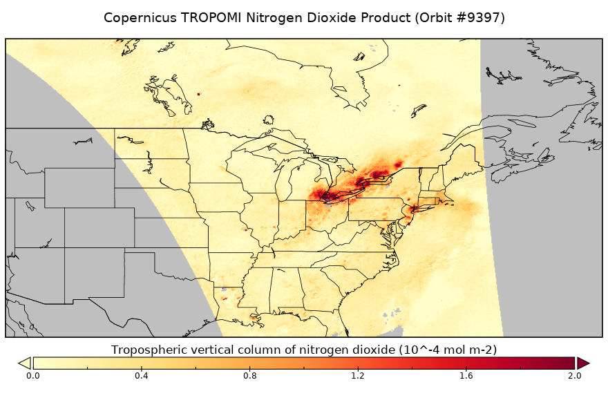
Federal
Sentinel-5P TROPOMI Near-Real-Time (NRT) Tropospheric NO2 1-Orbit L2 5.5km x 3.5km V2 (S5P_L2__NO2____HiR_NRT) at GES DISC
National Aeronautics and Space Administration —
The Sentinel-5P TROPOMI Near Real Time (NRT) Tropospheric NO2 1-Orbit L2 5.5km x 3.5km V2 (S5P_L2__NO2_HiRNRT) at GES DISC is the near real time version of the... -
Federal
MEaSUREs Antarctic Boundaries for IPY 2007-2009 from Satellite Radar V002 NGDA
National Aeronautics and Space Administration —
This data set, part of the NASA Making Earth System Data Records for Use in Research Environments (MEaSUREs) program, provides maps of Antarctic ice shelves,... -
Federal
MEaSUREs Greenland Ice Sheet Velocity Map from InSAR Data V002
National Aeronautics and Space Administration —
This data set, part of the NASA Making Earth System Data Records for Use in Research Environments (MEaSUREs) program, contains seasonal (winter) ice sheet-wide... -
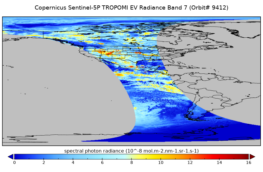
Federal
Sentinel-5P TROPOMI Near-Real-Time (NRT) Radiance product band 7 (SWIR detector) L1B 5.5km x 7km V2 (S5P_L1B_RA_BD7_HiR_NRT) at GES DISC
National Aeronautics and Space Administration —
The Sentinel-5P TROPOMI Near Real Time (NRT) Radiance product band 7 (SWIR detector) L1B 5.5km x 21km V2 (S5P_L1B_RA_BD7_HiR_NRT) product at GES DISC is the near real...

Official websites use .gov
A
.gov website belongs to an official government
organization in the United States.
Secure .gov websites use HTTPS
A
lock (
) or https:// means you’ve safely connected to
the .gov website. Share sensitive information only on official,
secure websites.