
-
Federal
4-m Grid of the Combined Multibeam and LIDAR Bathymetry Generated from National Oceanic and Atmospheric Administration (NOAA) Surveys H11224, H11225, H11250, H11251, H11252, H11361, H11441, H11442, H11445, H11446, H11997, H11999, H12012, and H12013 Offshore in Eastern Long Island Sound and Westernmost Block Island Sound (ELISCOMB_GEO, Geographic, WGS84) recent views
Department of the Interior —
The USGS, in cooperation with NOAA and the Connecticut DEP, is producing detailed maps of the seafloor in Long Island Sound. The current phase of this cooperative... -
Federal
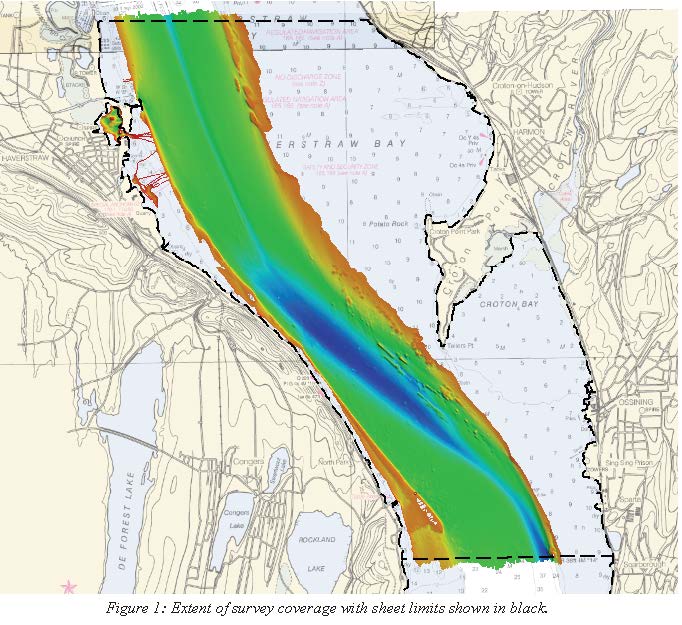
H08425A: NOS Hydrographic Survey , Vicinity of Tampa, Florida, 1958-08-20 recent views
National Oceanic and Atmospheric Administration, Department of Commerce —
The National Oceanic and Atmospheric Administration (NOAA) has the statutory mandate to collect hydrographic data in support of nautical chart compilation for safe... -
Federal
H08425: NOS Hydrographic Survey , Vicinity of Tampa, Florida, 1958-08-20 recent views
National Oceanic and Atmospheric Administration, Department of Commerce —
The National Oceanic and Atmospheric Administration (NOAA) has the statutory mandate to collect hydrographic data in support of nautical chart compilation for safe... -
Federal
Digital Geologic Map of the Culpeper East Quadrangle, Virginia (NPS, GRD, GRE, FRSP) recent views
Department of the Interior —
The Digital Geologic Map of the Culpeper East Quadrangle, Virginia is comprised of GIS data layers, two ancillary GIS tables, a Windows Help File with ancillary map... -
Federal
Hydrographic and Impairment Statistics Database: BEFR recent views
Department of the Interior —
Hydrographic and Impairment Statistics (HIS) is a National Park Service (NPS) Water Resources Division (WRD) project established to track certain goals created in... -
Federal
National Fish Habitat Partnership (NFHP) 2015 Cumulative Habitat Condition Indices with Limiting and Severe Disturbances for the Conterminous United States linked to NHDPlusV1 v2.0 recent views
Department of the Interior —
This CSV file contains cumulative fish habitat condition index (HCI) scores generated for river reaches of the conterminous United States as well as indices generated... -
Federal
H08142: NOS Hydrographic Survey , Vicinity of Three Arm Islands, Alaska, 1954-07-12 recent views
National Oceanic and Atmospheric Administration, Department of Commerce —
The National Oceanic and Atmospheric Administration (NOAA) has the statutory mandate to collect hydrographic data in support of nautical chart compilation for safe... -
Federal
Fort Davis National Historic Site Small-Scale Base GIS Data recent views
Department of the Interior —
This data set contains small-scale base GIS data layers compiled by the National Park Service Servicewide Inventory and Monitoring Program and Water Resources... -
Federal
Data Package: Long-term Continuous Water-Quality Monitoring at Obed Wild and Scenic River (OBRI), 2013-2024 recent views
Department of the Interior —
Data from continuous water quality datasondes co-located at three USGS gage sites at Obed Wild and Scenic River (OBRI). 2013-2024 -
Federal
H08281: NOS Hydrographic Survey , Dumbarton Bridge to Calaveras Point, California, 1957-05-20 recent views
National Oceanic and Atmospheric Administration, Department of Commerce —
The National Oceanic and Atmospheric Administration (NOAA) has the statutory mandate to collect hydrographic data in support of nautical chart compilation for safe... -
Federal
Landbird survey bird data collected in Hawaii Volcanoes National Park during 2015 and 2016 recent views
Department of the Interior —
The data are in the comma delimited file HAVO_2015_2016_BirdSurveyData.csv. Hawaiʻi Volcanoes National Park (HAVO) was surveyed for landbirds and landbird habitat... -
Federal
Bryce Canyon National Park Small-Scale Base GIS Data recent views
Department of the Interior —
This data set contains small-scale base GIS data layers compiled by the National Park Service Servicewide Inventory and Monitoring Program and Water Resources... -
Federal
Airborne magnetic survey, Boulder Batholith region, Montana, 2022 recent views
Department of the Interior —
This data release provides digital flight line data for a high-resolution airborne magnetic survey over parts of Montana in the vicinity of the Boulder Batholith. The... -
Federal
Hydrographic and Impairment Statistics Database: LONG recent views
Department of the Interior —
Hydrographic and Impairment Statistics (HIS) is a National Park Service (NPS) Water Resources Division (WRD) project established to track certain goals created in... -
Federal
D00188: NOS Hydrographic Survey , 2013-09-27 recent views
National Oceanic and Atmospheric Administration, Department of Commerce —
The National Oceanic and Atmospheric Administration (NOAA) has the statutory mandate to collect hydrographic data in support of nautical chart compilation for safe... -
Federal
H09488: NOS Hydrographic Survey , Potomac River, District of Columbia-Maryland-Virginia, 1976-11-15 recent views
National Oceanic and Atmospheric Administration, Department of Commerce —
The National Oceanic and Atmospheric Administration (NOAA) has the statutory mandate to collect hydrographic data in support of nautical chart compilation for safe... -
Federal
2014 Land Cover Land Use Horseshoe Bend recent views
Department of the Interior —
This collection of conservation areas consists of the floodplain of the combined streams of the Iowa River and the Cedar River. The study area begins just southeast... -
Federal
FIA Below Ground Forest Biomass (Image Service) recent views
Department of Agriculture —
The U.S. has been providing national-scale estimates of forest carbon stocks and stock change to meet United Nations Framework Convention on Climate Change reporting... -
Federal
H13023: NOS Hydrographic Survey , 2017-08-09 recent views
National Oceanic and Atmospheric Administration, Department of Commerce —
The National Oceanic and Atmospheric Administration (NOAA) has the statutory mandate to collect hydrographic data in support of nautical chart compilation for safe... -
Federal
H01911: NOS Hydrographic Survey , 1888-12-31 recent views
National Oceanic and Atmospheric Administration, Department of Commerce —
The National Oceanic and Atmospheric Administration (NOAA) has the statutory mandate to collect hydrographic data in support of nautical chart compilation for safe...

Official websites use .gov
A
.gov website belongs to an official government
organization in the United States.
Secure .gov websites use HTTPS
A
lock (
) or https:// means you’ve safely connected to
the .gov website. Share sensitive information only on official,
secure websites.