
-
Federal
MLS/Aura Level 3 Daily Binned Relative Humidity With Respect To Ice (RHI) on Assorted Grids V005 (ML3DBRHI) at GES DISC
National Aeronautics and Space Administration —
ML3DBRHI is the EOS Aura Microwave Limb Sounder (MLS) daily binned on various vertical grids product for relative humidity with respect to ice (RHI) derived from... -
Federal
CASSINI SS/S RPWS CALIBRATED LP POTENTIAL CURRENT V1.0
National Aeronautics and Space Administration —
The Cassini Radio and Plasma Wave Science (RPWS) Langmuir Probe Sweep voltage-current data set comprises calibrated Voltage-Current (U-I) characteristics acquired... -
Federal
Net Radiation and Albedo from MODIS for Xingu River Basin, Brazil, 2000-2012
National Aeronautics and Space Administration —
This dataset provides daily average land surface net radiation (Rnet) as an 8-day time series at approximately 0.5 km resolution for the upper Xingu River Basin in... -
Federal
2MASS All-Sky Survey Scan Information Table
National Aeronautics and Space Administration —
The 2MASS Scan Information Table provides basic data for each scan in the 2MASS All Sky Release. The table is organized according to the broad function and utility of... -
Federal
MODIS/Terra+Aqua Photosynthetically Active Radiation Daily/3-Hour L3 Global 5km SIN Grid V006
National Aeronautics and Space Administration —
MCD18A2 Version 6 was decommissioned on October 28, 2022. Users are encouraged to use the MCD18A2 Version 6.2 data product.The MCD18A2 Version 6 is a Moderate... -
Federal
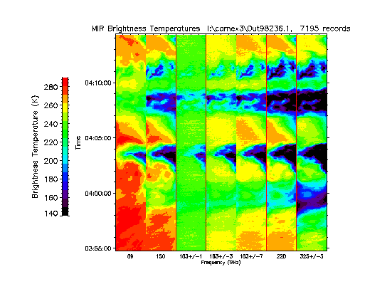
CAMEX-3 ER-2 Millimeter-wave Imaging Radiometer (MIR) V1
National Aeronautics and Space Administration —
The CAMEX-3 ER-2 Millimeter-wave Imaging Radiometer (MIR) dataset is a browse-only dataset containing plots of brightness temperature measurements collected by the... -
Federal
Randolph Glacier Inventory - A Dataset of Global Glacier Outlines, Version 4
National Aeronautics and Space Administration —
The Randolph Glacier Inventory (RGI) is a global set of glacier outlines; it is intended as a snapshot of the world’s glaciers. This data set provides a single... -
Federal
EXOSAT Observation Log
National Aeronautics and Space Administration —
This database table contains the EXOSAT observation log. This is a complete list of all EXOSAT observations, observing modes, and principal investigators. The log can... -
Federal
Global Mean Sea Level Trend from Integrated Multi-Mission Ocean Altimeters TOPEX/Poseidon, Jason-1, OSTM/Jason-2, Jason-3, and Sentinel-6 Version 5.2
National Aeronautics and Space Administration —
This dataset contains the Global Mean Sea Level (GMSL) trend generated from the Integrated Multi-Mission Ocean Altimeter Data for Climate Research Version 5.2. The... -
Federal
AMSRIce03 Surface Roughness Data, Version 1
National Aeronautics and Space Administration —
Notice to Data Users: The documentation for this data set was provided solely by the Principal Investigator(s) and was not further developed, thoroughly reviewed, or... -
Federal
AfriSAR LVIS L1A Geotagged Images V001
National Aeronautics and Space Administration —
This data set contains geotagged images collected over Gabon, Africa. The images were taken by the NASA Digital Mapping Camera paired with the Land, Vegetation, and... -
Federal
MGS MARS MAG CALIBRATED MAPPING DETAIL WORD RESOLUTION V1.0
National Aeronautics and Space Administration —
Calibrated high time resolution (detail word) from the MAG instrument on the MGS spacecraft, collected during the mapping and extended mission phases (1997-09-12 to... -
Federal
NSCAT Twice-Daily SIR-Enhanced EASE-Grid 2.0 Radar Backscatter V001
National Aeronautics and Space Administration —
This data set provides twice-daily enhanced-resolution radar backscatter images from 14 GHz NASA Scatterometer (NSCAT) observations by applying the Scatterometer... -
Federal
GOES17 ABI Deep Blue Aerosol L2
National Aeronautics and Space Administration —
The ABI G17 Deep Blue Aerosol 10-Min L2 Full Disk product, short-name AERDB_L2_ABI_G17 is produced every 30 minutes and contains full-disk observation data. The L2... -
Federal
CAR ARMCAS Arctic Cloud Radiation Measurements L1 V1 (CAR_ARMCAS_L1C) at GES DISC
National Aeronautics and Space Administration —
The Arctic Radiation Measurement in Column Atmosphere-surface System (ARMCAS) was a collaborative research effort between the Cloud and Aerosol Research (CAR) Group,... -
Federal
PDS Mars Exploration Rovers Data Release 41
National Aeronautics and Space Administration —
APXS, Atmospheric Opacity, HAZCAM, NAVCAM, MI, PANCAM, RAT, Rover Motion Counter, SPICE -
Federal
TNO AND CENTAUR COLORS V2.0
National Aeronautics and Space Administration —
This data set is intended to include published broadband colors of centaurs and Transneptunian Objects (TNOs) published through December 2004. It supersedes all... -
Federal
Lightning Instrument Package (LIP) IMPACTS V2
National Aeronautics and Space Administration —
The Lightning Instrument Package (LIP) IMPACTS dataset consists of electrical field measurements of lightning and navigation data collected by the Lightning... -
Federal
Polar Radiant Energy in the Far InfraRed Experiment (PREFIRE) Satellite 2 Raw Payload R01
National Aeronautics and Space Administration —
Polar Radiant Energy in the Far InfraRed Experiment (PREFIRE) Satellite 2 Raw Payload (PREFIRE_SAT2_0-PAYLOAD) contains the uncurated raw measurements from one of two... -
Federal
TROPICS03 L2B Deep Multispectral INtensity (DMIN) of Tropical cyclones estimator Algorithm V1.0
National Aeronautics and Space Administration —
The "Time-Resolved Observations of Precipitation structure and storm Intensity with a Constellation of Smallsats" (TROPICS) mission has a goal of providing nearly...

Official websites use .gov
A
.gov website belongs to an official government
organization in the United States.
Secure .gov websites use HTTPS
A
lock (
) or https:// means you’ve safely connected to
the .gov website. Share sensitive information only on official,
secure websites.