
-
Fire Intensity and Burn Severity Metrics for Circumpolar Boreal Forests, 2001-2013 NGDA
This data set provides products characterizing immediate and longer-term ecosystem changes from fires in the circumpolar boreal forests of Northern Eurasia and North America.... -
MODIS/Terra+Aqua Direct Broadcast Burned Area Monthly L3 Global 500m SIN Grid V061 NGDA
The Terra and Aqua combined MCD64A1 Version 6.1 Burned Area data product is a monthly, global gridded 500 meter (m) product containing per-pixel burned-area and quality... -
ABoVE: Burned Area, Depth, and Combustion for Alaska and Canada, 2001-2019 NGDA
This dataset provides annual gridded estimates of fire locations and associated burn fraction per pixel for Alaska and Canada at approximately 500 m spatial resolution for the... -
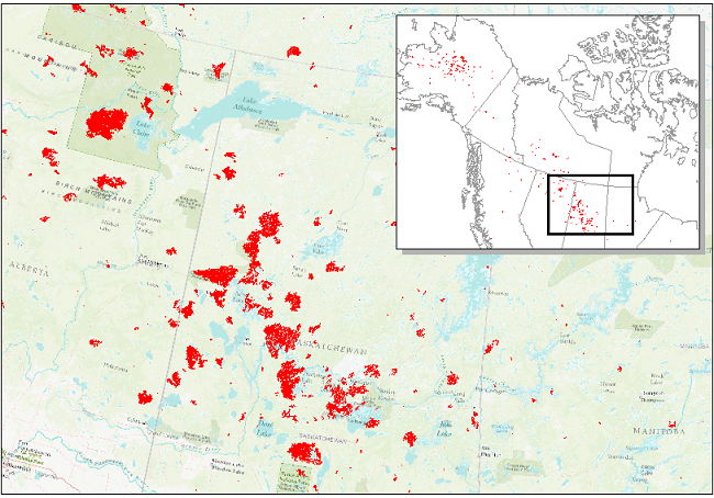
CARVE: Alaskan Fire Emissions Database (AKFED), 2001-2013 NGDA
This data set provides estimates of annual carbon emissions (kg carbon per square meter) from boreal fires at 450-m resolution for the state of Alaska between 2001 and 2013. To... -
Global Fire Atlas with Characteristics of Individual Fires, 2003-2016 NGDA
The Global Fire Atlas is a global dataset that tracks the day-to-day dynamics of individual fires to determine the timing and location of ignitions, fire size, duration, daily... -
LBA-ECO LC-23 Characterization of Vegetation Fire Dynamics for Brazil: 2001-2003 NGDA
Satellite fire detection was determined from two sensors, the Advanced Very High Resolution Radiometer (AVHRR) on NOAA-12 and the Moderate Resolution Imaging Spectroradiometer... -
ABoVE: Wildfire Date of Burning within Fire Scars across Alaska and Canada, 2001-2019 NGDA
This dataset provides estimates of wildfire progression represented by date of burning (DoB) within fire scars across Alaska and Canada for the period 2001-2019. Burn scar... -
Arctic Boreal Annual Burned Area, Circumpolar Boreal Forest and Tundra, V2, 2002-2022 NGDA
This dataset provides annual cumulative end-of-season burned area in circumpolar boreal forests and tundra for the years 2002-2022. The data were generated using the Arctic... -
NACP Regional: Gridded 1-deg Observation Data and Biosphere and Inverse Model Outputs NGDA
This data set contains standardized gridded observation data, terrestrial biosphere model output data, and inverse model simulations of carbon flux parameters that were used in... -
Annual wildland fire emissions (WFEIS v0.5) for Conterminous US and Alaska, 2001-2013 NGDA
This data set contains annual modeled estimates of wildland fire emissions at 0.01 degree (~1-km) spatial resolution from the Wildland Fire Emissions Information System (WFEIS... -
LBA-ECO LC-23 ASTER and MODIS Fire Data Comparison for Brazil: 2003-2004 NGDA
This data set contains data associated with MODIS fire maps generated using two different algorithms and compared against fire maps produced by ASTER. These data relate to a...

Official websites use .gov
A
.gov website belongs to an official government
organization in the United States.
Secure .gov websites use HTTPS
A
lock (
) or https:// means you’ve safely connected to
the .gov website. Share sensitive information only on official,
secure websites.