
-
AMPR FIRE III ACE V1
The Advanced Microwave Precipitation Radiometer (AMPR) was deployed during the First ISCCP Regional Experiment-III Arctic Cloud Experiment (FIRE-III/ACE). AMPR data were... -
CAMEX-3 LiDAR Atmospheric Sensing Experiment (LASE) Imagery V1
The CAMEX-3 LiDAR Atmospheric Sensing Experiment (LASE) Imagery dataset is a browse-only dataset that consists of plotted reflectivity data collected by the LiDAR Atmospheric... -
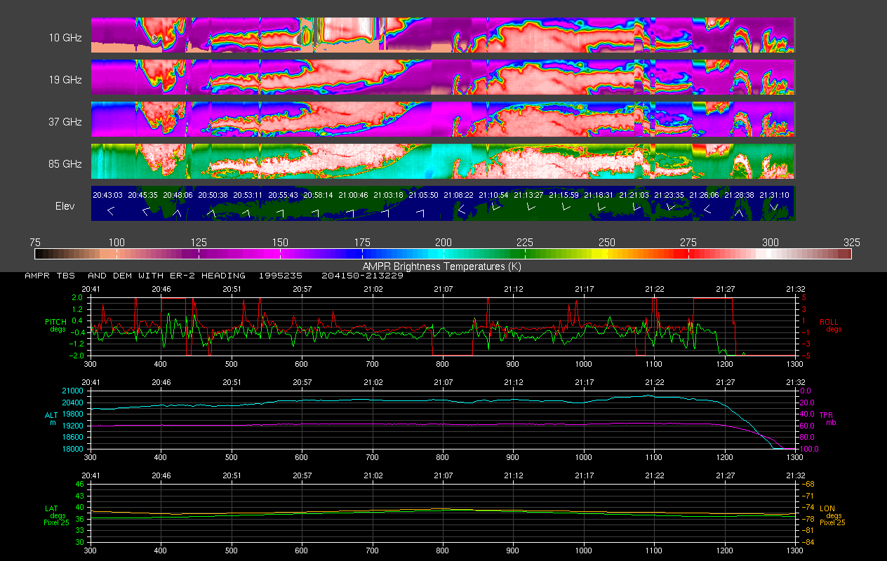
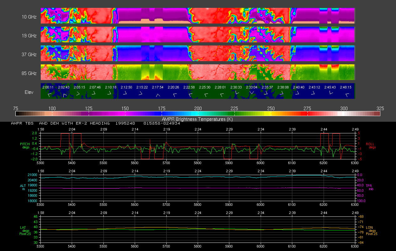
AMPR BRIGHTNESS TEMPERATURE CAMEX-2 V2
The Advanced Microwave Precipitation Radiometer (AMPR) was deployed during the Convection and Moisture Experiment 2 (CAMEX-2). AMPR data were collected at a combination of... -
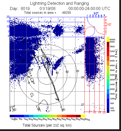
LIGHTNING DETECTION AND RANGING (LDAR) RAW DATA V1
Lightning Detection and Ranging (LDAR) Raw data consists of level 1 lightning data collected from February 25, 1997 through June 11, 2008. The LDR system is located at the... -
MODIS/Terra Monthly mean Day-Time Land Surface Temperature at 1x1 degree V005 (MOD11CM1D) at GES DISC NGDA
The dataset contains global monthly day-time land surface temperature averaged within 1 by 1 degree grid cells. The source for the data is MODIS/Terra MOD11C3 Collection 005... -
Real System Failures
This resource area contains descriptions of actual electronic systems failure scenarios with an emphasis on the diversity of failure modes and effects that can befall dependable... -
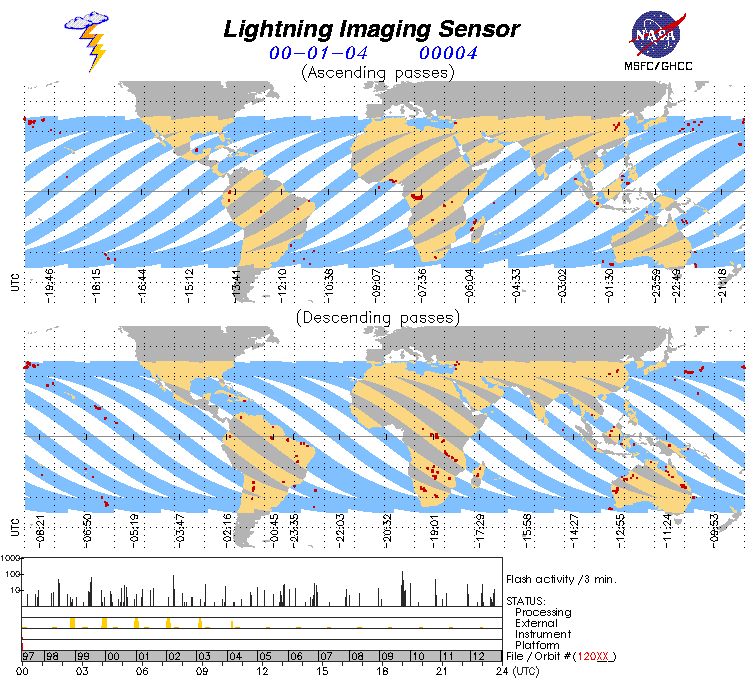
Lightning Imaging Sensor (LIS) on TRMM Science Data V4
The Lightning Imaging Sensor (LIS) Science Data was collected by the LIS instrument on the Tropical Rainfall Measuring Mission (TRMM) satellite used to detect the distribution... -
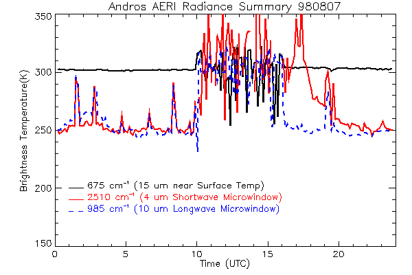
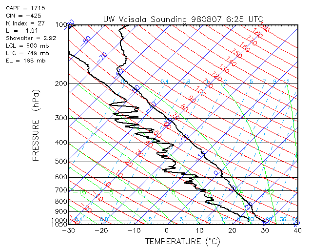
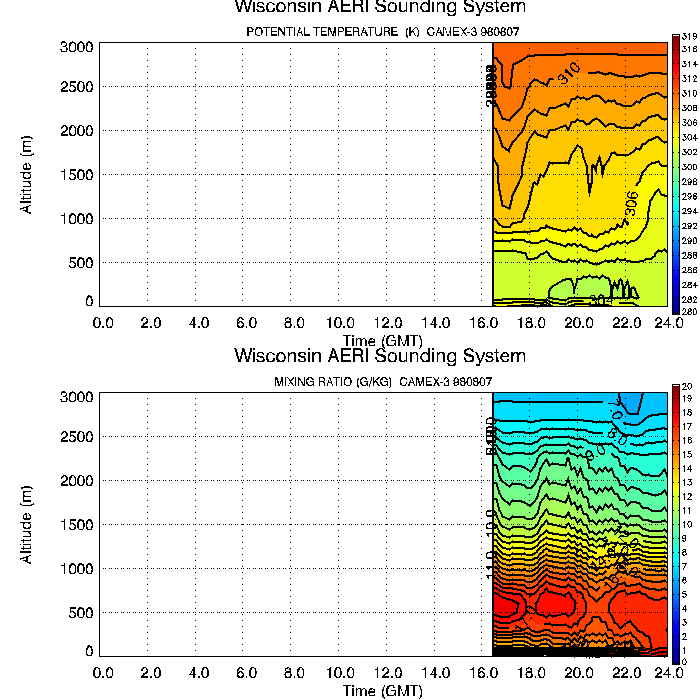
CAMEX-3 ATMOSPHERIC EMITTED RADIANCE INTERFEROMETER (AERI) V1
The Atmospheric Emitted Radiance Interferometer (AERI) was used to make atmospheric temperature and moisture retrievals. AERI provides absolutely calibrated radiances which can... -
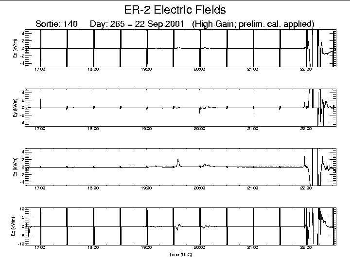
CAMEX-4 ER-2 LIGHTNING INSTRUMENT PACKAGE (LIP) V1
The CAMEX-4 ER-2 Lightning Instrument Package (LIP) dataset was collected by the ER-2 LIP, which allows the vector components of the electric field (i.e, Ex, Ey, Ez ) to be... -
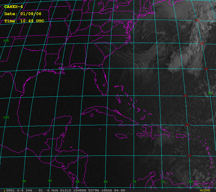
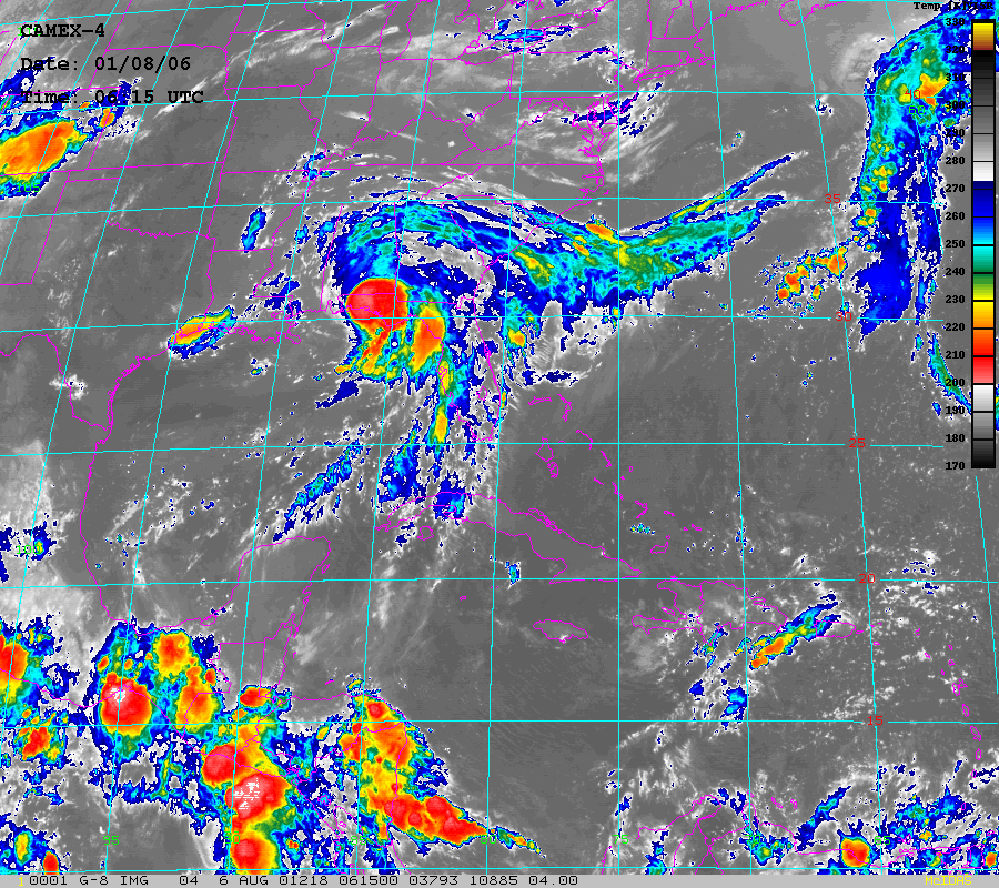
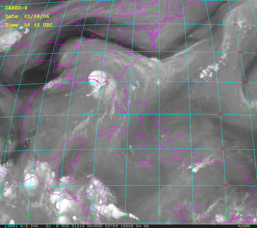
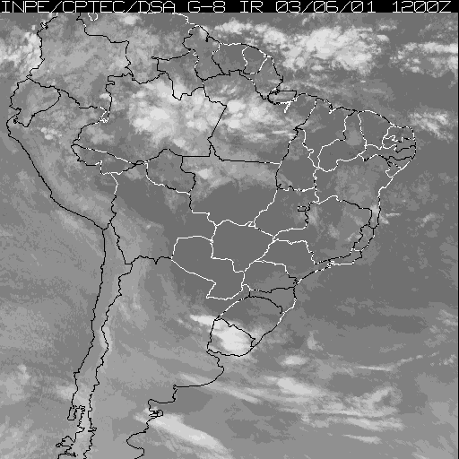
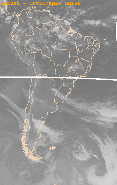
CAMEX-4 GOES-8 PRODUCTS V1
The CAMEX-4 GOES-8 Products dataset was collected during the CAMEX-4 field campaign, which ocused on the study of tropical cyclone (hurricane) development, tracking,... -
GPM GROUND VALIDATION HIGH ALTITUDE IMAGING WIND AND RAIN AIRBORNE PROFILER (HIWRAP) MC3E V1
The GPM Ground Validation High Altitude Imaging Wind and Rain Airborne Profiler (HIWRAP) MC3E dataset was collected by the High-Altitude Imaging Wind and Rain Airborne Profiler... -
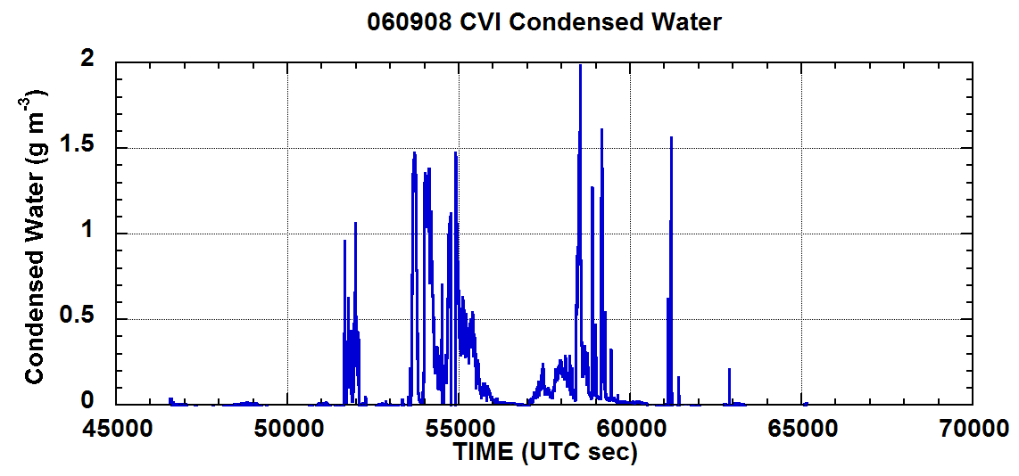
NAMMA CVI CLOUD CONDENSED WATER CONTENT V1
In the NAMMA CVI Cloud Condensed Water Content dataset the counterflow virtual impactor (CVI) was used to measure condensed water content (liquid water or ice in particles about... -
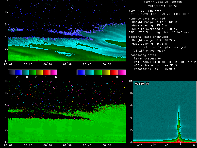
GPM GROUND VALIDATION MCGILL VERTICAL POINTING X-BAND (VERTIX) RADAR GCPEX V1
The GPM Ground Validation McGill Vertical Pointing X-Band (VertiX) Radar GCPEx dataset consists of radar reflectivity and Doppler velocity data collected by the Vertically... -
CAMEX-3 CLOUD AND AEROSOL PARTICLE CHARACTERIZATION (CAPAC) V1
CAPAC is a series of three instruments: the Forward Scattering Spectrometer Probe model 300 (FSSP-300), the Two Dimensional Optical Array Probes [Cloud and Precipitation Probes... -
BOREAS/SRC AMS Suite A Surface Meteorological and Radiation Data: 1996
Contains the data collected in 1996 by the AMS suite A instrument set operated by SRC and provided to BORIS. -
BOREAS Scanning Lidar Imager of Canopies by Echo Recovery (SLICER): Level-3 Data
Scanning Lidar Imager of Canopies by Echo Recovery (SLICER) data were acquired in support of BOReal Ecosystem-Atmosphere Study (BOREAS) at all of the Tower Flux (TF) sites in... -
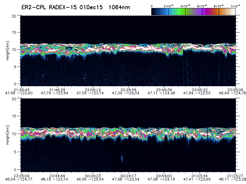
GPM Ground Validation Cloud Physics LiDAR (CPL) OLYMPEX V1
The GPM Ground Validation Cloud Physics Lidar (CPL) OLYMPEX dataset consists of extinction profiles, layer optical depth, layer lidar ratio, and aircraft parameter measurements... -
LBA-ECO CD-01 Meteorological Data, Tapajos and Amazon Rivers, Santarem, Brazil: 2001
This data set contains meteorological data collected around the confluence of the Tapajos River with the Amazon River in the Amazon Basin near Santarem, Brazil, in July and... -
AIRS/Aqua L1B Near Real Time (NRT) Infrared (IR) quality assurance subset V005 (AIRIBQAP_NRT) at GES DISC
The AIRS Level 1B Near Real Time (NRT) product (AIRIBQAP_NRT_005) differs from the routine product (AIRIBQAP_005) in 2 ways to meet the three hour latency requirements of the... -
ISLSCP II Atmospheric Carbon Dioxide Consumption by Continental Erosion
The Continental Atmospheric CO2 Consumption data set represents gridded estimates for the riverine export of carbon and of sediments based on empirical models. All data exist...

Official websites use .gov
A
.gov website belongs to an official government
organization in the United States.
Secure .gov websites use HTTPS
A
lock (
) or https:// means you’ve safely connected to
the .gov website. Share sensitive information only on official,
secure websites.