
-
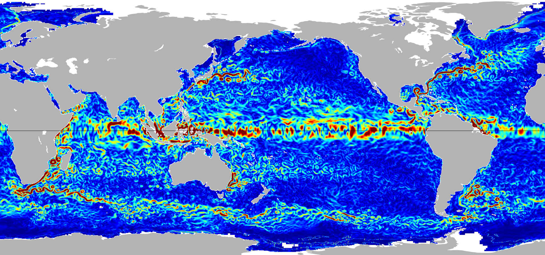
Ocean Surface Current Analyses Real-time (OSCAR) Surface Currents - Final 0.25 Degree (Version 2.0) 33 recent views
Ocean Surface Current Analyses Real-time (OSCAR) is a global surface current database and NASA funded research project. OSCAR ocean mixed layer velocities are calculated from... -
Ocean Surface Current Analyses Real-time (OSCAR) Surface Currents - Near Real Time 0.25 Degree (Version 2.0)
Ocean Surface Current Analyses Real-time (OSCAR) is a global surface current database and NASA funded research project. OSCAR ocean mixed layer velocities are calculated from... -
SWOT Simulated Level 2 North America Continent High Rate Raster Product Version 1.0
This dataset contains a simulated rasterized water surface elevation and inundation-extent product to be provided by the Surface Water and Ocean Topography (SWOT) mission. SWOT... -
SWOT Simulated Level 2 North America Continent KaRIn High Rate Pixel Cloud Vector Attribute Product Version 1.0
This dataset provides a simulated water surface elevation product that resembles the Ka-band Interferometer (KaRIn) measurements by the Surface Water and Ocean Topography (SWOT)... -
High Resolution Empirical Tide Prediction Software Version 14
This dataset provides sea surface height and ocean surface currents associated with the predictable astronomical tide at the M2, S2, N2, K1, and O1 frequencies. The tidal... -
Integrated Multi-Mission Ocean Altimeter Data for Climate Research complete time series Version 5.1
This dataset contains along track Sea Surface Height Anomalies (SSHA) from the TOPEX/Poseidon, Jason-1, OSTM/Jason-2, and Jason-3 missions geo-referenced to a mean reference... -
OPERA Dynamic Surface Water Extent from Harmonized Landsat Sentinel-2 provisional product (Version 1)
This dataset contains Level-3 Dynamic OPERA provisional surface water extent product version 1. The data are provisional surface water extent observations beginning April 2023.... -
Integrated Multi-Mission Ocean Altimeter Data for Climate Research Version 5.1
This dataset contains along track Sea Surface Height Anomalies (SSHA) for individual 10-day cycles from the TOPEX/Poseidon, Jason-1, OSTM/Jason-2, and Jason-3 missions geo-... -
OPERA Dynamic Surface Water Extent from Harmonized Landsat Sentinel-2 CalVal Database (Version 1)
This dataset contains the calibration/validation (CalVal) database for the OPERA DSWx-HLS provisional product. The CalVal database is a zip file of an Amazon Web Services S3... -
The Lake Observations by Citizen Scientists & Satellites (LOCSS) Level 1 Version 1.0
This dataset contains data from the Lake Observations by Citizen Science and Satellites project, LOCSS which is a lake monitoring network. The data represent the location and... -
SWOT Simulated Level 2 North America Continent KaRIn High Rate Water Mask Pixel Cloud Product Version 1.0
This dataset includes simulated water surface elevations that resemble the Ka-band Interferometer (KaRIn) measurements by the Surface Water and Ocean Topography (SWOT) mission.... -
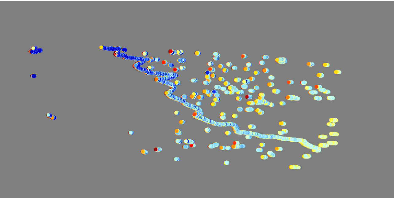
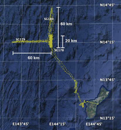
Adaptive Sampling of Rain and Ocean Salinity from Autonomous Seagliders (Guam 2019-2020)
This dataset was produced by the Adaptive Sampling of Rain and Ocean Salinity from Autonomous Seagliders (NASA grant NNX17AK07G) project, an investigation to develop tools and... -
SWOT Simulated Level 2 North America Continent High Rate River Vectors Product Version 1.0
This dataset contains a simulated river data product to be provided by the Surface Water and Ocean Topography (SWOT) mission. SWOT will provide a global coverage but this... -
Ocean Surface Current Analyses Real-time (OSCAR) Surface Currents - Interim 0.25 Degree (Version 2.0)
Ocean Surface Current Analyses Real-time (OSCAR) is a global surface current database and NASA funded research project. OSCAR ocean mixed layer velocities are calculated from...

Official websites use .gov
A
.gov website belongs to an official government
organization in the United States.
Secure .gov websites use HTTPS
A
lock (
) or https:// means you’ve safely connected to
the .gov website. Share sensitive information only on official,
secure websites.