

113 datasets found for "Centroids"
-
Federal
Access to Jobs and Workers via Transit - Download 103 recent views
U.S. Environmental Protection Agency —
A collection of performance indicators and regional benchmarks for consistently comparing neighborhoods (census block groups) across the US in regards to their... -
Federal
Administrative Boundaries Centroids of National Park System Units NGDA 26 recent views
Department of the Interior —
National Park Service unit points. -
County
LakeCountyParcels 10 recent views
Lake County, Illinois —
Download In State Plane Projection Here In addition to the Tax Parcel polygons feature class, the hyperlink download above also contains a parcel point data layer... -
Federal
DOE Legacy Management Sites
Department of Energy —
Each point is a representation of an U.S. Department of Energy Office of Legacy Management (LM) site. The coordinates of each site point are either the location of a... -
Federal
North Pacific Nearshore Sea Surface Temperature (SST) shapefile format (1981-2009)
Department of the Interior —
The Sea Surface Temperature (SST) data of the nearshore region of the North Pacific show temperature ranges in degrees C using points whose locations correspond to... -
Federal
Daily and Annual PM2.5, O3, and NO2 Concentrations at ZIP Codes for the Contiguous U.S., 2000-2016, v1.0
National Aeronautics and Space Administration —
The Daily and Annual PM2.5, O3, and NO2 Concentrations at ZIP Codes for the Contiguous U.S., 2000-2016, v1.0 data set contains daily and annual concentration... -
Federal
Satellite tracking data for post-nesting green turtles from Northwest Florida (2002-2020)
Department of the Interior —
This dataset includes processed satellite tracking data collected from green turtles between July 2002 and October 2020 in the Gulf of Mexico. Tracks were located... -
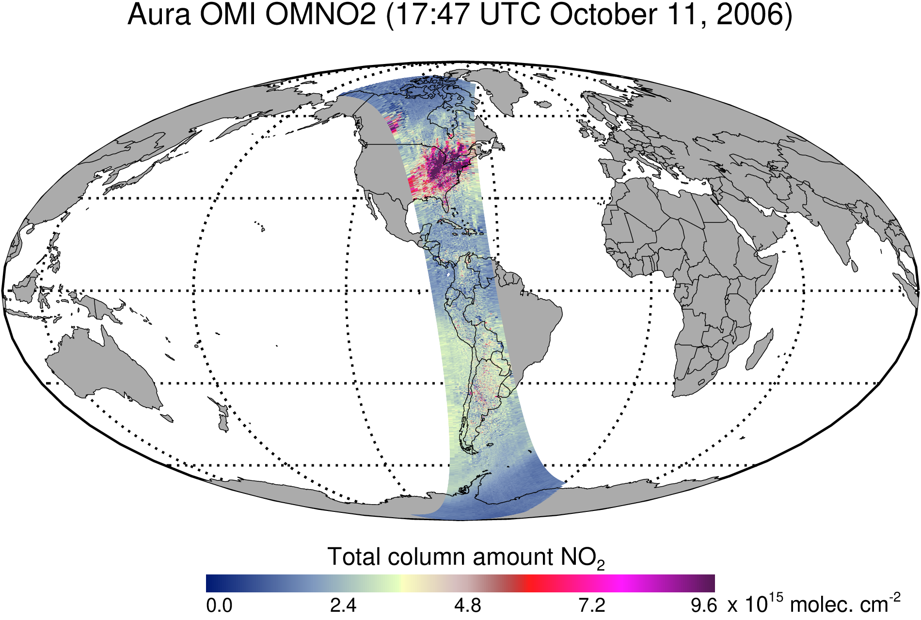
Federal
OMI/Aura Nitrogen Dioxide (NO2) Total and Tropospheric Column 1-orbit L2 Swath 13x24 km V003 (OMNO2) at GES DISC
National Aeronautics and Space Administration —
The Version 4.0 Aura Ozone Monitoring Instrument (OMI) Nitrogen Dioxide (NO2) Standard Product (OMNO2) is now available from the NASA Goddard Earth Sciences Data and... -
Federal
FWS Centroids
Department of the Interior —
This data layer depicts centroid points that have been placed upon the lands and waters administered by the U.S. Fish and Wildlife Service (USFWS) in North America,... -
Federal
AIRS/Aqua L1B Near Real Time (NRT) Infrared (IR) geolocated and calibrated radiances V005 (AIRIBRAD_NRT) at GES DISC
National Aeronautics and Space Administration —
WARNING: On 2021/09/23 the EOS Aqua executed a Deep Space Maneuver (DSM). In the DSM, the spacecraft is turned such that the normal Earth field of regard is deep... -
Federal
Poverty Mapping Project: Small Area Estimates of Poverty and Inequality
National Aeronautics and Space Administration —
The Poverty Mapping Project: Small Area Estimates of Poverty and Inequality data set consists of consumption-based poverty, inequality and related measures for... -
Federal
A national dataset of rasterized building footprints for the U.S.
Department of the Interior —
The Bing Maps team at Microsoft released a U.S.-wide vector building dataset in 2018, which includes over 125 million building footprints for all 50 states in GeoJSON... -
Federal
AIRS/Aqua L1B Infrared (IR) geolocated and calibrated radiances V005 (AIRIBRAD) at GES DISC at GES DISC
National Aeronautics and Space Administration —
WARNING: On 2021/09/23 the EOS Aqua executed a Deep Space Maneuver (DSM). In the DSM, the spacecraft is turned such that the normal Earth field of regard is deep... -
Federal
Jobs within a 30-minute transit ride - Download
U.S. Environmental Protection Agency —
A collection of performance indicators for consistently comparing neighborhoods (census block groups) across the US in regards to their accessibility to jobs or... -
Federal
Data from Decadal Change in Groundwater Quality Web Site, 1988-2021
Department of the Interior —
Evaluating Decadal Changes in Groundwater Quality: Groundwater-quality data were collected from 5,000 wells between 1988-2001 (first decadal sampling event) by the... -
Federal
Geospatial data of watershed characteristics for select U.S. Geological Survey streamgaging stations in New Mexico, Oklahoma, and Texas useful for statistical study of annual peak streamflows in and near Texas
Department of the Interior —
This dataset provides watershed delineations for 1,703 U.S. Geological Survey (USGS) streamgaging stations (gages) for geospatial statistical study of peak... -
Federal
Archive of Census Related Products (ACRP): 1990 ZIP Equivalency Files
National Aeronautics and Space Administration —
The 1990 Zip Equivalency Files portion of the Archive of Census Related Products (ACRP) contains population and housing data derived from the U.S. Census Bureau's... -
Federal
Missouri River bed elevations near Fort Calhoun Power Plant surveyed during 2011 flood on July, 25
Department of the Interior —
A RESON SeaBat™ 7125 multibeam echosounder in conjunction with an Applanix Position Orientation Solution for Marine Vessels (POS MV™) WaveMaster system motion sensor,... -
Federal
Arctic Ecoregional Sea Surface Temperature (SST) shapefile format (shp)
Department of the Interior —
The Sea Surface Temperature (SST) data of the Arctic show temperature ranges in degrees C using points whose locations correspond to the centroids of AVHRR Pathfinder...
113 datasets found for "Centroids"