WindSat/Coriolis surface soil moisture (LPRM) L3 1 day 25 km x 25 km daytime V001 (LPRM_WINDSAT_DY_SOILM3) at GES DISC
Access & Use Information
Downloads & Resources
-
Google Scholar search resultsHTML
Search results for publications that cite this dataset by its DOI.
-
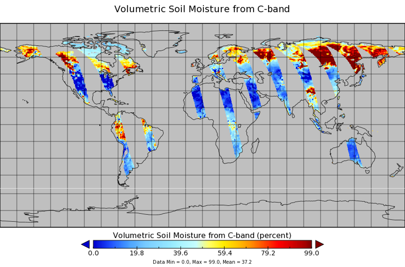
Get a related visualizationPNG
LPRM_WINDSAT_DY_SOILM3_001.png
-
This dataset's landing pageHTML
Access the dataset landing page from the GES DISC website.
-
Download this dataset through a directory mapHTML
Access the data via HTTPS.
-
Download this dataset through Earthdata SearchHTML
Use the Earthdata Search Client to find and retrieve data sets across...
-
Use OPeNDAP to access the dataset's dataHTML
Access the data via the OPeNDAP protocol.
-
View documentation related to this datasetHTML
GES DISC Hydrology Documentation
-
Landing PageLanding Page
References
| https://doi.org/10.1029/2007JF000769 |
| https://doi.org/10.1007/s10712-008-9044-0 |
| https://doi.org/10.1029/2008JD010257 |
| https://doi.org/10.1109/LGRS.2011.2114872 |
| https://doi.org/10.1175/JHM-D-13-0200.1 |
Dates
| Metadata Created Date | November 12, 2020 |
|---|---|
| Metadata Updated Date | December 7, 2023 |
Metadata Source
- Data.json Data.json Metadata
Harvested from NASA Data.json
Graphic Preview

Additional Metadata
| Resource Type | Dataset |
|---|---|
| Metadata Created Date | November 12, 2020 |
| Metadata Updated Date | December 7, 2023 |
| Publisher | NASA/GSFC/SED/ESD/GCDC/GESDISC |
| Maintainer | |
| Identifier | C1488311742-GES_DISC |
| Data First Published | 2012-04-06 |
| Language | en-US |
| Data Last Modified | 2012-04-06 |
| Category | NRL Coriolis, geospatial |
| Public Access Level | public |
| Bureau Code | 026:00 |
| Metadata Context | https://project-open-data.cio.gov/v1.1/schema/catalog.jsonld |
| Metadata Catalog ID | https://data.nasa.gov/data.json |
| Schema Version | https://project-open-data.cio.gov/v1.1/schema |
| Catalog Describedby | https://project-open-data.cio.gov/v1.1/schema/catalog.json |
| Citation | Vrije Universiteit Amsterdam (Richard de Jeu) and NASA GSFC (Manfred Owe). Goddard Earth Sciences Data and Information Services Center (GES DISC) (Bill Teng). 2014-09-15. LPRM_WINDSAT_DY_SOILM3. Version 001. WindSat/Coriolis surface soil moisture (LPRM) L3 1 day 25 km x 25 km daytime V001. Greenbelt, MD, USA. Archived by National Aeronautics and Space Administration, U.S. Government, Goddard Earth Sciences Data and Information Services Center (GES DISC). https://doi.org/10.5067/SZ5L2MRK43S2. https://disc.gsfc.nasa.gov/datacollection/LPRM_WINDSAT_DY_SOILM3_001.html. |
| Creator | Vrije Universiteit Amsterdam (Richard de Jeu) and NASA GSFC (Manfred Owe) |
| Editor | Goddard Earth Sciences Data and Information Services Center (GES DISC) (Bill Teng) |
| Graphic Preview File | https://docserver.gesdisc.eosdis.nasa.gov/public/project/Images/LPRM_WINDSAT_DY_SOILM3_001.png |
| Harvest Object Id | 65b791ea-6c32-4eb8-b8ba-629de1e59835 |
| Harvest Source Id | 58f92550-7a01-4f00-b1b2-8dc953bd598f |
| Harvest Source Title | NASA Data.json |
| Homepage URL | https://doi.org/10.5067/SZ5L2MRK43S2 |
| Metadata Type | geospatial |
| Old Spatial | -180.0 -64.0 180.0 83.0 |
| Program Code | 026:001 |
| Related Documents | https://doi.org/10.1029/2007JF000769, https://doi.org/10.1007/s10712-008-9044-0, https://doi.org/10.1029/2008JD010257, https://doi.org/10.1109/LGRS.2011.2114872, https://doi.org/10.1175/JHM-D-13-0200.1 |
| Release Place | Greenbelt, MD, USA |
| Series Name | LPRM_WINDSAT_DY_SOILM3 |
| Source Datajson Identifier | True |
| Source Hash | a7691c91693d5e650d88b9e91f88575de54c7139c47a3dd524172acdd3e4b5f6 |
| Source Schema Version | 1.1 |
| Spatial | |
| Temporal | 2003-02-01T00:00:00Z/2012-08-01T23:59:59.999Z |
Didn't find what you're looking for? Suggest a dataset here.

