Snow Properties and Wildlife Tracks in Washington and Alaska
Access & Use Information
Downloads & Resources
-
Google Scholar search resultsHTML
Search results for publications that cite this dataset by its DOI.
-
Download this datasetHTML
This link allows direct data access via Earthdata login
-
View documentation related to this datasetHTML
ORNL DAAC Data Set Documentation
-
This dataset's landing pageHTML
Data set Landing Page DOI URL
-
View documentation related to this datasetPDF
Snow Properties and Wildlife Tracks in Washington and Alaska:...
-
Get a related visualizationJPEG
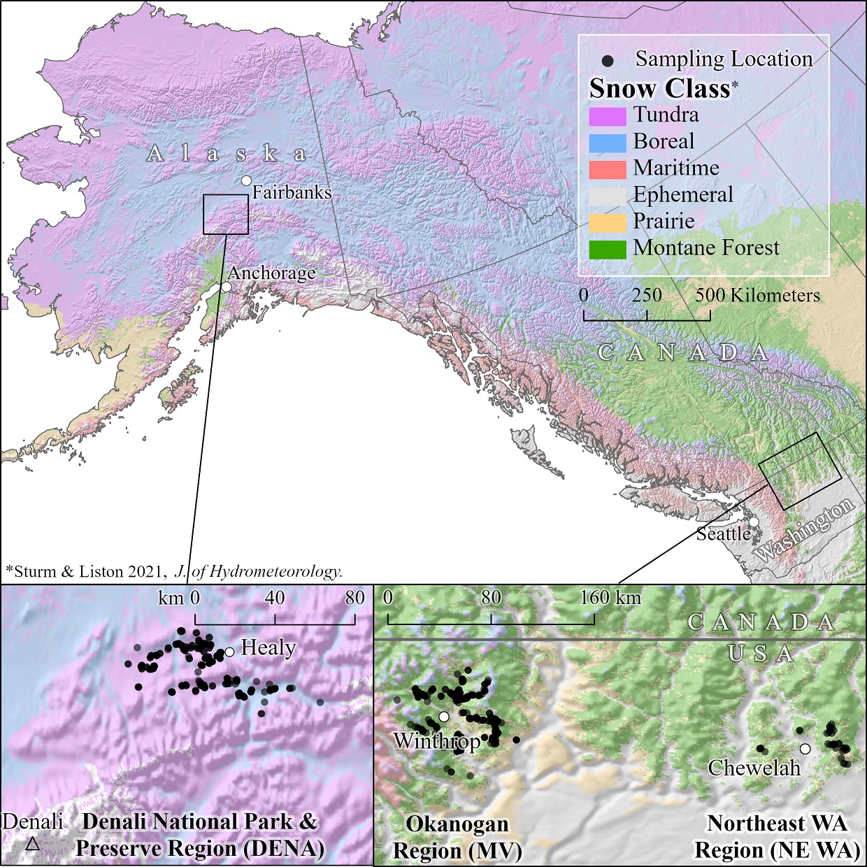
Study areas. The Denali study area in interior Alaska comprises mostly tundra...
-
The dataset's project home pageHTML
ABoVE project site
-
Landing PageLanding Page
Dates
| Metadata Created Date | October 4, 2023 |
|---|---|
| Metadata Updated Date | December 6, 2023 |
Metadata Source
- Data.json Data.json Metadata
Harvested from NASA Data.json
Graphic Preview

Additional Metadata
| Resource Type | Dataset |
|---|---|
| Metadata Created Date | October 4, 2023 |
| Metadata Updated Date | December 6, 2023 |
| Publisher | ORNL_DAAC |
| Maintainer | |
| Identifier | C2772851281-ORNL_CLOUD |
| Data First Published | 2023-09-21 |
| Language | en-US |
| Data Last Modified | 2023-09-26 |
| Category | ABoVE, geospatial |
| Public Access Level | public |
| Bureau Code | 026:00 |
| Metadata Context | https://project-open-data.cio.gov/v1.1/schema/catalog.jsonld |
| Metadata Catalog ID | https://data.nasa.gov/data.json |
| Schema Version | https://project-open-data.cio.gov/v1.1/schema |
| Catalog Describedby | https://project-open-data.cio.gov/v1.1/schema/catalog.json |
| Citation | Sullender, B.K., C.X. Cunningham, J.D. Lundquist, and L.R. Prugh. 2023. Snow Properties and Wildlife Tracks in Washington and Alaska. ORNL DAAC, Oak Ridge, Tennessee, USA. https://doi.org/10.3334/ORNLDAAC/2188 |
| Graphic Preview Description | Study areas. The Denali study area in interior Alaska comprises mostly tundra and boreal snow. The Okanogan study area in Washington is diverse but comprised mostly montane forest. Other Okanogan snow classes are prairie and ephemeral, with some maritime on the western extremes and very limited boreal/tundra at the highest elevations. Northeast Washington contains montane forest, prairie, and ephemeral snow classes. Black points show locations of sampled snow tracks in each study area. |
| Graphic Preview File | https://daac.ornl.gov/ABOVE/guides/Snow_Wildlife_Tracks_AK_WA_Fig1.jpg |
| Harvest Object Id | 3a432c41-ef20-449c-b9fe-182045775f3f |
| Harvest Source Id | 58f92550-7a01-4f00-b1b2-8dc953bd598f |
| Harvest Source Title | NASA Data.json |
| Homepage URL | https://doi.org/10.3334/ORNLDAAC/2188 |
| Metadata Type | geospatial |
| Old Spatial | -150.01 48.05 -117.17 63.97 |
| Program Code | 026:001 |
| Source Datajson Identifier | True |
| Source Hash | 0cbe3aae851daf156e5fa4756b423f34b72cb189df3bee8e5cd5882ab0505fba |
| Source Schema Version | 1.1 |
| Spatial | |
| Temporal | 2021-01-09T00:00:00Z/2023-03-13T23:59:59Z |
Didn't find what you're looking for? Suggest a dataset here.

