

Low Elevation Coastal Zone (LECZ) Urban-Rural Population Estimates, Global Rural-Urban Mapping Project (GRUMP), Alpha Version
Access & Use Information
Public: This dataset is intended for public access and use.
License: No license information was provided. If this work was prepared by an officer or employee of the United States government as part of that person's official duties it is considered a U.S. Government Work.
Downloads & Resources
-
Google Scholar search resultsHTML
Search results for publications that cite this dataset by its DOI.
-
Get a related visualizationJPEG
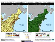
Sample browse graphic of the data set.
-
Download this datasetHTML
Data Download Page
-
Get a related map visualizationHTML
Maps Download Page
-
View documentation related to this datasetHTML
Documentation Page
-
View documentation related to this datasetHTML
Data Set Overview Page
-
Landing PageLanding Page
References
| https://sedac.ciesin.columbia.edu/downloads/docs/lecz/coastal_tiempo.pdf |
| https://doi.org/10.7927/H4MW2F2J |
| https://doi.org/10.7927/H4CC0XMD |
Dates
| Metadata Created Date | November 12, 2020 |
|---|---|
| Metadata Updated Date | December 7, 2023 |
Metadata Source
- Data.json Data.json Metadata
Harvested from NASA Data.json
Graphic Preview
Additional Metadata
| Resource Type | Dataset |
|---|---|
| Metadata Created Date | November 12, 2020 |
| Metadata Updated Date | December 7, 2023 |
| Publisher | SEDAC |
| Maintainer | |
| Identifier | C179002007-SEDAC |
| Data First Published | 2007-12-31 |
| Language | en-US |
| Data Last Modified | 2007-12-31 |
| Category | LECZ, geospatial |
| Public Access Level | public |
| Bureau Code | 026:00 |
| Metadata Context | https://project-open-data.cio.gov/v1.1/schema/catalog.jsonld |
| Metadata Catalog ID | https://data.nasa.gov/data.json |
| Schema Version | https://project-open-data.cio.gov/v1.1/schema |
| Catalog Describedby | https://project-open-data.cio.gov/v1.1/schema/catalog.json |
| Citation | McGranahan, G., D. Balk, and B. Anderson. 2007-12-31. Low Elevation Coastal Zone (LECZ) Urban-Rural Population Estimates, Global Rural-Urban Mapping Project (GRUMP), Alpha Version. Version 1.00. Palisades, NY. Archived by National Aeronautics and Space Administration, U.S. Government, NASA Socioeconomic Data and Applications Center (SEDAC). https://doi.org/10.7927/H4TM782G. https://doi.org/10.7927/H4TM782G. |
| Creator | McGranahan, G., D. Balk, and B. Anderson |
| Graphic Preview Description | Maps Download Page |
| Graphic Preview File | https://sedac.ciesin.columbia.edu/data/set/lecz-urban-rural-population-estimates-v1/maps |
| Harvest Object Id | fe318d6e-e366-42b6-98e5-94ec6556d8b5 |
| Harvest Source Id | 58f92550-7a01-4f00-b1b2-8dc953bd598f |
| Harvest Source Title | NASA Data.json |
| Homepage URL | https://doi.org/10.7927/H4TM782G |
| Metadata Type | geospatial |
| Old Spatial | -180.0 -58.0 180.0 85.0 |
| Program Code | 026:001 |
| Related Documents | https://sedac.ciesin.columbia.edu/downloads/docs/lecz/coastal_tiempo.pdf, https://doi.org/10.7927/H4MW2F2J, https://doi.org/10.7927/H4CC0XMD |
| Release Place | Palisades, NY |
| Source Datajson Identifier | True |
| Source Hash | 01d4f08fcd199c7165ba3e8d10cf7caed0558678aef4d5fb2c70b4f7b766a55c |
| Source Schema Version | 1.1 |
| Spatial | |
| Temporal | 1990-01-01T00:00:00Z/2000-01-01T00:00:00Z |
Didn't find what you're looking for? Suggest a dataset here.