AfriSAR: Polarimetric Height Profiles by TomoSAR, Lope and Rabi Forests, Gabon, 2016
Access & Use Information
Downloads & Resources
-
Google Scholar search resultsHTML
Search results for publications that cite this dataset by its DOI.
-
Download this datasetHTML
This link allows direct data access via Earthdata login
-
View documentation related to this datasetHTML
ORNL DAAC Data Set Documentation
-
This dataset's landing pageHTML
Data set Landing Page DOI URL
-
Use OPeNDAP to access the dataset's dataHTML
USE SERVICE API
-
View documentation related to this datasetKML
AfriSAR: Polarimetric Height Profiles by TomoSAR, Lope and Rabi Forests,...
-
View documentation related to this datasetPDF
AfriSAR: Polarimetric Height Profile via SAR Tomography, Lope and Rabi,...
-
View documentation related to this datasetKML
AfriSAR: Polarimetric Height Profiles by TomoSAR, Lope and Rabi Forests,...
-
Get a related visualizationPNG
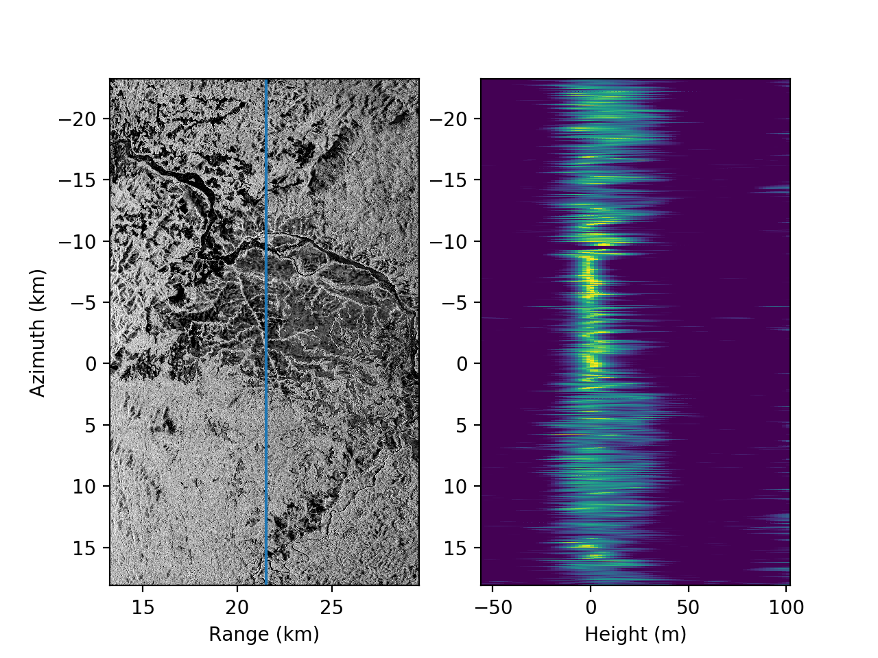
Tomographic image of Lope National Park focused to z=0 (left) and the height...
-
View documentation related to this datasetHTML
The THREDDS location for this Collection.
-
Landing PageLanding Page
Dates
| Metadata Created Date | July 27, 2023 |
|---|---|
| Metadata Updated Date | December 6, 2023 |
Metadata Source
- Data.json Data.json Metadata
Harvested from NASA Data.json
Graphic Preview

Additional Metadata
| Resource Type | Dataset |
|---|---|
| Metadata Created Date | July 27, 2023 |
| Metadata Updated Date | December 6, 2023 |
| Publisher | ORNL_DAAC |
| Maintainer | |
| Identifier | C2734257089-ORNL_CLOUD |
| Data First Published | 2018-12-19 |
| Language | en-US |
| Data Last Modified | 2023-07-18 |
| Category | AfriSAR, geospatial |
| Public Access Level | public |
| Bureau Code | 026:00 |
| Metadata Context | https://project-open-data.cio.gov/v1.1/schema/catalog.jsonld |
| Metadata Catalog ID | https://data.nasa.gov/data.json |
| Schema Version | https://project-open-data.cio.gov/v1.1/schema |
| Catalog Describedby | https://project-open-data.cio.gov/v1.1/schema/catalog.json |
| Citation | Hawkins, B.P., N. Pinto, M. Lavalle, and S. Hensley. 2018. AfriSAR: Polarimetric Height Profiles by TomoSAR, Lope and Rabi Forests, Gabon, 2016. ORNL DAAC, Oak Ridge, Tennessee, USA. https://doi.org/10.3334/ORNLDAAC/1577 |
| Graphic Preview Description | Tomographic image of Lope National Park focused to z=0 (left) and the height profile (right) for the slice marked by the blue line. Note the contrast between dark areas dominated by surface scattering and the bright areas with scattering through the forest canopy. |
| Graphic Preview File | https://daac.ornl.gov/AFRISAR/guides/Polarimetric_height_profile_Fig1.png |
| Harvest Object Id | 3868c120-1604-4c96-af0d-a553bd59ae31 |
| Harvest Source Id | 58f92550-7a01-4f00-b1b2-8dc953bd598f |
| Harvest Source Title | NASA Data.json |
| Homepage URL | https://doi.org/10.3334/ORNLDAAC/1577 |
| Metadata Type | geospatial |
| Old Spatial | 9.67 -2.08 11.86 0.1 |
| Program Code | 026:001 |
| Source Datajson Identifier | True |
| Source Hash | 97b9cda47f5a2001e21bc69e902b0536608de7edbf14cb5c53b181fdefc3741d |
| Source Schema Version | 1.1 |
| Spatial | |
| Temporal | 2016-02-25T00:00:00Z/2016-02-28T23:59:59Z |
Didn't find what you're looking for? Suggest a dataset here.

