

9 datasets found for "Coal"
-
Federal
BLM CO RGFO AECRMP Coal Available Underground 20240108
Department of the Interior —
This layer originated from the Coal Unsuitability Analysis. The original dataset contained areas available for underground coal leasing in Alternatives B, C, and D.... -
Federal
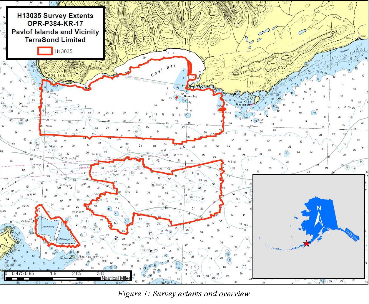
H13035: NOS Hydrographic Survey , Pavlof Islands and Vicinity, 2017-09-26
National Oceanic and Atmospheric Administration, Department of Commerce —
The National Oceanic and Atmospheric Administration (NOAA) has the statutory mandate to collect hydrographic data in support of nautical chart compilation for safe... -
Federal
H11518: NOS Hydrographic Survey , Southwestern Alaskan Peninsula, Alaska, 2006-06-16
National Oceanic and Atmospheric Administration, Department of Commerce —
The National Oceanic and Atmospheric Administration (NOAA) has the statutory mandate to collect hydrographic data in support of nautical chart compilation for safe... -
Federal
Roadless Areas: Colorado Roadless Rule (Feature Layer)
Department of Agriculture —
This feature class describes the boundaries of Roadless Areas designated by the Colorado Roadless Rule of 2012 and managed by the US Forest Service. These roadless... -
Federal
BLM CO Big Game Corridor Decision Area
Department of the Interior —
The decision area includes all BLM public lands (including BLM Bankhead Jones Lands) and split-estate private, local government, and state lands (excluding lands with... -
Federal
BLM Colorado Federal Mineral Estate
Department of the Interior —
This data set is a result of compiling differing source materials of various vintages.Source material examples used to create and maintain dataset include: BLM 100k... -
Federal
BLM Natl MLRS Coal Cases
Department of the Interior —
This dataset contains coal cases derived from Legal Land Descriptions (LLD) contained in the US Bureau of Land Management's, BLM, Mineral and Land Record System(MLRS)... -
Federal
H11950: NOS Hydrographic Survey , California Coastal Mapping Program, California, 2008-09-02
National Oceanic and Atmospheric Administration, Department of Commerce —
The National Oceanic and Atmospheric Administration (NOAA) has the statutory mandate to collect hydrographic data in support of nautical chart compilation for safe... -
University
Coal Mine Permit Boundaries
Earth Data Analysis Center, University of New Mexico —
ESRI ArcView shapefile depicting New Mexico coal mines permitted under the Surface Mining Control and Reclamation Act of 1977 (SMCRA), by either the NM Mining &...
9 datasets found for "Coal"