
-
Federal
GRIP HURRICANE IMAGING RADIOMETER (HIRAD) V1
National Aeronautics and Space Administration —
The GRIP Hurricane Imaging Radiometer (HIRAD) V1 dataset contains measurements of brightness temperature taken at 4, 5, 6 and 6.6 GHz, as well as MERRA 2 m wind speed... -
Federal
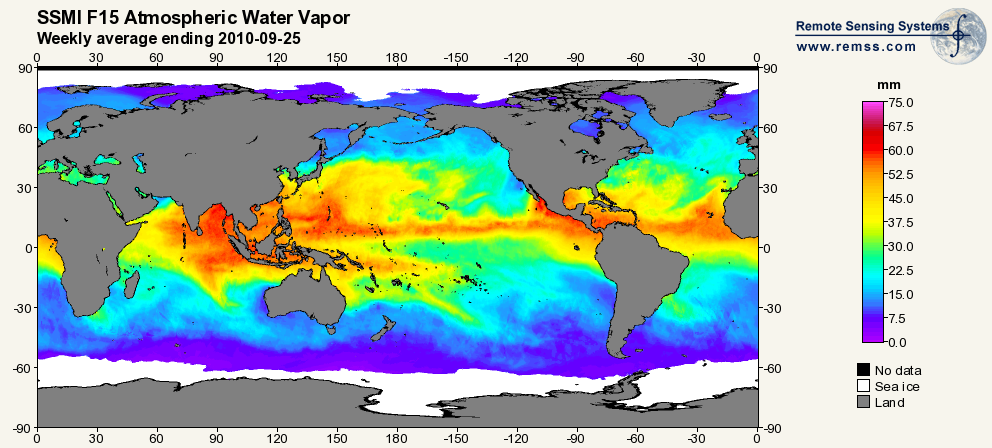
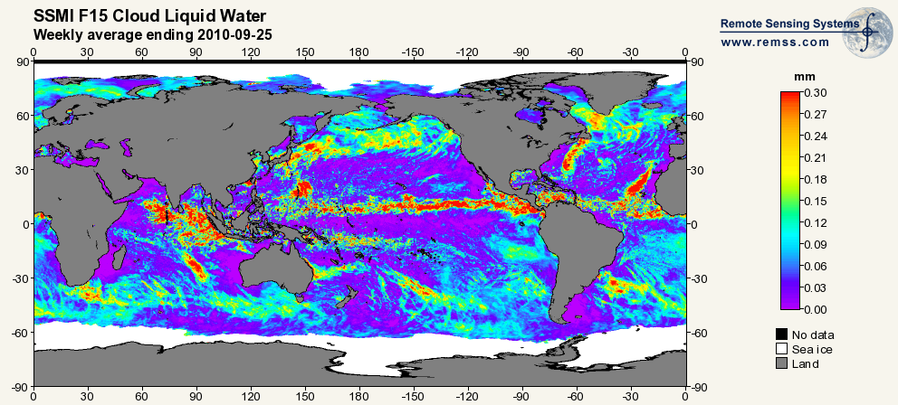
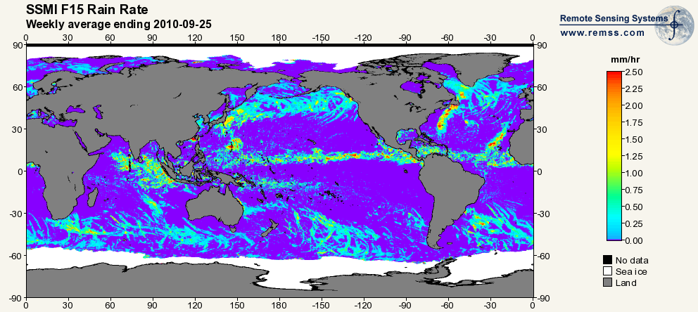
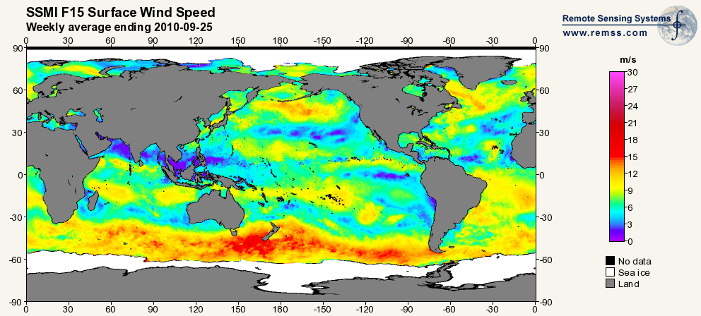
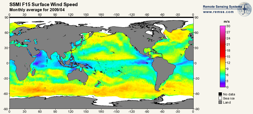
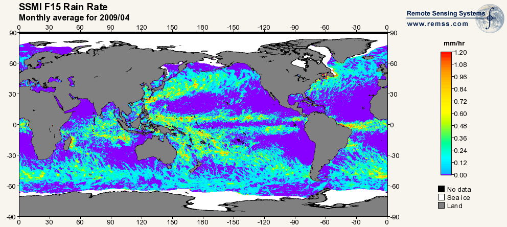
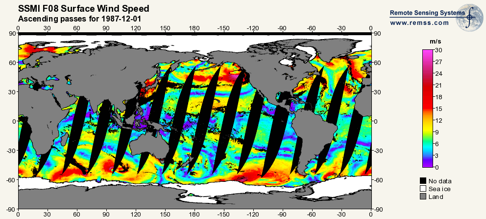
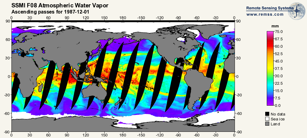
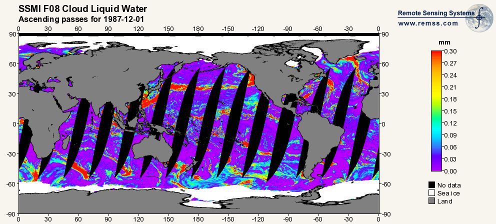
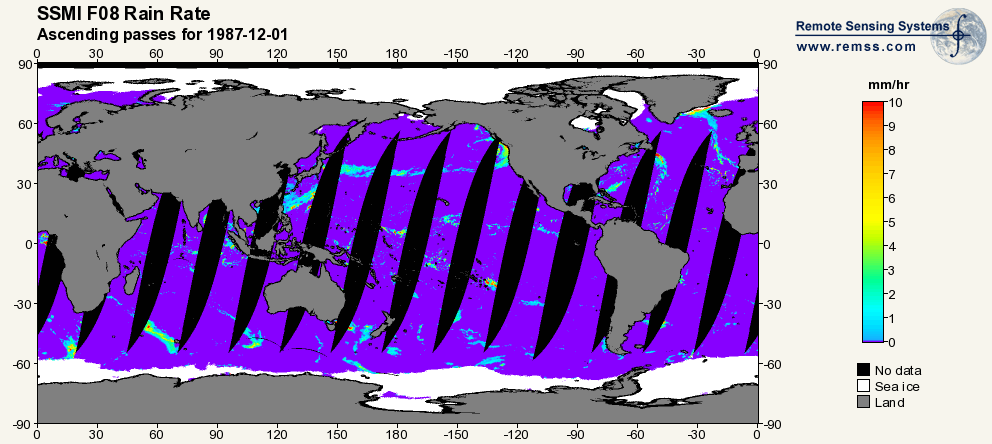
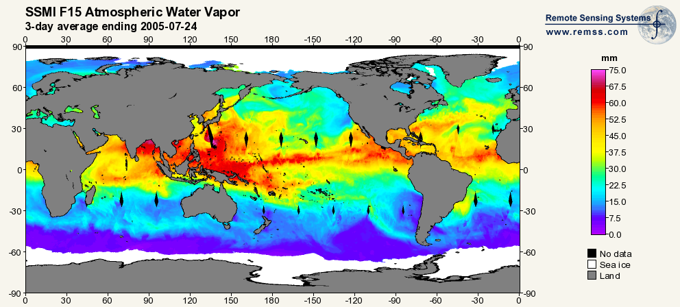
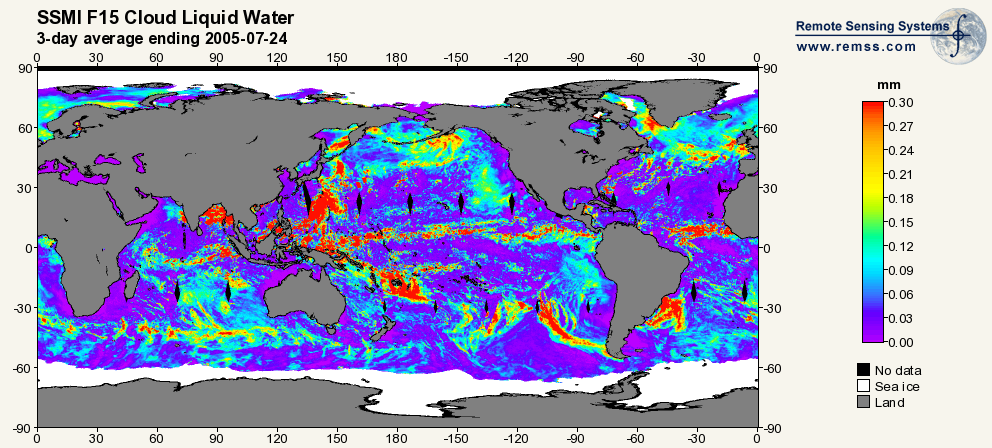
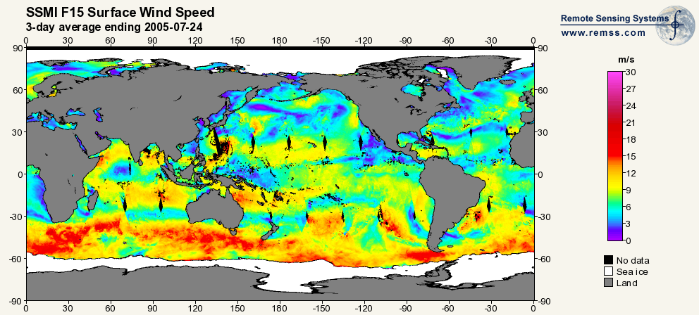
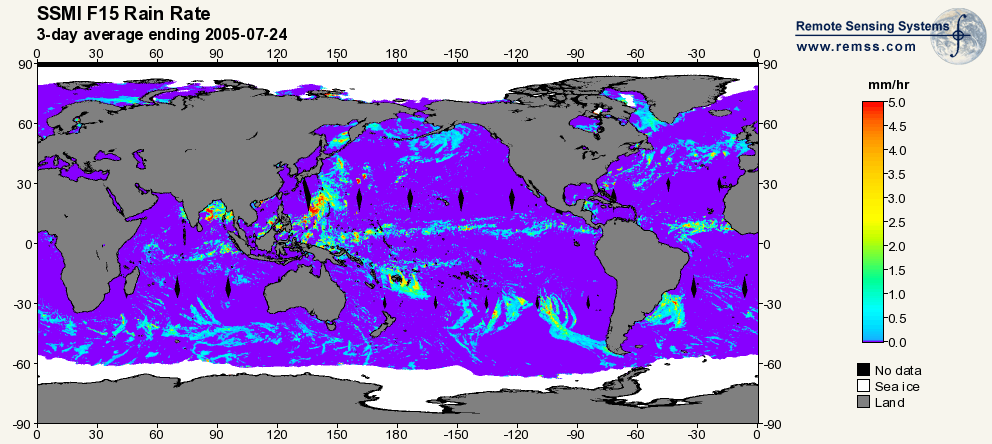
RSS SSM/I OCEAN PRODUCT GRIDS WEEKLY AVERAGE FROM DMSP F15 NETCDF V7
National Aeronautics and Space Administration —
The RSS SSM/I Ocean Product Grids Weekly Average from DMSP F15 netCDF dataset is part of the collection of Special Sensor Microwave/Imager (SSM/I) and Special Sensor... -
Federal
REGIONAL AIR-SEA INTERACTION (RASI) GAP WIND AND COASTAL UPWELLING EVENTS CLIMATOLOGY GULF OF TEHUANTEPEC, MEXICO V1
National Aeronautics and Space Administration —
The Regional Air-Sea Interactions (RASI) Gap Wind and Coastal Upwelling Events Climatology Gulf of Tehuantepec, Mexico dataset was created using an automated... -
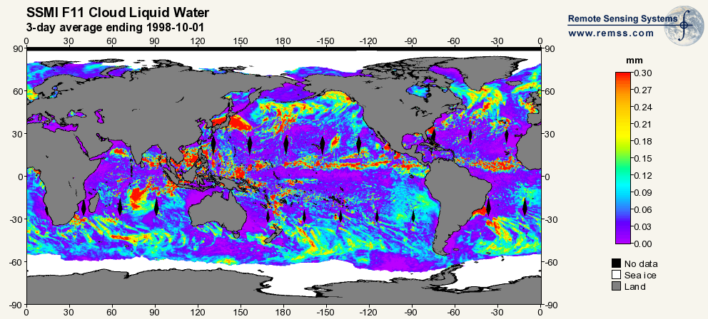
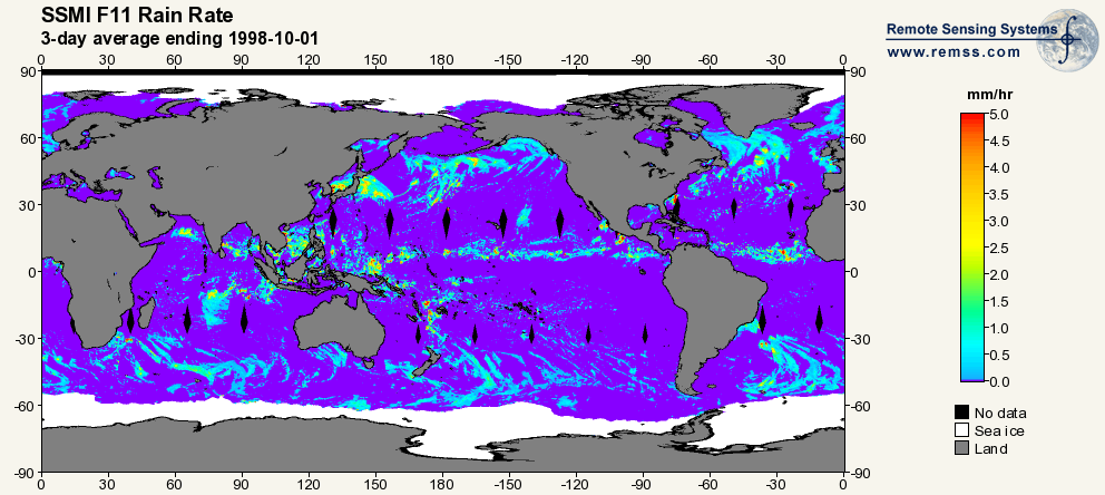
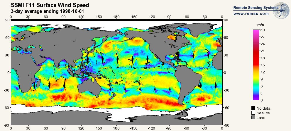
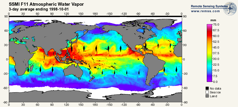
Federal
RSS SSM/I OCEAN PRODUCT GRIDS 3-DAY AVERAGE FROM DMSP F11 NETCDF V7
National Aeronautics and Space Administration —
The RSS SSM/I Ocean Product Grids 3-Day Average from DMSP F11 netCDF dataset is part of the collection of Special Sensor Microwave/Imager (SSM/I) and Special Sensor... -
Federal
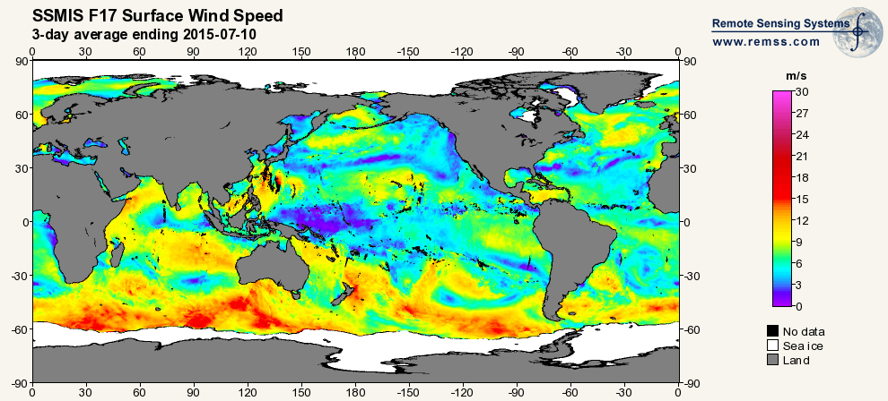
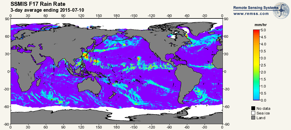
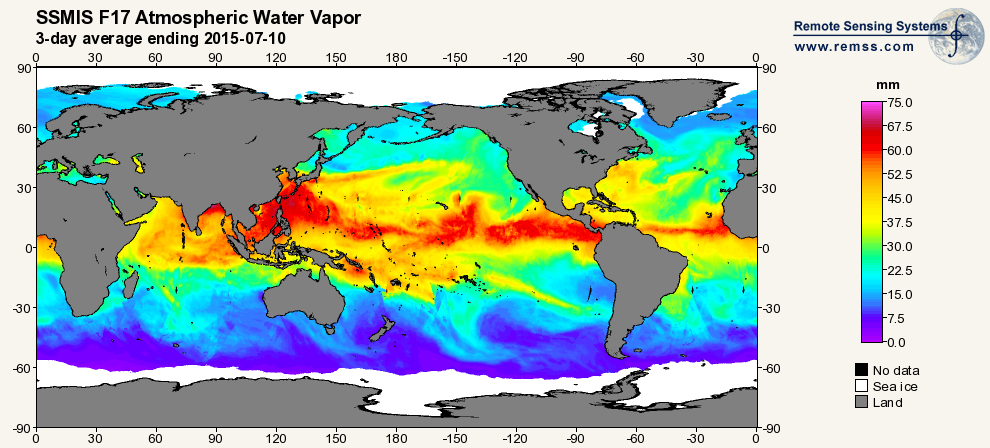
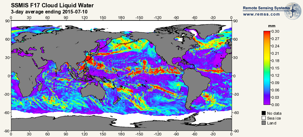
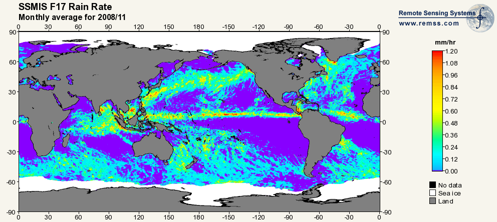
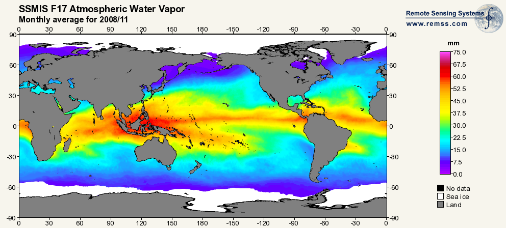
RSS SSMIS OCEAN PRODUCT GRIDS 3-DAY AVERAGE FROM DMSP F17 NETCDF V7
National Aeronautics and Space Administration —
The RSS SSMIS Ocean Product Grids 3-Day Average from DMSP F17 netCDF dataset is part of the collection of Special Sensor Microwave/Imager (SSM/I) and Special Sensor... -
Federal
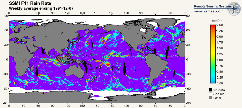
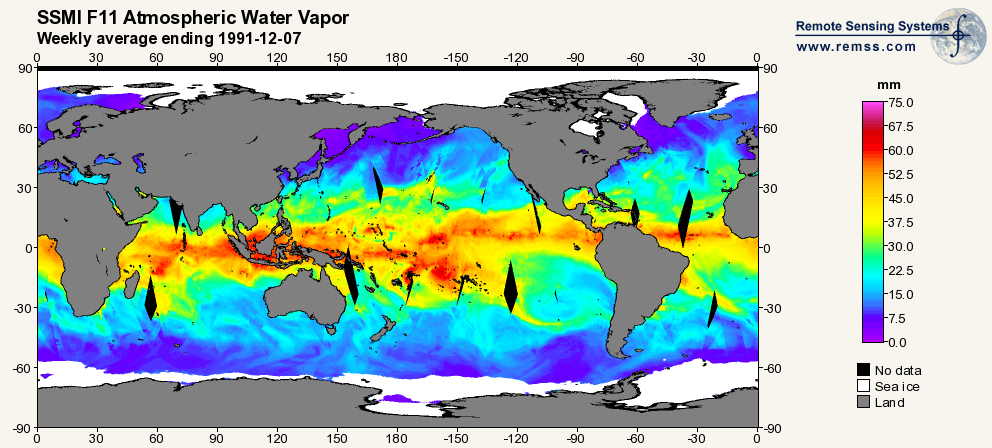
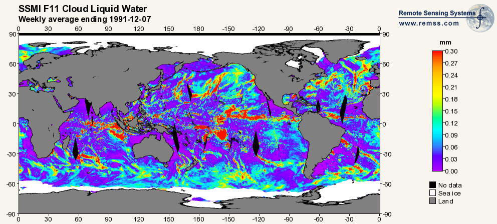
RSS SSM/I OCEAN PRODUCT GRIDS WEEKLY AVERAGE FROM DMSP F11 NETCDF V7
National Aeronautics and Space Administration —
The RSS SSM/I Ocean Product Grids Weekly Average from DMSP F11 netCDF dataset is part of the collection of Special Sensor Microwave/Imager (SSM/I) and Special Sensor... -
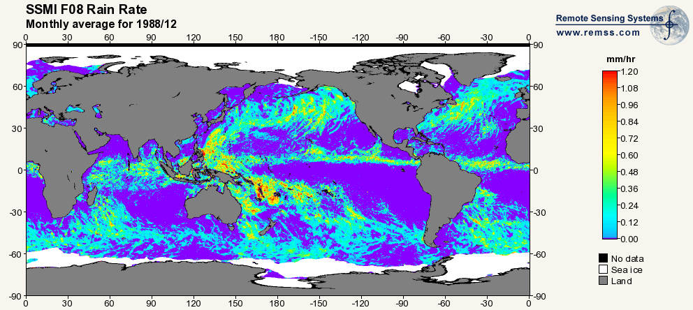
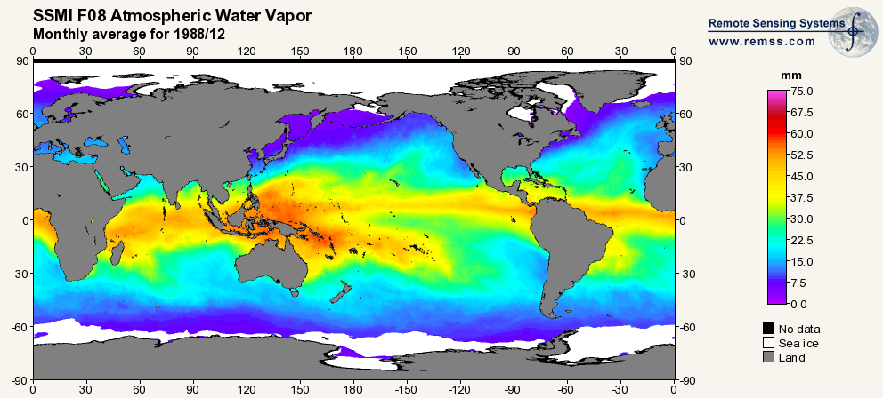
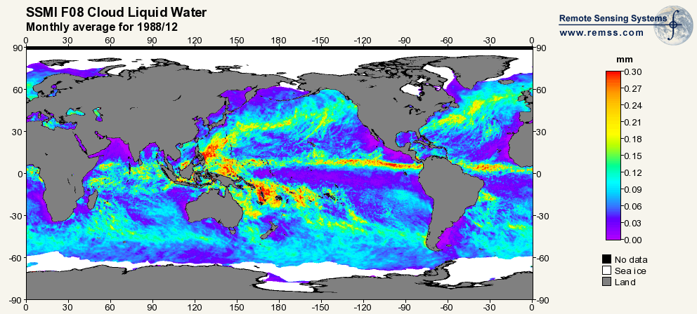
Federal
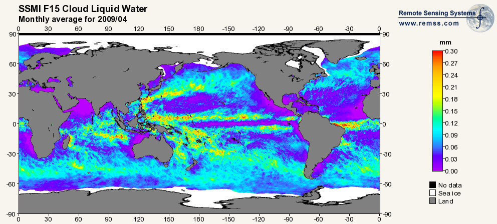
RSS SSM/I OCEAN PRODUCT GRIDS MONTHLY AVERAGE FROM DMSP F15 NETCDF V7
National Aeronautics and Space Administration —
The RSS SSM/I Ocean Product Grids Monthly Average from DMSP F15 netCDF dataset is part of the collection of Special Sensor Microwave/Imager (SSM/I) and Special Sensor... -
Federal
SEDIMENT ANALYSIS NETWORK FOR DECISION SUPPORT (SANDS) LANDSAT GEOTIFF V1
National Aeronautics and Space Administration —
The Sediment Analysis Network for Decision Support (SANDS) Landsat Geotiff dataset includes images for sediment redistribution after a hurricane on the coast of the... -
Federal
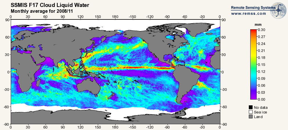
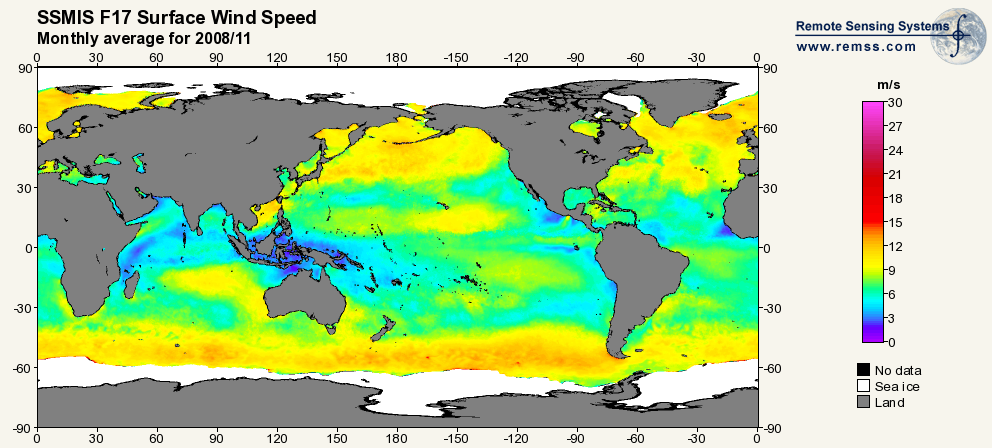
RSS SSMIS OCEAN PRODUCT GRIDS MONTHLY AVERAGE FROM DMSP F17 NETCDF V7
National Aeronautics and Space Administration —
The RSS SSMIS Ocean Product Grids Monthly Average from DMSP F17 netCDF dataset is part of the collection of Special Sensor Microwave/Imager (SSM/I) and Special Sensor... -
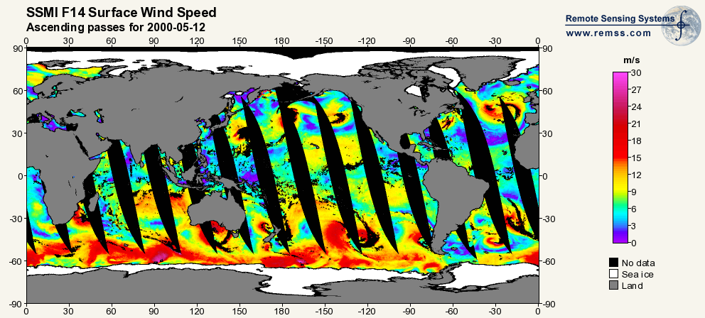
Federal
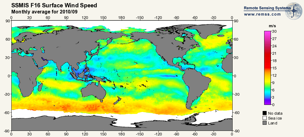
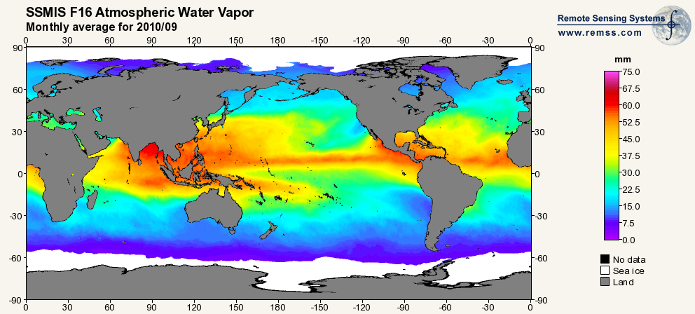
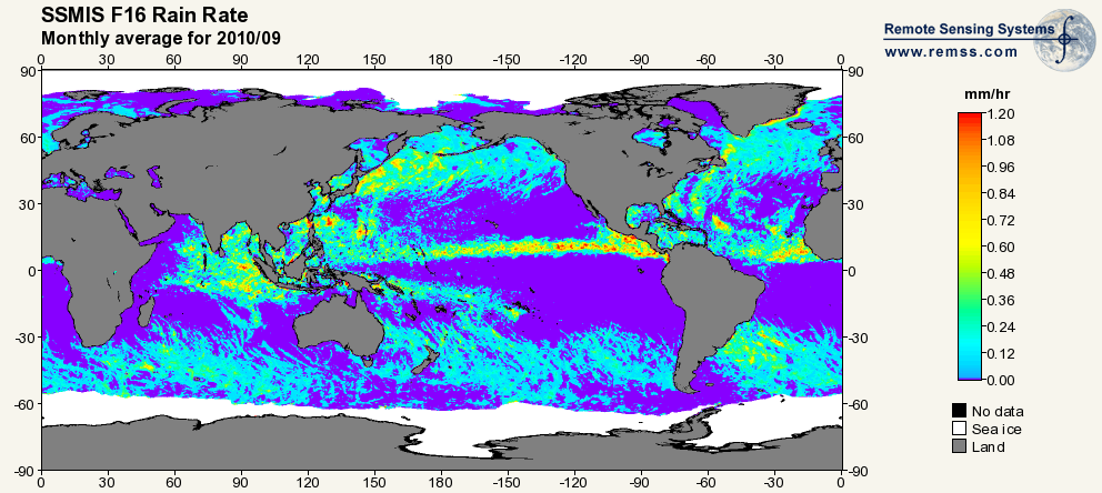
RSS SSMIS OCEAN PRODUCT GRIDS MONTHLY AVERAGE FROM DMSP F16 NETCDF V7
National Aeronautics and Space Administration —
The RSS SSMIS Ocean Product Grids Monthly Average from DMSP F16 netCDF dataset is part of the collection of Special Sensor Microwave/Imager (SSM/I) and Special Sensor... -
Federal
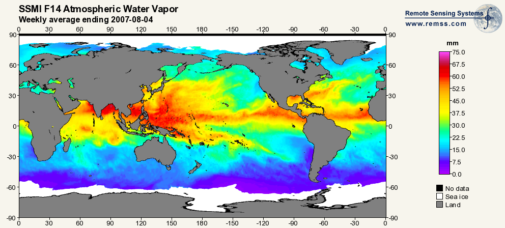
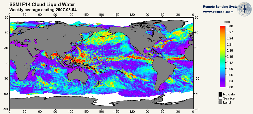
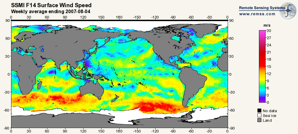
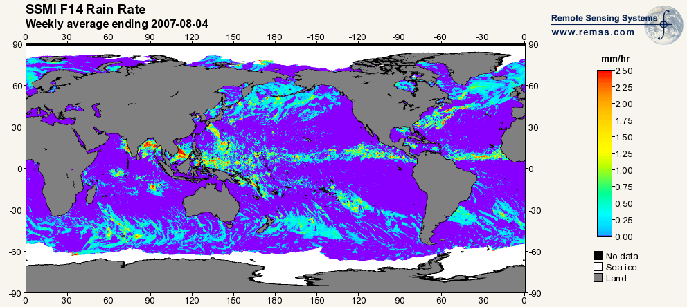
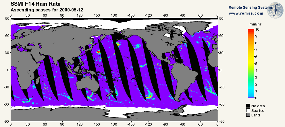
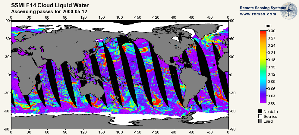
RSS SSM/I OCEAN PRODUCT GRIDS WEEKLY AVERAGE FROM DMSP F14 NETCDF V7
National Aeronautics and Space Administration —
The RSS SSM/I Ocean Product Grids Weekly Average from DMSP F14 netCDF dataset is part of the collection of Special Sensor Microwave/Imager (SSM/I) and Special Sensor... -
Federal
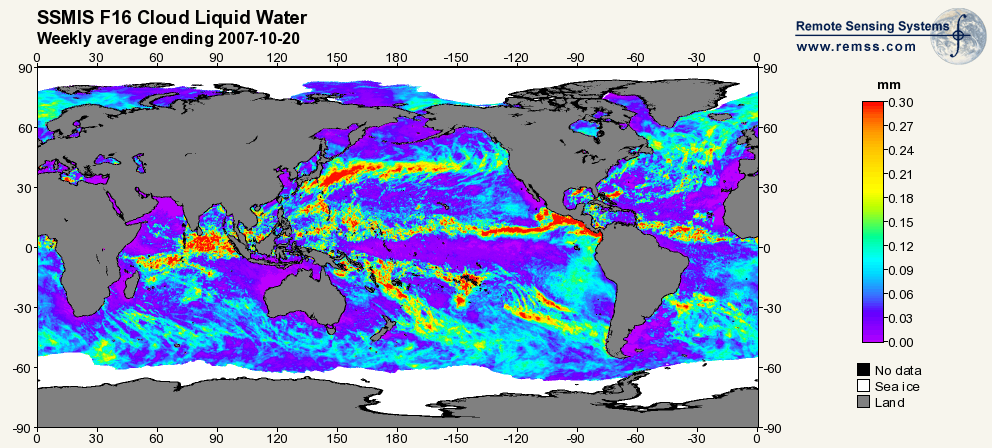
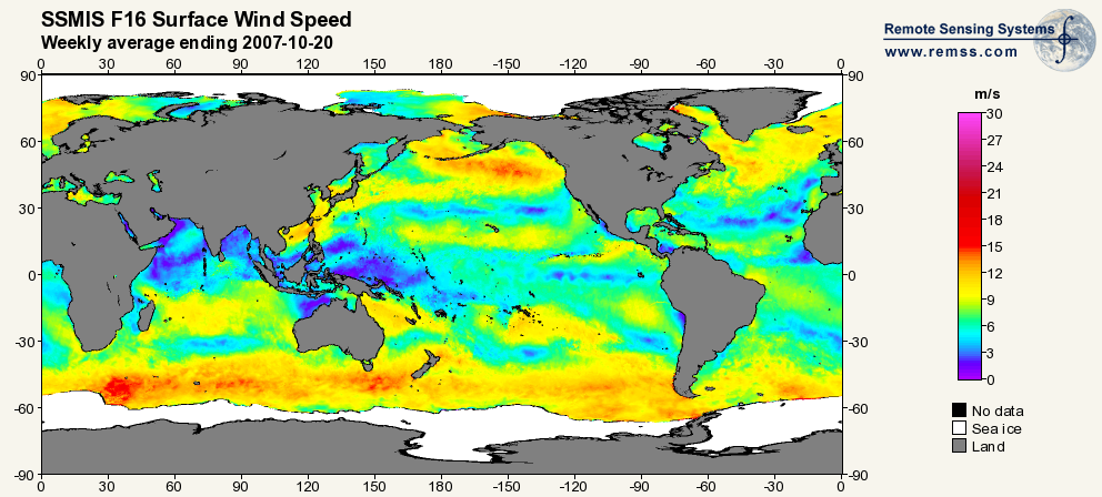
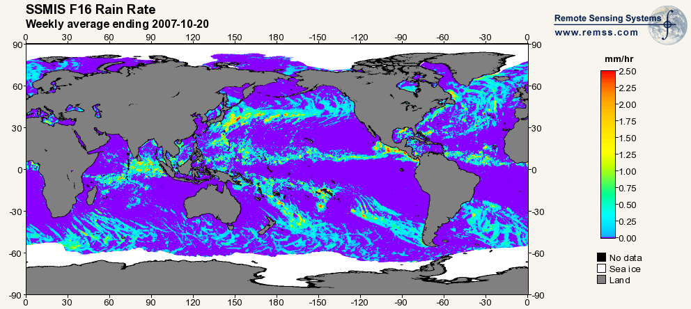
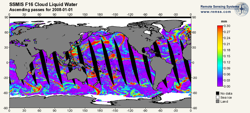
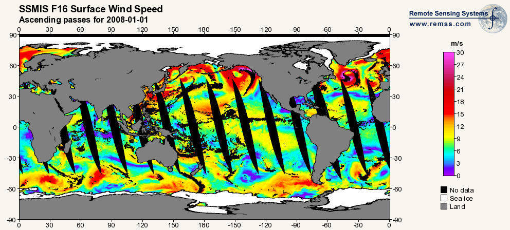
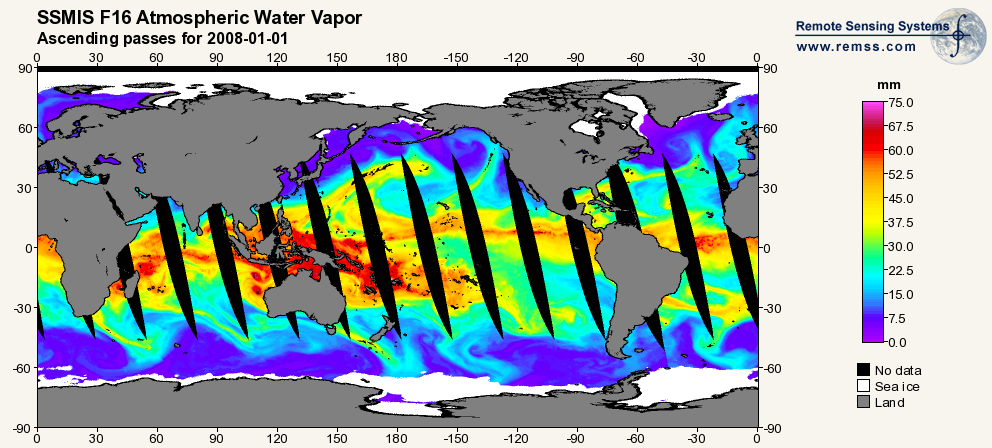
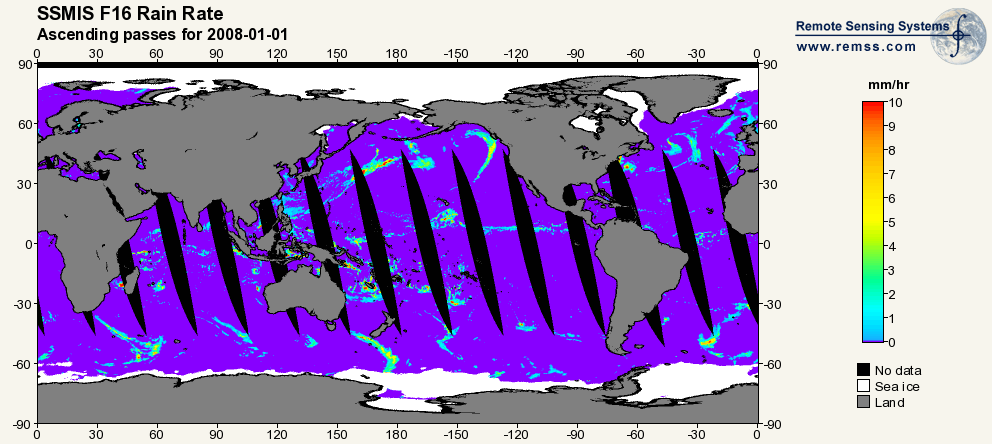
RSS SSMIS OCEAN PRODUCT GRIDS WEEKLY AVERAGE FROM DMSP F16 NETCDF V7
National Aeronautics and Space Administration —
The RSS SSMIS Ocean Product Grids Weekly Average from DMSP F16 netCDF dataset is part of the collection of Special Sensor Microwave/Imager (SSM/I) and Special Sensor... -
Federal
RSS SSM/I OCEAN PRODUCT GRIDS DAILY FROM DMSP F8 NETCDF V7
National Aeronautics and Space Administration —
The RSS SSM/I Ocean Product Grids Daily from DMSP F8 netCDF dataset is part of the collection of Special Sensor Microwave/Imager (SSM/I) and Special Sensor Microwave... -
Federal
RSS SSM/I OCEAN PRODUCT GRIDS MONTHLY AVERAGE FROM DMSP F8 NETCDF V7
National Aeronautics and Space Administration —
The RSS SSM/I Ocean Product Grids Monthly Average from DMSP F8 netCDF dataset is part of the collection of Special Sensor Microwave/Imager (SSM/I) and Special Sensor... -
Federal
RSS SSM/I OCEAN PRODUCT GRIDS DAILY FROM DMSP F14 NETCDF V7
National Aeronautics and Space Administration —
The RSS SSM/I Ocean Product Grids Daily from DMSP F14 netCDF dataset is part of the collection of Special Sensor Microwave/Imager (SSM/I) and Special Sensor Microwave... -
Federal
RSS SSM/I OCEAN PRODUCT GRIDS 3-DAY AVERAGE FROM DMSP F15 NETCDF V7
National Aeronautics and Space Administration —
The RSS SSM/I Ocean Product Grids 3-Day Average from DMSP F15 netCDF dataset is part of the collection of Special Sensor Microwave/Imager (SSM/I) and Special Sensor... -
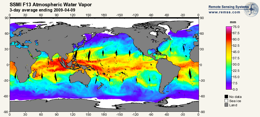
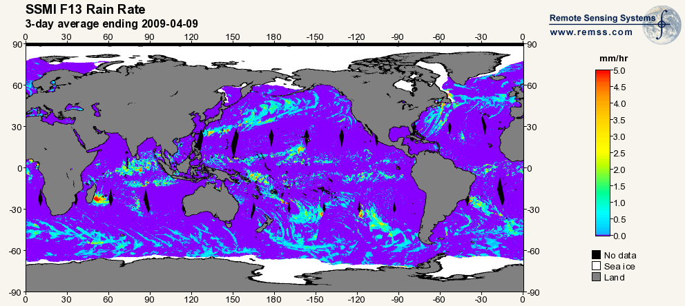
Federal
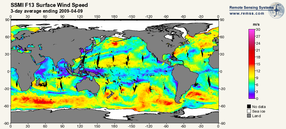
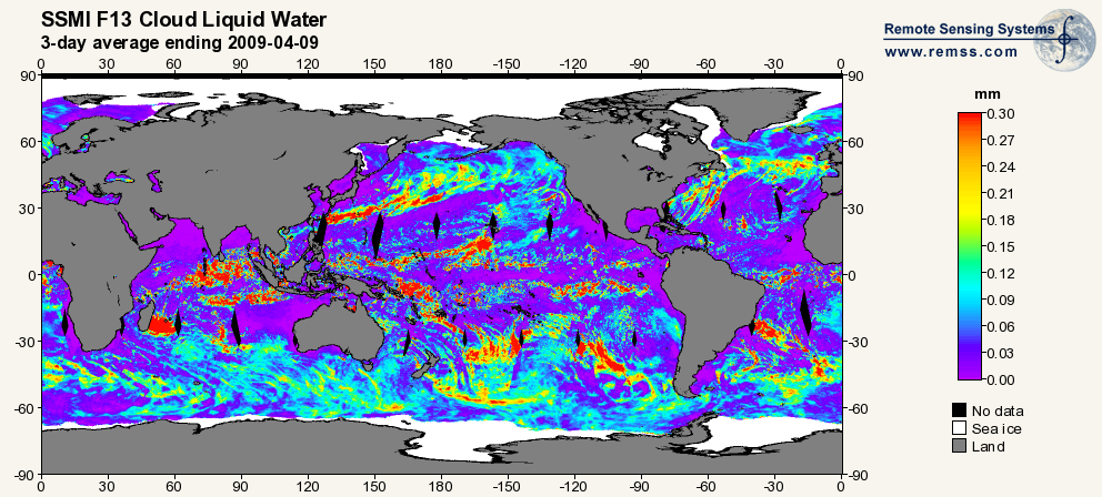
RSS SSM/I OCEAN PRODUCT GRIDS 3-DAY AVERAGE FROM DMSP F13 NETCDF V7
National Aeronautics and Space Administration —
The RSS SSM/I Ocean Product Grids 3-Day Average from DMSP F13 netCDF dataset is part of the collection of Special Sensor Microwave/Imager (SSM/I) and Special Sensor... -
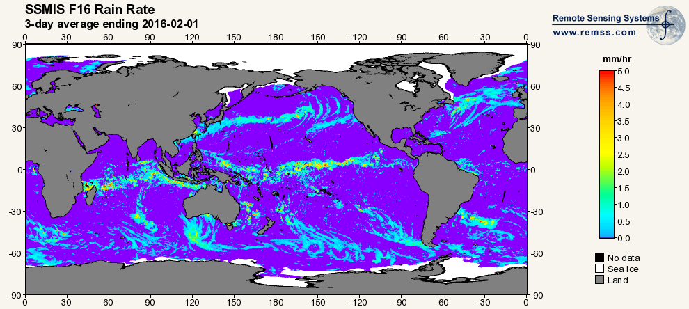
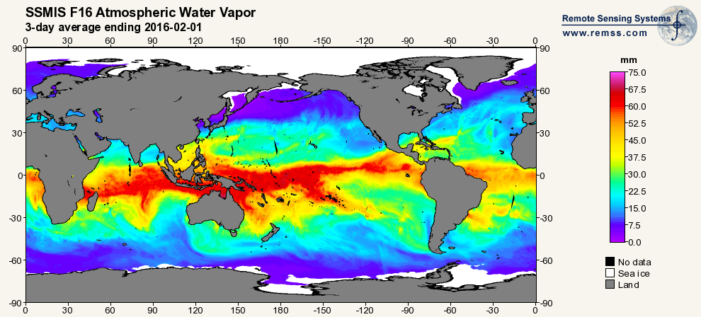
Federal
RSS SSMIS OCEAN PRODUCT GRIDS 3-DAY AVERAGE FROM DMSP F16 NETCDF V7
National Aeronautics and Space Administration —
The RSS SSMIS Ocean Product Grids 3-Day Average from DMSP F16 netCDF dataset is part of the collection of Special Sensor Microwave/Imager (SSM/I) and Special Sensor... -
Federal
TRMM MICROWAVE IMAGER (TMI) WENTZ OCEAN PRODUCTS V3
National Aeronautics and Space Administration —
The TRMM Microwave Imager (TMI) Wentz Ocean Products dataset used the TRMM Microwave Imager (TMI), which is a 5-channel, dual-polarized, passive microwave radiometer.... -
Federal
RSS SSMIS OCEAN PRODUCT GRIDS DAILY FROM DMSP F16 NETCDF V7
National Aeronautics and Space Administration —
The RSS SSMIS Ocean Product Grids Daily from DMSP F16 netCDF dataset is part of the collection of Special Sensor Microwave/Imager (SSM/I) and Special Sensor Microwave...

Official websites use .gov
A
.gov website belongs to an official government
organization in the United States.
Secure .gov websites use HTTPS
A
lock (
) or https:// means you’ve safely connected to
the .gov website. Share sensitive information only on official,
secure websites.