
-
Federal
Probabilistic Freeze-Thaw Record for the Northern Hemisphere, 2016-2020
National Aeronautics and Space Administration —
This dataset provides a probabilistic freeze/thaw (FT) data record from 2016 to 2020 for the Northern Hemisphere derived using a deep learning model (U-Net). The... -
Federal
BOREAS Follow-On DSP-10 Regridded Land Cover Maps for 1994
National Aeronautics and Space Administration —
These images were produced by aggregating the 1-km land cover classification by Lou Steyaert at multiple resolutions (2 km, 10x5 minutes, and 0.5 degree). These data... -
Federal
Integrated Biosphere Simulator Model (IBIS), Version 2.5
National Aeronautics and Space Administration —
The Integrated Biosphere Simulator (or IBIS) is designed to be a comprehensive model of the terrestrial biosphere. Tthe model represents a wide range of processes,... -
Federal
Land Surface Model (LSM 1.0) for Ecological, Hydrological, Atmospheric Studies
National Aeronautics and Space Administration —
The NCAR LSM 1.0 is a land surface model developed to examine biogeophysical and biogeochemical land-atmosphere interactions, especially the effects of land surfaces... -
Federal
PnET-BGC: Modeling Biogeochemical Processes in a Northern Hardwood Forest Ecosystem
National Aeronautics and Space Administration —
This archived model product contains the directions, executables, and procedures for running PnET-BGC to recreate the results of: Gbondo-Tugbawa, S.S., C.T. Driscoll... -
Federal
BOREAS Follow-On HMet-03 Hourly Meteorological Data at Flux Towers, 1994-1996
National Aeronautics and Space Administration —
Point data developed from in situ observations at four flux tower sites were combined to produce continuous, above the canopy, meteorological forcing data sets.... -
Federal
BOREAS Follow-On FLX-03 Area-Averaged Flux Data for the NSA and SSA
National Aeronautics and Space Administration —
Calculations of area-averaged fluxes using extracted flux data from BORIS. -
Federal
Aircraft Flux-Detrended: Univ. Col. (FIFE)
National Aeronautics and Space Administration —
Detrended boundary layer fluxes recorded on aircraft flights over the Konza -
Federal
BlueFlux: Dissolved Carbon and Greenhouse Gases
National Aeronautics and Space Administration —
This dataset provides dissolved carbon (dissolved inorganic carbon and dissolved organic carbon), greenhouse gases, dissolved organic matter optical, and hydrological... -
Federal
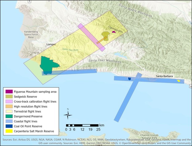
SHIFT: Vegetation Plot Photos, Santa Barbara, CA, USA, 2022
National Aeronautics and Space Administration —
This dataset contains photographs of the plots where field vegetation sampling was conducted during the 2022 NASA Surface Biology Geology (SBG) High Frequency Time... -
Federal
BOREAS Follow-On DSP-06 CASI LAI and Canopy Closure of Conifer Flux Tower Sites
National Aeronautics and Space Administration —
The LAI and canopy closure images over the BOREAS conifer flux tower sites were produced at a spatial resolution of 30 m using the Forest-Light Interaction Model. The... -
Federal
BOREAS Follow-On DSP-10 Regridded TM Mosaic Land Cover Maps for 1994
National Aeronautics and Space Administration —
Existing 30-m land cover Thematic Mapper classification by CCRS was aggregated and reprocessed and are now available at multiple resolutions (10x5 minutes and 30... -
Federal
Biome-BGC: Terrestrial Ecosystem Process Model, Version 4.1.1
National Aeronautics and Space Administration —
Biome-BGC is a computer program that estimates fluxes and storage of energy, water, carbon, and nitrogen for the vegetation and soil components of terrestrial... -
Federal
BOREAS Follow-On DSP-05 Process-Modeled Net Primary Productivity
National Aeronautics and Space Administration —
The BOREAS DSP-5 team generated a NPP image over the BOREAS region from a process-based ecosystem model, the Boreal Ecosystem Productivity Simulator (BEPS). The NPP... -
Federal
Aircraft Flux-Raw: U of Wy. (FIFE)
National Aeronautics and Space Administration —
Raw (unmodified) boundary layer fluxes recorded on aircraft flights over Konza -
Federal
SHIFT: Vegetation Plot Characterization, Santa Barbara County, CA, 2022
National Aeronautics and Space Administration —
This dataset contains vegetation plot locations, descriptions, fractional cover, and sample identifier information from surveys conducted as part of the 2022 NASA... -
Federal
SHIFT: Laboratory Foliar Chemical Analysis Results for Field Samples, CA, 2022
National Aeronautics and Space Administration —
This dataset holds laboratory foliar chemical analyses results for field samples collected during the 2022 NASA Surface Biology Geology (SBG) High Frequency Time... -
Federal
Probabilistic Freeze-Thaw Record for the Northern Hemisphere, 2016-2020
National Aeronautics and Space Administration —
This dataset provides a probabilistic freeze/thaw (FT) data record from 2016 to 2020 for the Northern Hemisphere derived using a deep learning model (U-Net). The... -
Federal
Simulated Fine Particulate Matter (PM2.5) Estimates over Alaska, 2001-2015
National Aeronautics and Space Administration —
The dataset provides simulated PM2.5 concentration estimates over Alaska, U.S. PM2.5 (particulate matter with diameter <= 2.5 microns) concentrations in air...

Official websites use .gov
A
.gov website belongs to an official government
organization in the United States.
Secure .gov websites use HTTPS
A
lock (
) or https:// means you’ve safely connected to
the .gov website. Share sensitive information only on official,
secure websites.