
-
Federal
NACP North American Forest Dynamics Project: Forest Disturbance and Regrowth Data 16 recent views
National Aeronautics and Space Administration —
This data set provides the results of time-series analyses of Landsat imagery for 55 selected forested sites across the conterminous U.S.A. The output is a pair of... -
Federal
Global Fire Emissions Database, Version 4.1 (GFEDv4) NGDA 14 recent views
National Aeronautics and Space Administration —
This dataset provides global estimates of monthly burned area, monthly emissions and fractional contributions of different fire types, daily or 3-hourly fields to... -
Federal
BOREAS RSS-16 Level-3b DC-8 AIRSAR SY Images 13 recent views
National Aeronautics and Space Administration —
Satellite and aircraft SAR data used in conjunction with various ground measurements to determine the moisture regime of the boreal forest. The NASA JPL AIRSAR is a... -
Federal
Shuttle Radar Topography Mission (SRTM) Version 2 13 recent views
National Aeronautics and Space Administration —
NASA has released version 2 of the Shuttle Radar Topography Mission digital topographic data (also known as the "finished" version). Version 2 is the result of a... -
Federal
Global Gridded Geographically Based Economic Data (G-Econ), Version 4 13 recent views
National Aeronautics and Space Administration —
The Global Gridded Geographically Based Economic Data (G-Econ), Version 4 contains derived one degree grid cells of Gross Domestic Product (GDP) data in Grid and... -
Federal
National Oceanic and Atmospheric Administration (NOAA) 12 recent views
National Aeronautics and Space Administration —
NOAA measurements from 1996 to 1999 along the Eastern US coastal region. -
Federal
CYGNSS Level 1 Raw Intermediate Frequency Data Record 12 recent views
National Aeronautics and Space Administration —
This Level 1 (L1) dataset contains the Raw Intermediate Frequency (IF) sensor data from the Delay Doppler Mapping Instrument aboard the CYGNSS satellite... -
Federal
Global Flood Hazard Frequency and Distribution 11 recent views
National Aeronautics and Space Administration —
The Global Flood Hazard Frequency and Distribution is a 2.5 minute grid derived from a global listing of extreme flood events between 1985 and 2003 (poor or missing... -
Federal
GLDAS Noah Land Surface Model L4 monthly 0.25 x 0.25 degree V2.0 (GLDAS_NOAH025_M) at GES DISC 10 recent views
National Aeronautics and Space Administration —
NASA Global Land Data Assimilation System Version 2 (GLDAS-2) has three components: GLDAS-2.0, GLDAS-2.1, and GLDAS-2.2. GLDAS-2.0 is forced entirely with the... -
Federal
ASTER Global DEM NGDA 10 recent views
National Aeronautics and Space Administration —
ASTER is capable of collecting in-track stereo using nadir- and aft-looking near infrared cameras. Since 2001, these stereo pairs have been used to produce single-... -
Federal
VEMAP 2: Annual Ecosystem Model Responses to U.S. Climate Change, 1994-2100
National Aeronautics and Space Administration —
Phase 2 of the VEMAP Project developed historical (1895-1993) gridded data sets of climate (temperature, precipitation, solar radiation, humidity, and wind speed) and... -
Federal
Effects of Climate Change on Global Food Production from SRES Emissions and Socioeconomic Scenarios
National Aeronautics and Space Administration —
The Effects of Climate Change on Global Food Production from SRES Emissions and Socioeconomic Scenarios is an update to a major crop modeling study by the NASA... -
Federal
Shuttle Radar Topography Mission 1-arc second Global
National Aeronautics and Space Administration —
The Shuttle Radar Topography Mission (SRTM) was flown aboard the space shuttle Endeavour February 11-22, 2000. The National Aeronautics and Space Administration... -
Federal
MODIS/Aqua Clouds 5-Min L2 Swath 1km and 5km NGDA
National Aeronautics and Space Administration —
The MODIS/Aqua Clouds 5-Min L2 Swath 1km and 5km product consists of cloud optical and physical parameters. The cloud optical parameters are generated at 1km and... -
Federal
NACP Integrated Wildland and Cropland 30-m Fuel Characteristics Map, U.S.A., 2010
National Aeronautics and Space Administration —
The data set provides a 30-m comprehensive fuelbed characteristics map for both the wildland and cropland areas of the conterminous United States (CONUS) for 2010.... -
Federal
NASA Shuttle Radar Topography Mission Global 1 arc second V003
National Aeronautics and Space Administration —
The Land Processes Distributed Active Archive Center (LP DAAC) is responsible for the archive and distribution of the NASA Making Earth System Data Records for Use in... -
Federal
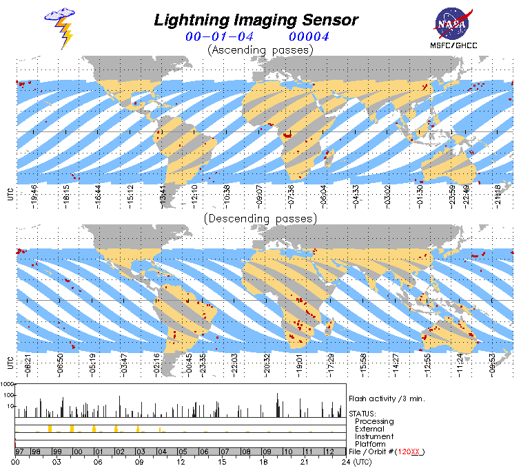
Lightning Imaging Sensor (LIS) on TRMM Science Data V4
National Aeronautics and Space Administration —
The Lightning Imaging Sensor (LIS) Science Data was collected by the LIS instrument on the Tropical Rainfall Measuring Mission (TRMM) satellite used to detect the... -
Federal
MISR L2 TOA/Cloud Stereo Product subset for the INTEX-B region V002
National Aeronautics and Space Administration —
MISR Level 2 TOA/Cloud Stereo Product containing the Stereoscopically Derived Cloud Mask (SDCM), cloud winds, Reflecting Level Reference Altitude (RLRA), with... -
Federal
BigFoot Field Data for North American Sites, 1999-2003
National Aeronautics and Space Administration —
The BigFoot project gathered field data for selected EOS Land Validation Sites in North America from 1999 to 2003. Data collected and derived for varying intervals at... -
Federal
Global Land Cover Mapping and Estimation Yearly 30 m V001
National Aeronautics and Space Administration —
NASA’s Making Earth System Data Records for Use in Research Environments (MEaSUREs) Global Land Cover Mapping and Estimation (GLanCE) annual 30 meter (m) Version 1...

Official websites use .gov
A
.gov website belongs to an official government
organization in the United States.
Secure .gov websites use HTTPS
A
lock (
) or https:// means you’ve safely connected to
the .gov website. Share sensitive information only on official,
secure websites.