
-
Federal
Tropospheric Emission Spectrometer (TES) Data 17 recent views
National Aeronautics and Space Administration —
TES focuses on the troposphere, the layer of atmosphere that stretches from the ground to the altitude at which airplanes fly. With very high spectral resolution, TES... -
Federal
KORUS-AQ B200 Remotely Sensed Geostationary Trace gas and Aerosol Sensor Optimization (GeoTASO) Data
National Aeronautics and Space Administration —
KORUSAQ_AircraftRemoteSensing_GeoTASO_B200_Data are remotely sensed data collected by the Geostationary Trace gas and Aerosol Sensor Optimization (GeoTASO) instrument... -
Federal
KORUS-AQ Aircraft Merge Data Files
National Aeronautics and Space Administration —
KORUSAQ_Merge_Data are pre-generated merge data files combining various products collected during the KORUS-AQ field campaign. This collection features pre-generated... -
Federal
CALIPSO Lidar Level 2 Vertical Feature Mask (VFM), V4-51
National Aeronautics and Space Administration —
CAL_LID_L2_VFM-Standard-V4-21 is the Cloud-Aerosol Lidar and Infrared Pathfinder Satellite Observations (CALIPSO) Lidar Level 2 Vertical Feature Mask (VFM), Version... -
Federal
Inventory of Arctic Rain on Snow Events: Meteorological and Surface Conditions, Version 1
National Aeronautics and Space Administration —
This data set contains surface and upper air data from global atmospheric reanalysis, and passive microwave brightness temperatures for rain on snow events in the... -
Federal
CALIPSO Lidar Level 2 1 km Cloud Layer, V4-51
National Aeronautics and Space Administration —
CAL_LID_L2_01kmCLay-Standard-V4-51 is the Cloud-Aerosol Lidar and Infrared Pathfinder Satellite Observations (CALIPSO) Lidar Level 2 1 km Cloud Layer, Version 4-51... -
Federal
KORUS-AQ Environmental Protection Agency (EPA) Ground Site Data
National Aeronautics and Space Administration —
KORUSAQ_Ground_EPA_Data are the Environmental Protection Agency (EPA) data collected at various ground sites as part of the KORUS-AQ field campaign. Contained in this... -
Federal
BUV/Nimbus-4 Level 2 Compressed Ozone Profile Data V005 (BUVN4L2CPOZ) at GES DISC
National Aeronautics and Space Administration —
The Nimbus-4 BUV Level 2 Compressed Ozone Profile Data collection or CPOZ contains total ozone, reflectivities, ozone mixing ratios and layer ozone amounts measured... -
Federal
SCOAPE R/V Point Sur Data
National Aeronautics and Space Administration —
SCOAPE_RVPointSur_Data is the data collected from instruments onboard the University of Southern Mississippi’s Research Vessel (R/V) Point Sur during the Satellite... -
Federal
KORUS-AQ Miscellaneous Data
National Aeronautics and Space Administration —
KORUSAQ_Miscellaneous_Data are miscellaneous ancillary files collected during the KORUS-AQ field campaign. This product includes data collected onboard the UMD Cessna... -
Federal
OWLETS-1 Ozonesonde Data
National Aeronautics and Space Administration —
OWLETS1_Sondes_Data_1 is the Ozone Water-Land Environmental Transition Study (OWLETS-1) ozone data collected via synchronous ozonesonde launches at the NASA Langley... -
Federal
KORUS-AQ B200 Aircraft In Situ Meteorological and Navigational Data
National Aeronautics and Space Administration —
KORUSAQ_MetNav_AircraftInSitu_B200_Data are in-situ meteorological and navigational data collected onboard the B200 aircraft during the KORUS-AQ field campaign. This... -
Federal
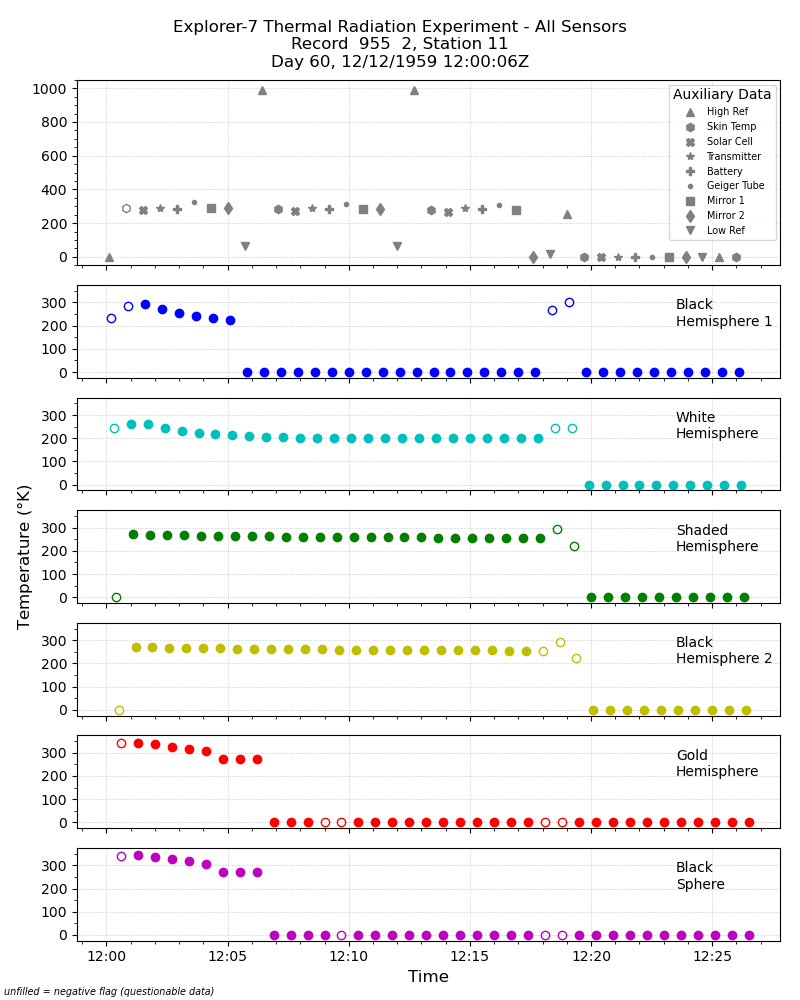
Explorer-7 Thermal Radiation Experiment Temperature Values from All Sensors V001 (EXP7L1TRTALL) at GES DISC
National Aeronautics and Space Administration —
Explorer-7 Thermal Radiation Experiment Temperature Values from All Sensors product contains temperature readings from all five bolometers in order to measure solar,... -
Federal
KORUS-AQ NASA Ground Site Data
National Aeronautics and Space Administration —
KORUSAQ_Ground_NASA_Data are ground site measurements collected by NASA instrumentation at the NIER-Taehwa ground site during the KORUS-AQ field campaign. This... -
Federal
KORUS-AQ DC-8 Aircraft In Situ Trace Gas Data
National Aeronautics and Space Administration —
KORUSAQ_TraceGas_AircraftInSitu_DC8_Data are in-situ trace gas data collected onboard the DC-8 aircraft during the KORUS-AQ field campaign. Data were collected using... -
Federal
ISLSCP II EDGAR 3 Gridded Greenhouse and Ozone Precursor Gas Emissions
National Aeronautics and Space Administration —
The EDGAR (Emission Database for Global Atmospheric Research) database project is a comprehensive task carried out jointly by the National Institute for Public Health... -
Federal
CALIPSO Lidar Level 2 5 km Aerosol Layer Data, V4-51
National Aeronautics and Space Administration —
CAL_LID_L2_05kmALay-Standard-V4-51 is the Cloud-Aerosol Lidar and Infrared Pathfinder Satellite Observation (CALIPSO) Lidar Level 2 5 km Aerosol Layer Data, Version... -
Federal
KORUS-AQ DC-8 Aircraft In Situ J Value (Photolysis Rate) Data
National Aeronautics and Space Administration —
KORUSAQ_jValue_AircraftInSitu_DC8_Data are in-situ j-value (photolysis rate) measurements collected onboard the DC-8 aircraft during the KORUS-AQ field campaign.... -
Federal
Explorer-7 Thermal Radiation Experiment Selected White Sensor Temperature (Nighttime) Values V001 (EXP7L1TRTWHT) at GES DISC
National Aeronautics and Space Administration —
Explorer-7 Thermal Radiation Experiment Selected White Sensor Temperature (Nighttime) Values product contains the temperatures measured by the white sensor at night.... -
Federal
OWLETS-2 Ozonesonde Data
National Aeronautics and Space Administration —
OWLETS2_Sondes_Data_1 is the Ozone Water-Land Environmental Transition Study (OWLETS-1) ozone data collected via synchronous ozonesonde launches at the Howard...

Official websites use .gov
A
.gov website belongs to an official government
organization in the United States.
Secure .gov websites use HTTPS
A
lock (
) or https:// means you’ve safely connected to
the .gov website. Share sensitive information only on official,
secure websites.